Dry Until the Arrival of Isaias
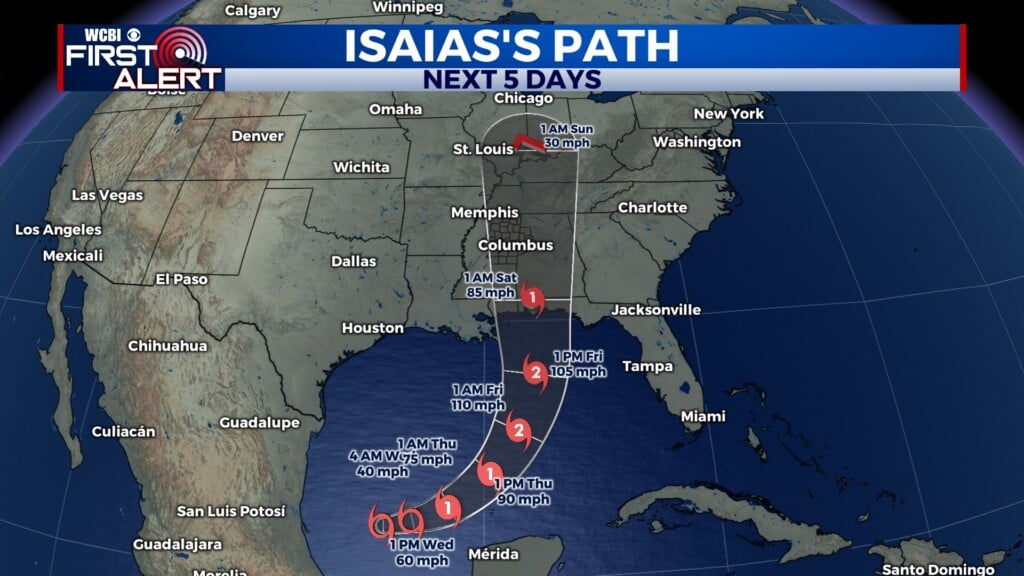
COLUMBUS, Mississippi (WCBI) – The NE corner will see the remnants of Isaias Saturday, but until then lots of sunshine will keep temperatures high.
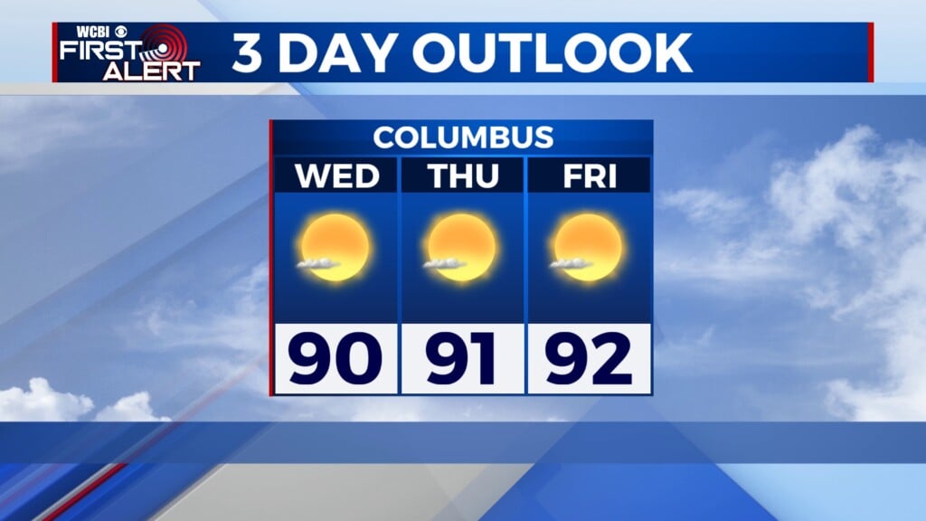
TONIGHT & TOMORROW – Nice, comfortable weather will continue through the evening. If you get cold easily, you might want a light jacket. However, you won’t need that jacket for your Thursday. Plenty of sunshine will keep the afternoon warm into the low 90’s for another day.
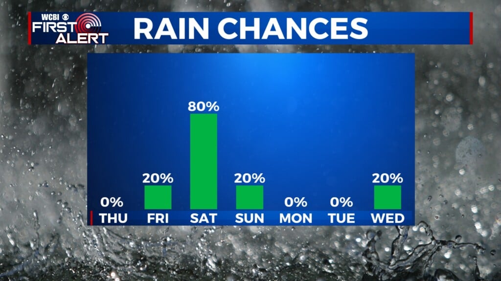
FRIDAY – By Friday, rain chances will steadily increase into the late afternoon and evening. Before the rain though, it will be another day in the low 90’s with clouds increasing throughout the day.
THIS WEEKEND – Saturday will be quite the washout from Isaias. Avoid flooded roadways and low-lying areas that are susceptible to flooding. Wind gusts can get up to 35mph and the rain will keep temps down in the mid 70’s. By Sunday, most of the rain will be gone, but a lingering shower cannot be ruled out. Temps will slowly start warming back up into the low 80’s.
TROPICS – As of 4PM, Isaias continues spinning as a Tropical Storm. Sustained winds are approximately 65MPH, gusting up to 75MPH. This system is moving to the ENE at 8MPH. Moving slow but building strength. The expectancy is for Isaias to reach hurricane status overnight. The forecast is for the storm to reach Category 2 strength before landfall. Storm surge could be anywhere from 3-7 feet along the Gulf Coast. Tropical Alerts are already in place. If you know anyone from New Orleans to Pensacola, remind them to have a plan before the storm arrives.