Frost Potential This Weekend
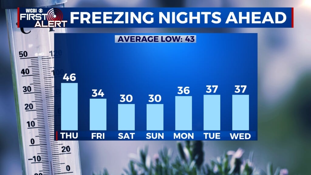
COLUMBUS, Mississippi (WCBI) – Cold front after cold front will tank temps below freezing overnight by Friday.
TONIGHT & TOMORROW – The first cold front will pass through tonight bringing the potential for a few isolated showers. For tonight, the low will get down to a chilly mid 40’s before the 30’s come the next night. Cooler and drier air behind the front will limit temps Thursday to the upper 60’s in the afternoon with no chance for rain.

FRIDAY – Friday morning will be off to a cold and crisp start. The low that morning will reach the mid 30’s and another front passing will drop temps to the upper 50’s for the afternoon high. Be ready for sweater weather all day and allot time to warm up your car in the mornings.
THIS WEEKEND – If you’re heading to Starkville for the early 11 a.m. MSU game, you’ll definitely want to dress warm. While there will be plenty of sunshine, the afternoon high will only warm to the mid-50’s! Don’t be surprised if you wake up to some frost on your car Saturday and Sunday morning. Sunday will continue to be chilly with temps in the upper 50’s. Some showers are possible late Sunday.