A Few Isolated Showers Today
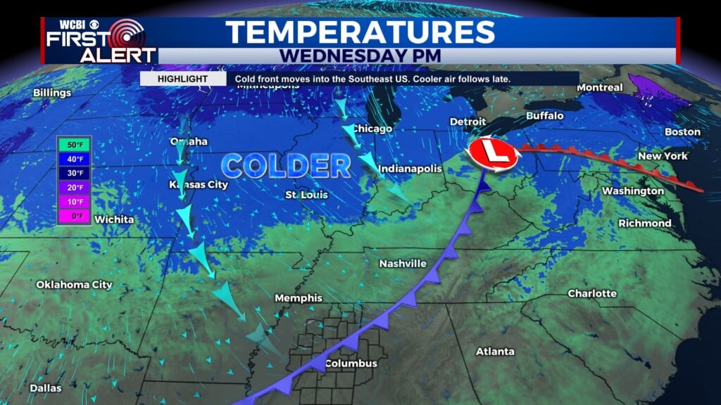
COLUMBUS, Miss. (WCBI) — With a cold front moving through this evening, we can expect a few isolated showers across parts of our area today. A big drop in temperatures is on the way once the front passes.

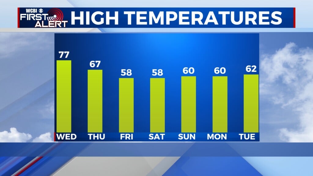
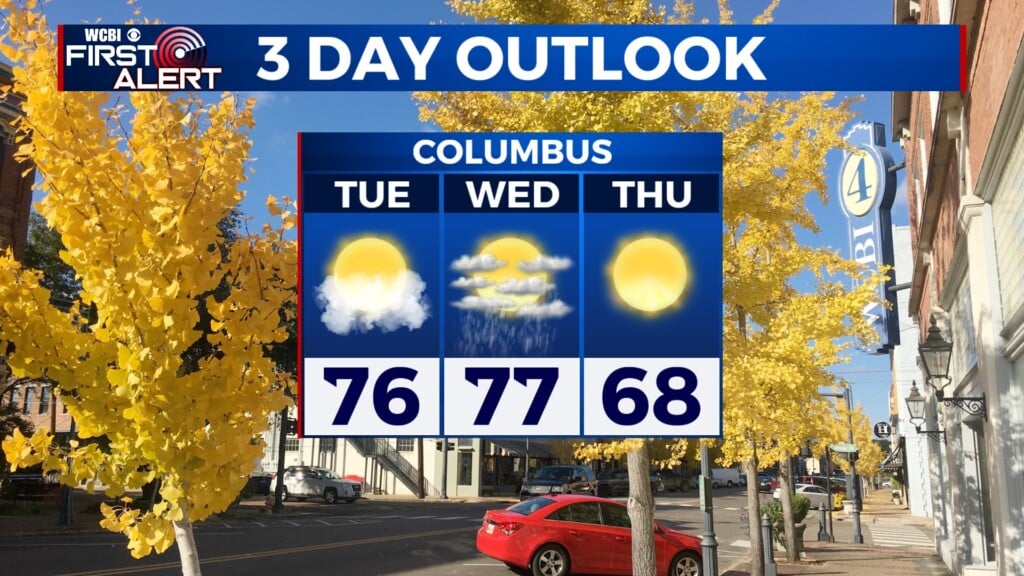
WEDNESDAY: A few isolated showers are likely to pop up throughout the day ahead of the cold front pushing in, due to increased moisture flowing up from the Gulf. However, rainfall will not be heavy or widespread, and any showers that do pop up should be brief. Cloudy skies in the morning will break later on, though. We’ll have partly cloudy conditions after noon — so we’ll definitely see the sunshine in portions of our area. The high temperature today will reach 77°. Light and variable morning winds will increase to 5 to 10 mph out of the west-southwest.

WEDNESDAY NIGHT: Once the front moves out of the twin state region, skies will be mostly clear for the rest of the night. The low temperature will get down to around 46°. Southwesterly winds at 5 to 10 mph will shift to be more northwesterly following the frontal passage.
THURSDAY: Though skies will be sunny for most of the day, it won’t be quite as warm out there as it has been. The high temperature will only reach around 67°. Winds will be out of the northwest at 5 to 15 mph, with gusts up to 20 mph. Overnight, it will get pretty chilly, with a forecast low temperature of only 34°.