Another round of storms Friday then record heat possible next week
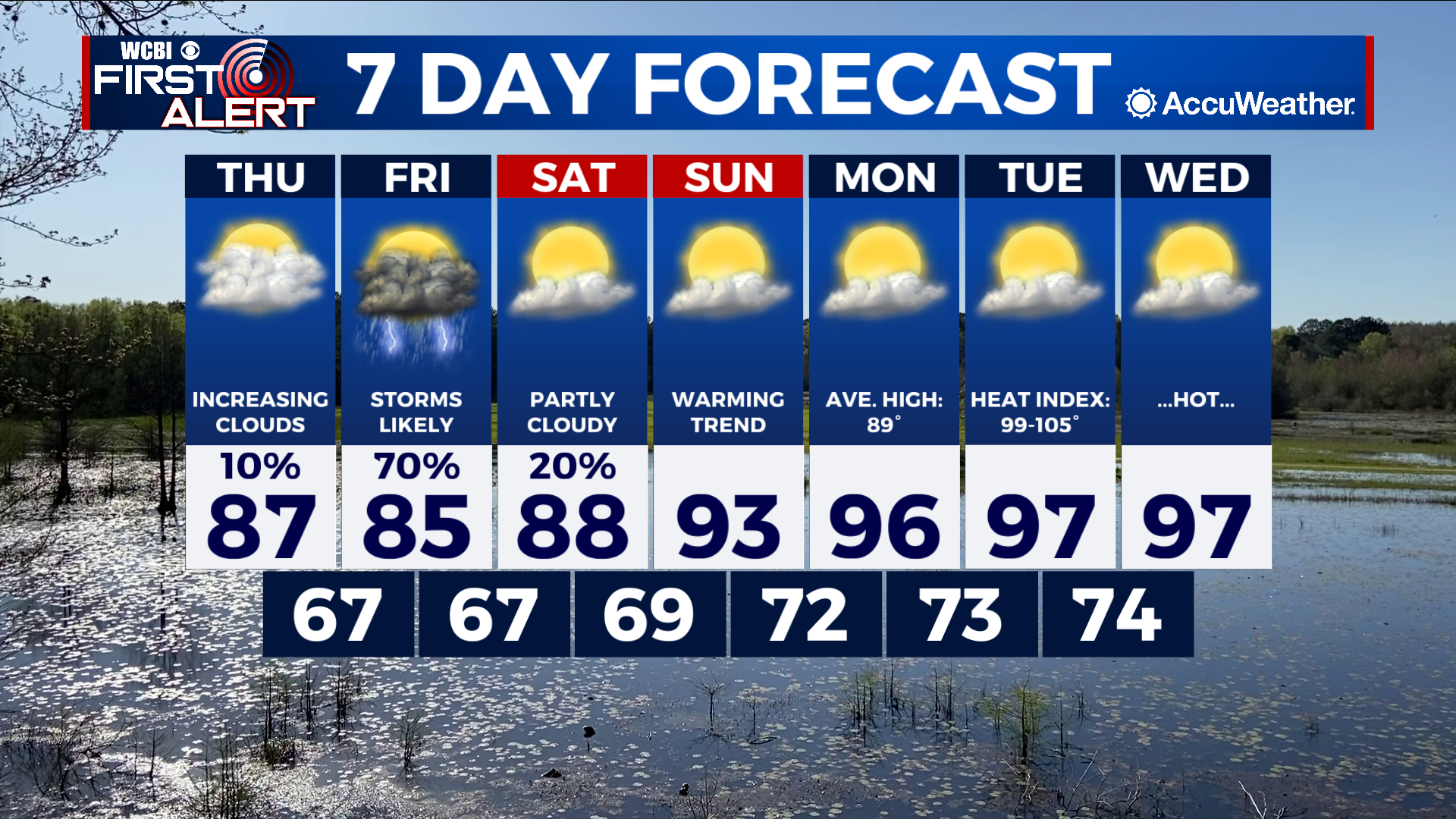
COLUMBUS, Mississippi (WCBI) – SUMMARY: Scattered showers and thunderstorms impacted the region today. We’ll get a break in the action tomorrow, then showers and thunderstorms return Friday.
TONIGHT: Scattered showers ending before 9pm; otherwise, mostly cloudy with lows in the upper-60s. Chance of rain: 40%.
THURSDAY: Partly cloudy, becoming mostly cloudy late in the day. Highs in the upper-80s. Calm wind.
THURSDAY NIGHT: Mostly cloudy with lows in the mid-60s.

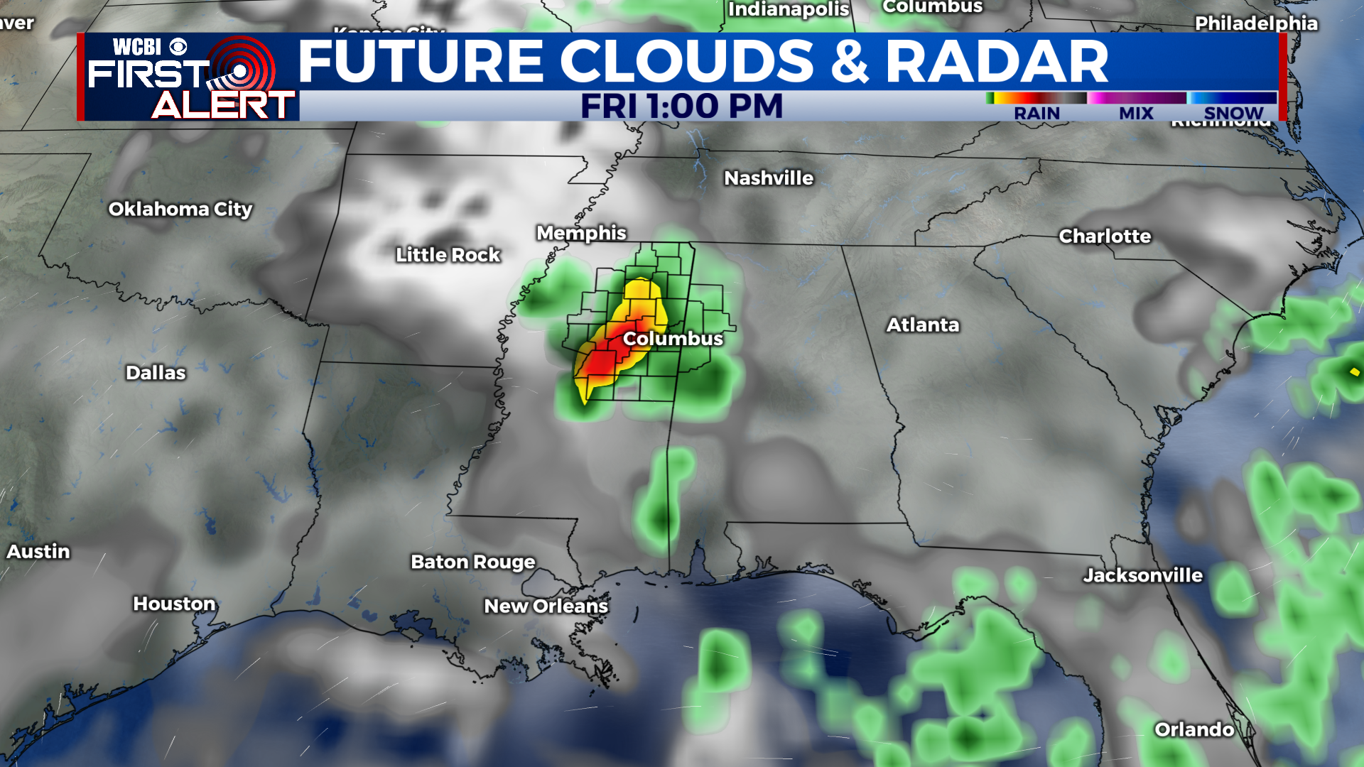
EXTENDED FORECAST: Scattered showers and thunderstorms will be possible Friday across the region. A few storms may be strong or severe. This weekend will be warm, but dry Saturday and Sunday. A warming trend will continue into next week, when daily high temperatures will reach the upper-90s by the middle of the week. Heat index values will range from 98-105° Tuesday and Wednesday.