Dry next couple days, active weather returns next week
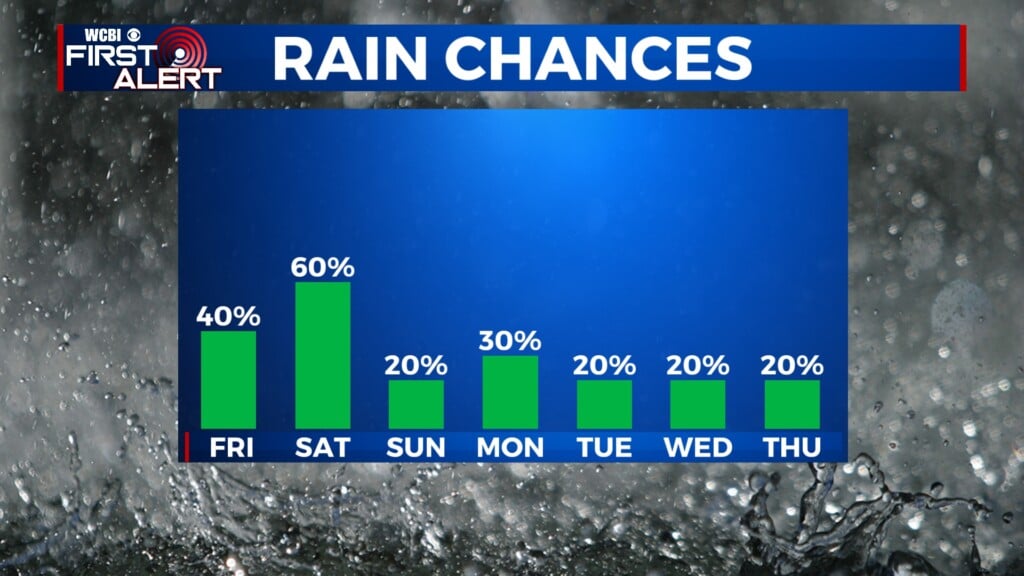
COLUMBUS, Mississippi (WCBI) – The weekend gets off to a sunny start, though clouds begin increasing by Sunday ahead of several days of rain chances next week.
FRIDAY: Full sun with highs in the 60s! Expect another breezy day, but it shouldn’t be as gusty as yesterday.
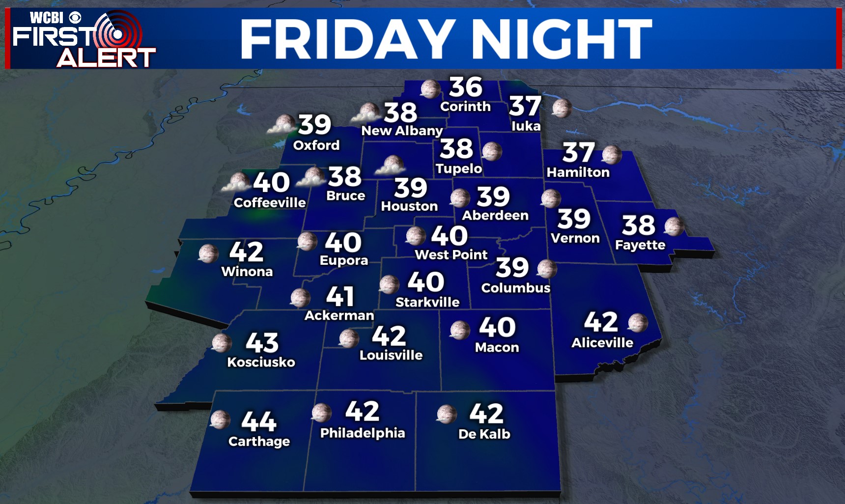
FRIDAY NIGHT: Those winds should relax after sunset, leaving another chilly overnight! Lows are expected to drop into the upper 30s to lower 40s, with some patchy frost possible in the normally colder spots.
WEEKEND: Saturday stays pleasant with highs approaching 70 degrees and more sunshine. Sunday starts dry, but clouds slowly fill in across the region by afternoon & evening. A lead system, occluding over the Plains states, should still send enough moisture for scattered showers and storms Sunday evening. These are most likely NW of the Natchez Trace, and some could become locally strong with hail or gusty winds.
NEXT WEEK: Isolated to scattered showers stay possible Monday with a mostly cloudy sky. The eclipse forecast locally continues to look bleak in terms of cloud coverage, but stay tuned for any changes! Tuesday – Thursday looks quite active with repeated rounds of rain & storms, and at some point, we could face a dual threat of flooding and severe weather.