Getting ready for Isaias
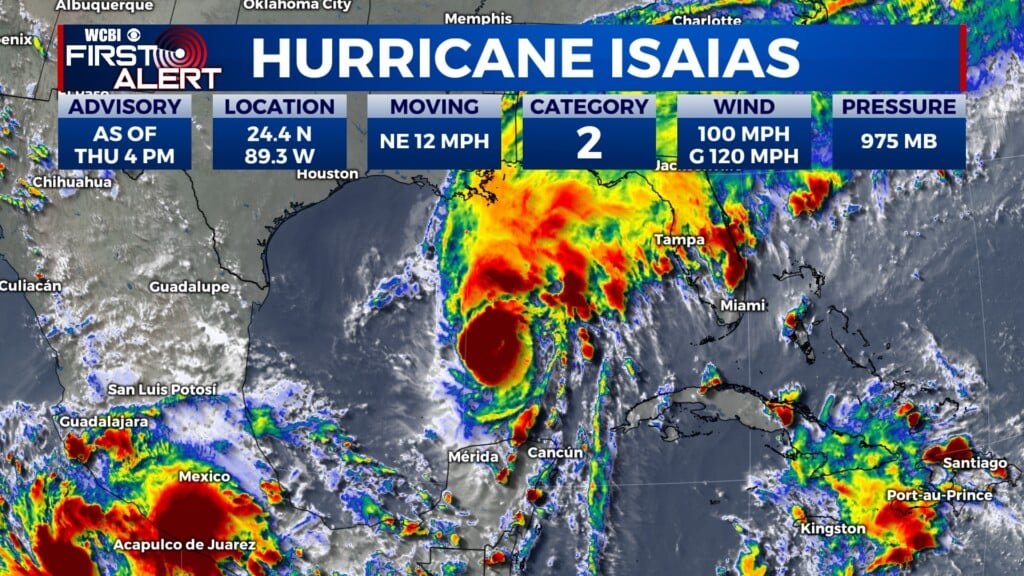
COLUMBUS, Mississippi (WCBI) – As of 4PM, Hurricane Isaias is a Category 2 hurricane. Impacts will begin late Friday night and continue through Sunday AM.
THURSDAY NIGHT: It will be calm for another night. This will be the night to bring in any outdoor furniture or strap objects down outdoors. Low temperatures will drop into the upper 50s/lower 60s.

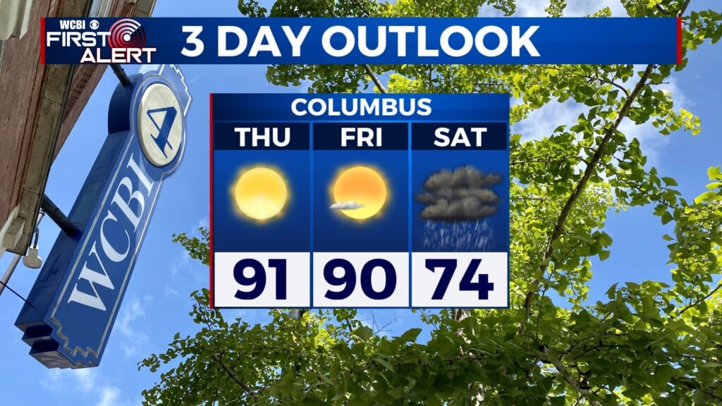
FRIDAY: Calm and building moisture through the morning. Afternoon high temperatures will reach the upper 80s and lower 90s once again. By the late afternoon, the outer bands of Hurricane Isaias will begin bringing clouds into NE MS and western AL. It will be a breezy/windy day. Sustained winds will be 5-15MPH with gusts up to 20MPH. Expect dry conditions through most of the day, isolated rain along the southern counties through the late afternoon. Increasing potential for showers and storms through the rest of the night. Into the evening, wind gusts will increase to 30MPH.

SATURDAY: Through the day, Hurricane Isaias will gradually weaken but continue dumping rain across the region. 1-3″ inches of rain are expected, locally up to 4″. Flooding and gusty winds are the highest concerns. Trees and powerlines could fall, leading to power outages. Temperatures will be much cooler, only reaching the lower 70s. By the afternoon, rain potential should begin to lighten some as the system continues driving North. For any BAMA fans, the WCBI Sports team has informed us that the game in Tuscaloosa is planned to continue as scheduled. There are modifications to tailgating and parking, so check in on those details if you have plans to go.