High Nineties Sticking Around
COLUMBUS, Mississippi (WCBI) — The strong upper-level high pressure system has kept our temperatures well above average all week. Unfortunately, it’s going to get even hotter before we feel any relief — from the high nineties up into the triple digits.
THURSDAY: The high temperature for today will be 97°. The southern portion of our area will have a maximum heat index value around 103°, while our counties toward the north remain under a heat advisory for heat indices upward of 105°. This heat advisory is in effect through Saturday evening, so the northern half of our area will feel warmer than 105° for at least the next few days. Skies will be bright and sunny for most of the day. Winds are out of the east-northeast at 5 mph.


THURSDAY NIGHT: It will feel pretty comfortable out there tonight, with a low temperature of 72°. Skies will be mostly clear, and winds will be calm.
FRIDAY: Much of the afternoon hours will be in the high nineties, with a high temperature around 100°. Heat index values will get up to around 106°, and lots of sunshine will continue to stick around. Winds will start out calm, but increase to 5 mph out of the northeast.

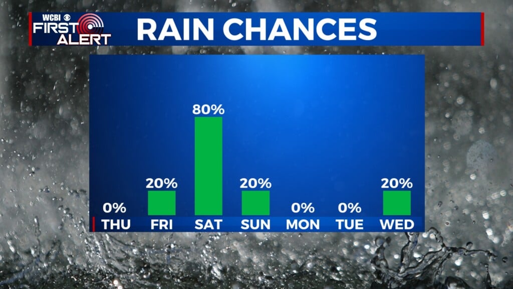
THIS WEEKEND: The upper-level high pressure will start to weaken. However, it will still control the weather pattern for a little while longer, keeping our skies clear and sunny. Temperatures will stay in the high nineties and possibly into the triple digits into early next week. Moisture starts to move into our area on Sunday, while bringing a small chance for isolated rain.