Rain returns Saturday afternoon
SUMMARY: Rain chances return to the forecast in the form of scattered showers and storms on Saturday afternoon. As a front approaches the area on Sunday, rain chances become much more widespread. Rain chances drop for Monday, with only scattered showers sticking around through Wednesday. Highs will be in the mid 80s Saturday, low 80s Sunday to Tuesday, and in the 70s for the rest of the week.
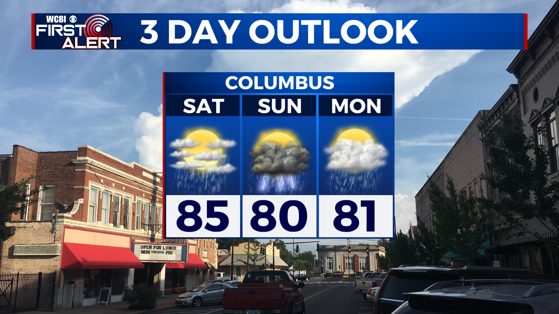
SATURDAY: A dry start to the day, but by the afternoon scattered showers and storms will be possible across the area. Otherwise, partly to mostly cloudy with a high in the mid 80s.
SATURDAY NIGHT: Rain tapers off for Saturday night, with only a stray shower or 2 possible. Lows in the mid to upper 60s under mostly cloudy skies.
SUNDAY: Much more widespread rain for Sunday, with cloud cover sticking around for much of the day. Some of the rain could be heavy at times. Highs will be in the upper 70s to low 80s.
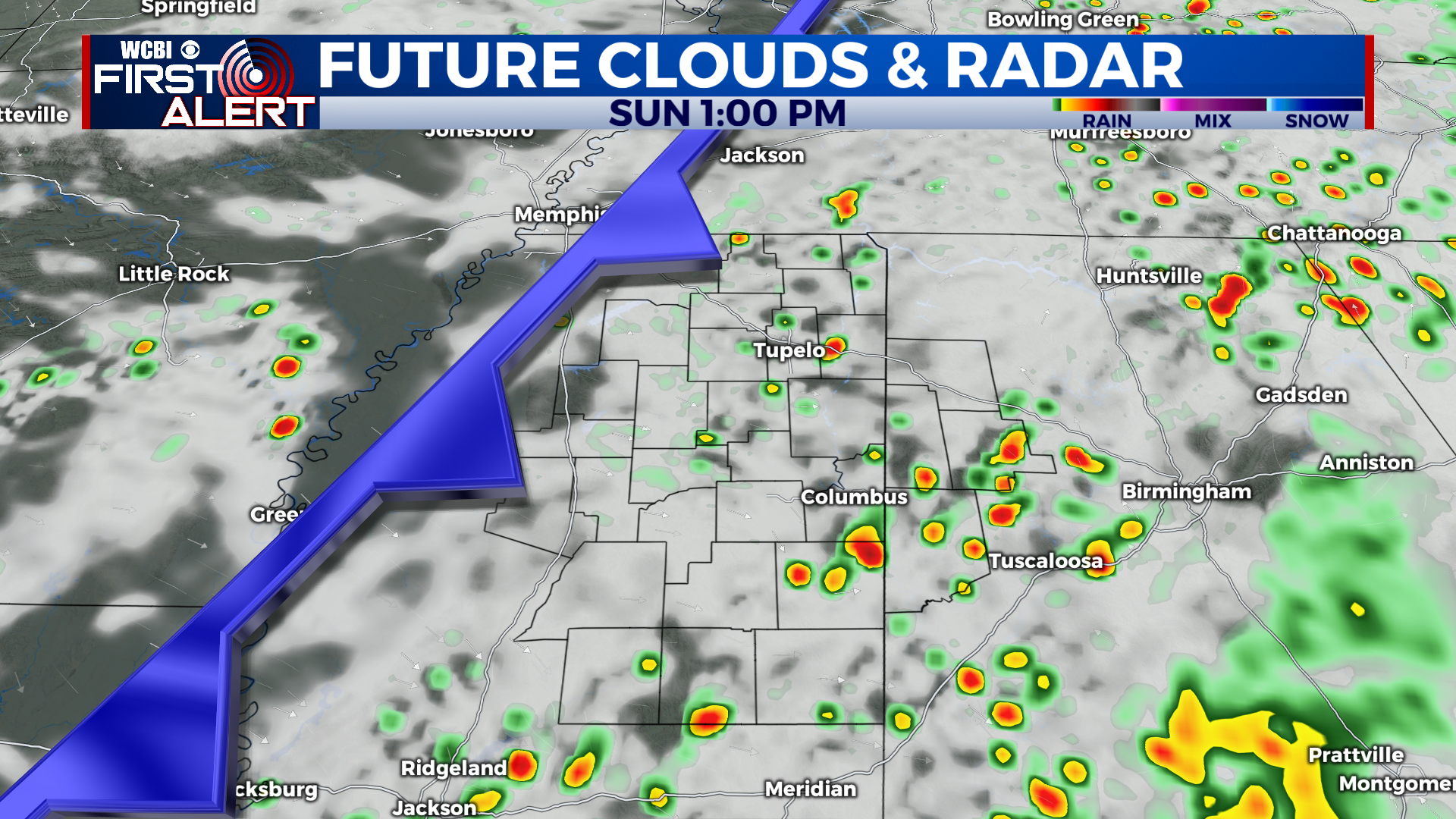
SUNDAY NIGHT: As the cold front clears the area, rain will end from west to east, with just a few lingering overnight showers. Skies will be mostly cloudy with a low in the mid 60s.
NEW WORK WEEK (MON-FRI): Scattered showers are in the forecast for Monday and Tuesday, with a high in the upper 70s to near 80 degrees. Lows will be in the upper 50s to around 60 degrees. Things dry out even more for Wednesday, with cooler temps in the upper 70s and only a stray shower or 2. Thursday and Friday look much drier, with partly cloudy skies and highs in the mid to upper 70s, and lows in the upper 50s.
TROPICS: Nothing of concern for the southeast over the next few days. October can still have impactful storms, so we’ll keep watching!
CONNECT WITH @WCBIWEATHER ON TWITTER, FACEBOOK AND INSTAGRAM