Stormy Weather
Multiple rounds of showers and thunderstorms this week
COLUMBUS, Mississippi (WCBI)- Prep the rain gear, showers and storms occupy the first full week of April.
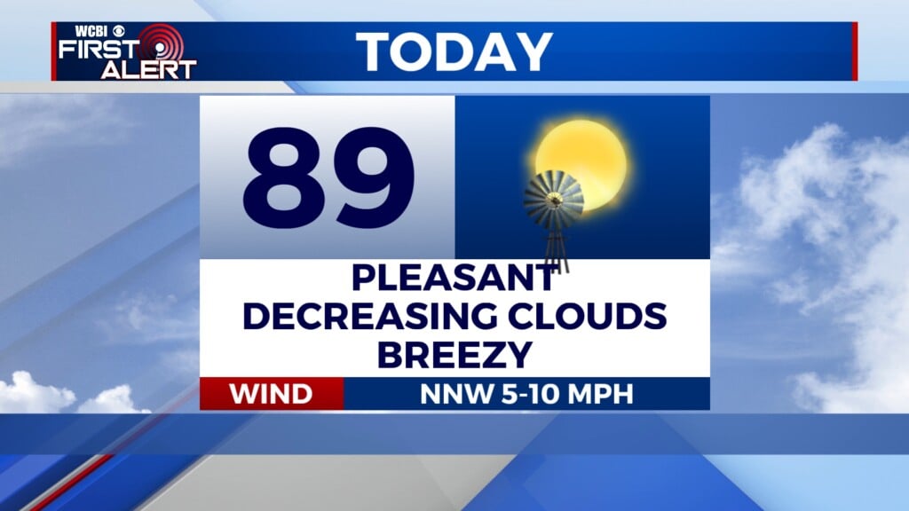
TODAY: Widespread showers and storms are expected to exit NE Mississippi by mid-morning leaving the possibility for a few isolated storms over the area this afternoon. Temperatures will warm to the upper 70s today with mostly cloudy skies overhead. A few peaks of sunshine will be visible as the day progresses.
TUESDAY: Conditions will be quieter as a new air-mass moves in temporarily from the west. Temperatures will peak in the low to mid 80s for most. Overnight will be warm as well with lows near 70.
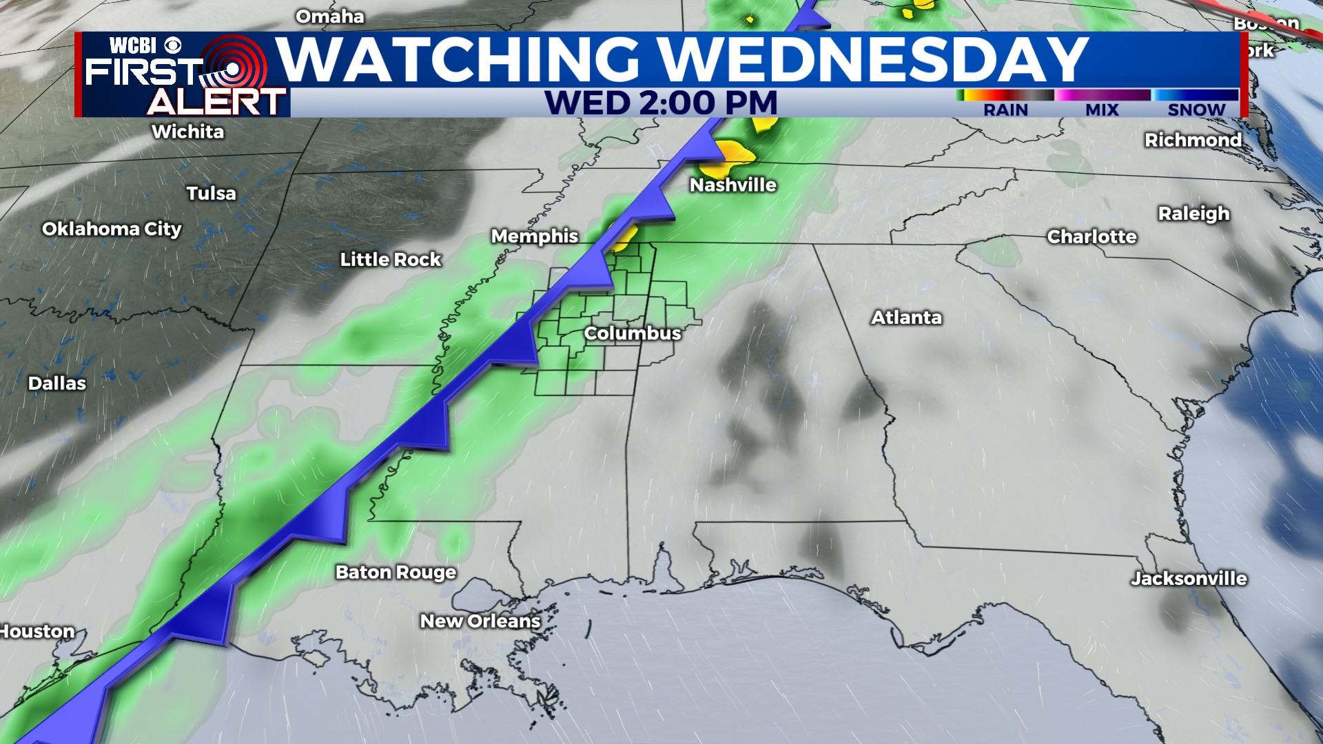
REST OF THE WEEK: Wednesday, rain and storm activity quickly returns. You will definitely need the raincoat and umbrella as Wednesday appears to be an all-day event. Some of the storms could be on the stronger side but the severe weather risk is lower at this time. Nevertheless, we are continuing to monitor this system and will update the forecast accordingly. Cooler, drier air will follow the frontal passage leaving temperatures in the 60s through Saturday. Clouds and rain linger through the remainder of the week. Sunday, expect some sunshine allowing highs to return to the 70s.