Sunny and Pleasant End to the Work Week
COLUMBUS, Miss. (WCBI) — With hot and dry conditions still in our area, it should be a nice end to the work week here in northeast Mississippi and western Alabama. However, this weekend will look completely different as a tropical cyclone intrudes upon the Southeast.
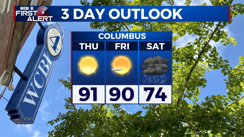
THURSDAY: Skies will be clear and sunny for most of the day. We’ll start the day with calm winds, but they’ll ramp up to about 5 mph out of the east-northeast. Today’s high temperature is 91°.

THURSDAY NIGHT: We will have mostly clear conditions overnight, although our southeastern counties could see a bit more cloud cover. Winds will be calm tonight, with a low temperature of 62°.
FRIDAY: Mostly sunny skies will make a pleasant end to the work week. Tomorrow’s high temperature will be around 90°, with easterly winds at 5 to 10 mph.

Tracking the Tropics
Isaias has officially reached hurricane status and was declared a Category 1 hurricane late last night. As of 4 a.m., it has sustained winds of up to 80 mph and gusts up to 100 mph. It is still brewing out in the Gulf, but is likely to continue strengthening as it moves toward the U.S. coast.

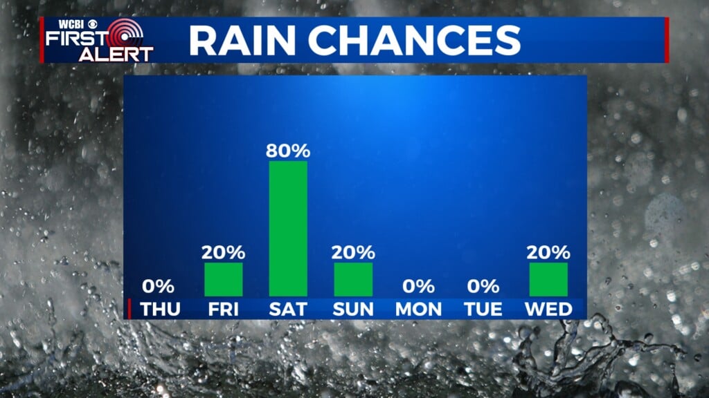
Starting overnight Friday into Saturday, there is a 20% chance of rain as the initial bands of Isaias make their way into our area. Rainfall is projected to reach northeast Mississippi around 1 a.m. Saturday, although the exact timing is still uncertain. It is possible we could start seeing some rain a bit earlier in the evening on Friday. As we get through Saturday, more heavy rain will move through our area, persisting for most of the day. Thunder and lightning are also possible within the more intense areas of the cyclone. Additionally, it will be windy, with sustained winds projected to be up to 20 mph at the surface and gusts up to 35 mph.

Be sure to tune in to WCBI News for all the best weather updates as Hurricane Isaias continues to approach the United States. You can tune in on channel 4 over the air, or visit our livestream web page.