Wednesday cold front brings cooler temps
COLUMBUS, Mississippi (WCBI) – Warm and breezy the past couple of days, but a cold front will be moving in from the NW Wednesday morning.
TUESDAY NIGHT: Extra moisture and heavy cloud coverage maintain across our sky for Tuesday night. Temperatures will be more mild because of that, only dropping into the middle 60s. The wind conditions will continue to be breezy, with gusts 20-25+ mph.
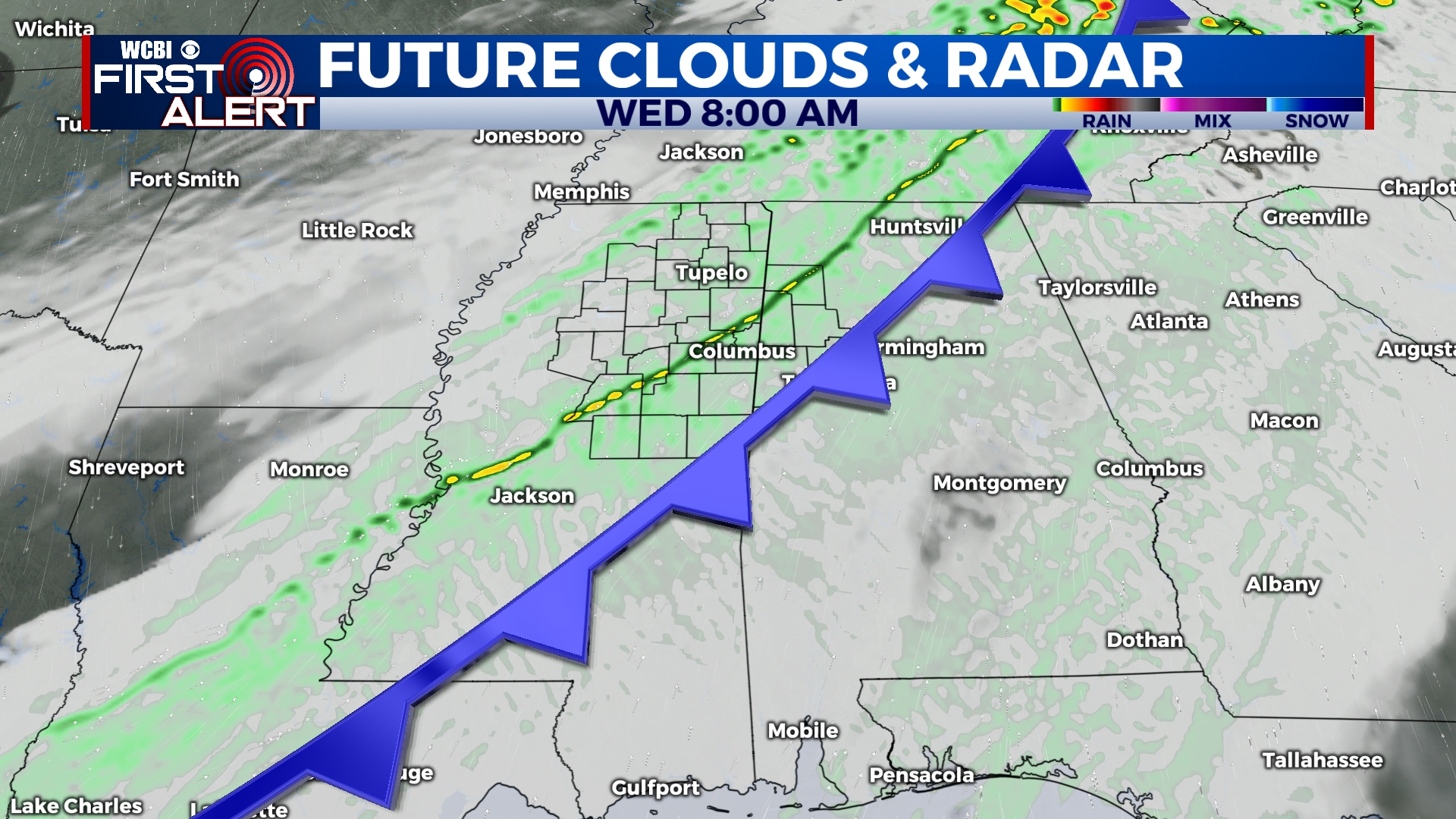
WEDNESDAY: There will be a strong cold front moving through northern Mississippi during the morning hours. Temperatures will be steadily dropping behind the front, the rest of the afternoon and into the evening. Brief, gusty showers are possible immediately along the front. Overnight lows Wednesday night will drop back to the 30s!
THURS/FRI: Cooler temperatures stick around for a couple of days. High temps both days will remain in the 50s. Most of Thursday seems dry, with a pick up again late and into Friday morning. A heavier chance for rain showers will be on Friday, finishing off the week. Low temperatures will going from the middle 40s to the lower 50s, due to heavier presence of the moisture and cloud coverage.