Freezing potential returns next week
COLUMBUS, Mississippi (WCBI) – After an extended period of warm weather, colder than usual weather returns to the Mid-South next week.
OVERNIGHT: Clouds clear late, leaving temperatures in the upper 30s with a chilly north to northwest breeze. Wind chills could be near freezing by daybreak.
MONDAY: Expect a good supply of sunshine through the day with highs only in the middle 50s and a continued northwest breeze. Monday night brings freezing potential to most of the region as overnight lows drop to the 29-32 degree range. A freeze watch is in effect for the entire region.
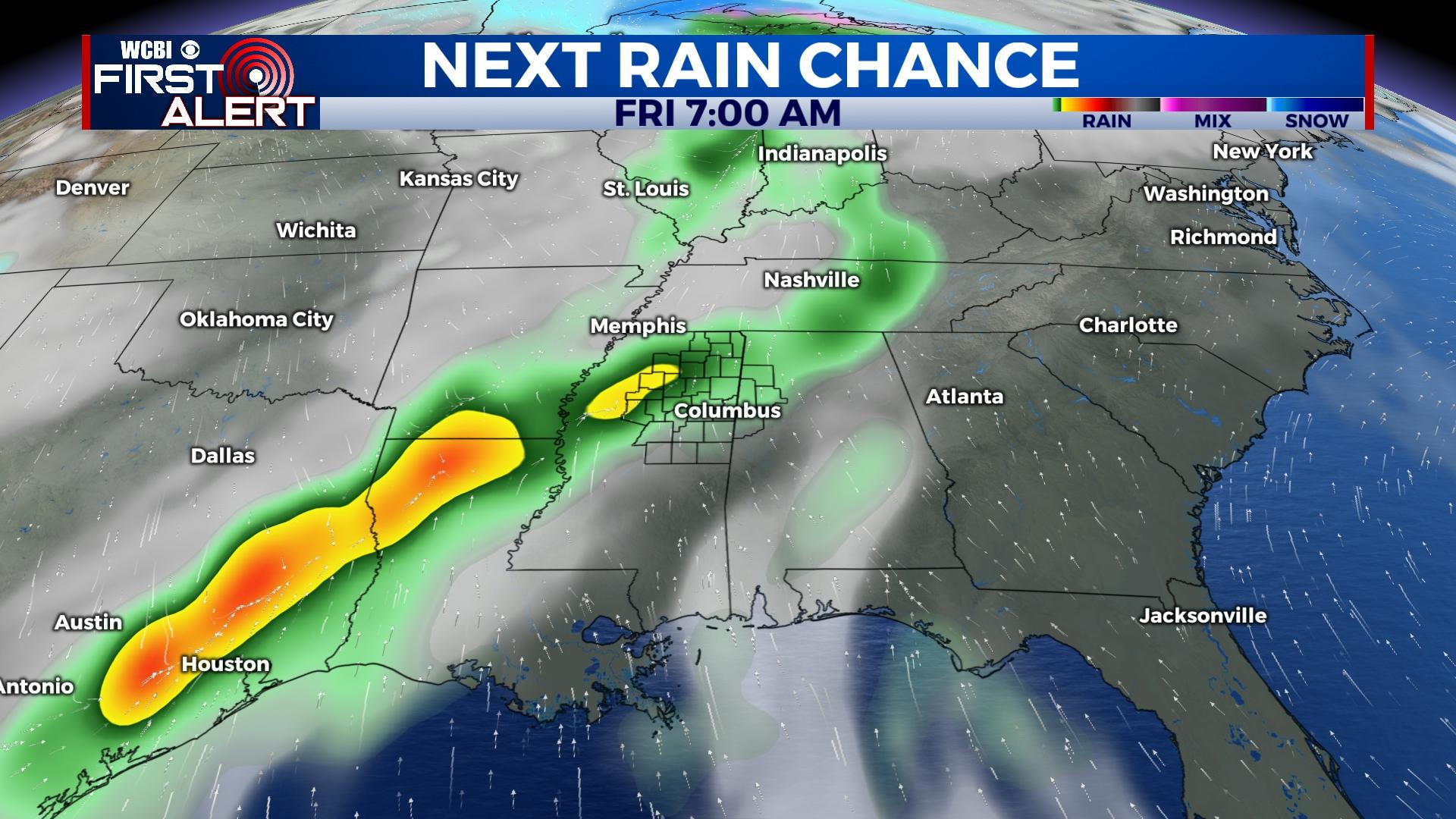
REST OF WEEK: While days will slowly get warmer through Wednesday, mornings will stay quite cold. Another round of freezing temperatures is expected Tuesday night. From there, a quick return to spring-like weather is in store Thursday as highs bounce back into the 70s. This warmth will be stunted by yet another strong front Friday – another round of showers and potential storms is on the way as well. Behind the rain & storms Friday afternoon, temperatures will quickly fall back into the 30s by next Saturday morning.