A pleasant weekend is in store ahead of warmer weather next week
COLUMBUS, Mississippi (WCBI) – SUMMARY: We’ll enjoy a near perfect weekend before temps warm up into the 70s and 80s next week. Strong to severe storms are possible on Wednesday 3/30.
TODAY: Aside from a few passing clouds, mostly sunny skies with a high of 68 degrees. Winds out of the NW at 5 to 10 mph.
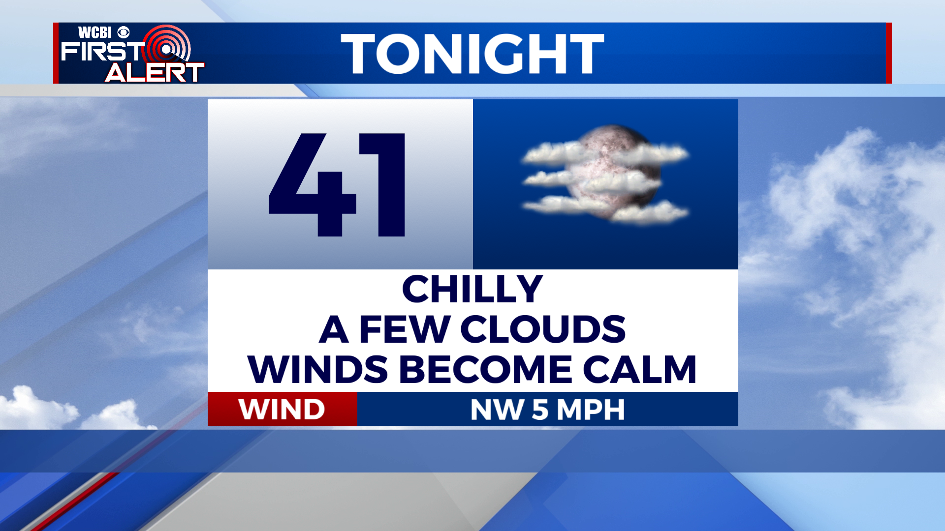
TONIGHT: It’ll be chilly. We’ll have broken clouds overhead and temps will dip into the lower 40s. Low of 41 degrees. Winds out of the NW around 5 mph, turning calm.
TOMORROW: We’ll once again enjoy mostly sunny skies and highs in the mid to upper 60s. High of 66 degrees. Winds becoming ENE around 5 mph.
MONDAY: We start off the week on a warm note! Mostly sunny skies with highs in the mid to upper 70s. High of 76 degrees. Winds becoming SW around 5 mph.

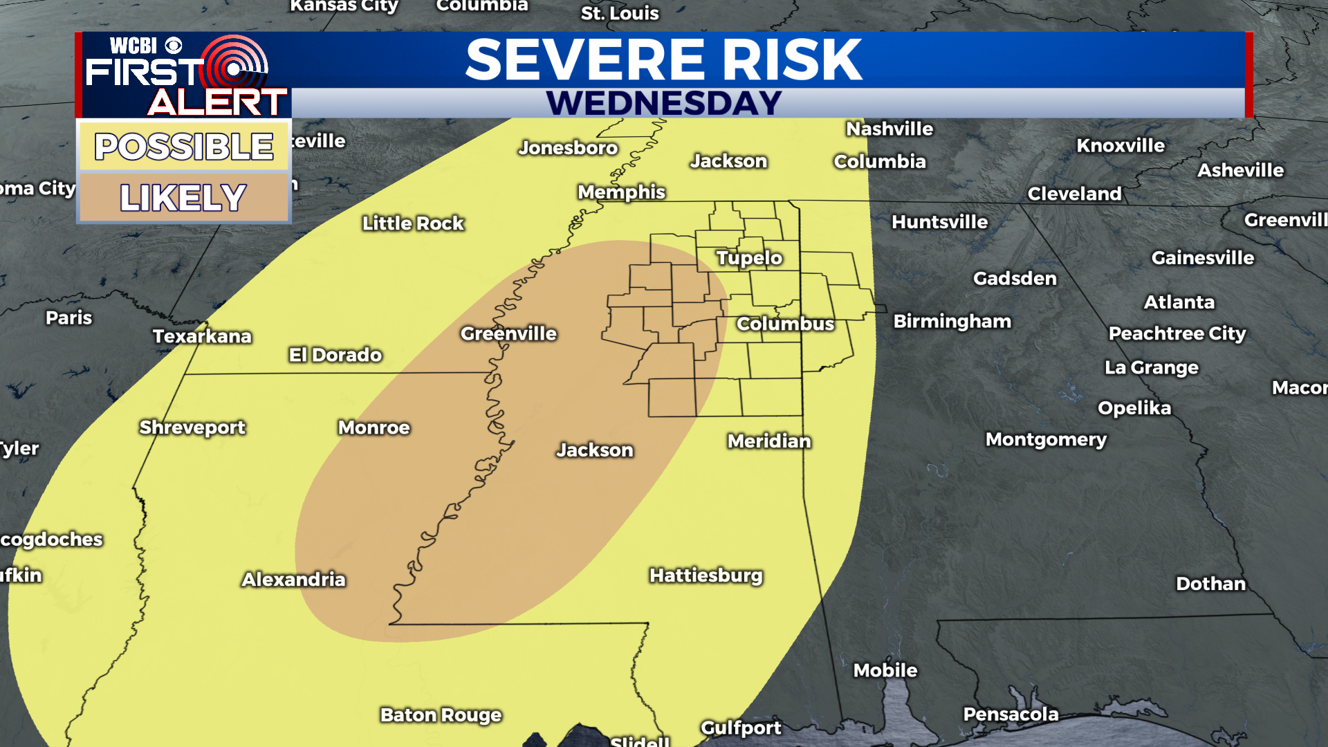
EXTENDED FORECAST: Temps will reach the 80s prior to our next weather system. Our attention turns to Wednesday as a potent low pressure system brings showers and storms to the region. The Storm Prediction Center has already placed the entire region under a risk for severe weather (seen below). Wind energy in the atmosphere looks impressive and will be plenty enough to support severe thunderstorms. However, since Wednesday is several days away, there are still some question marks to the forecast. As of now, storm timing looks to be during the afternoon and evening hours, and all severe weather hazards appear possible. Keep checking back for updates over the next few days. After Wednesday, things look calm and comfortable. With that being said, enjoy this beautiful weather and we’ll keep an eye on Wednesday. Have a great weekend!