Clouds stick around, rain chances go back up mid-week
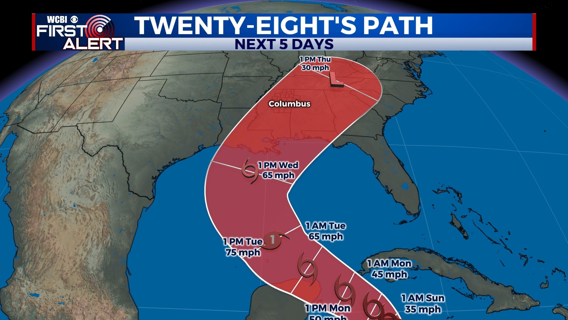
As one round of rain and storms exits the area, our attention turns to our next system which will bring us some rain by the middle of the week. A tropical system forming in the Gulf could bring us even more rain around the same time. Fortunately, Friday and Halloween weekend look dry for now.
SATURDAY NIGHT: Patchy light drizzle will continue tonight, but we’re not expecting any significant rain activity or thunder. Skies will remain mostly cloudy with temperatures generally staying in the mid 50s overnight.
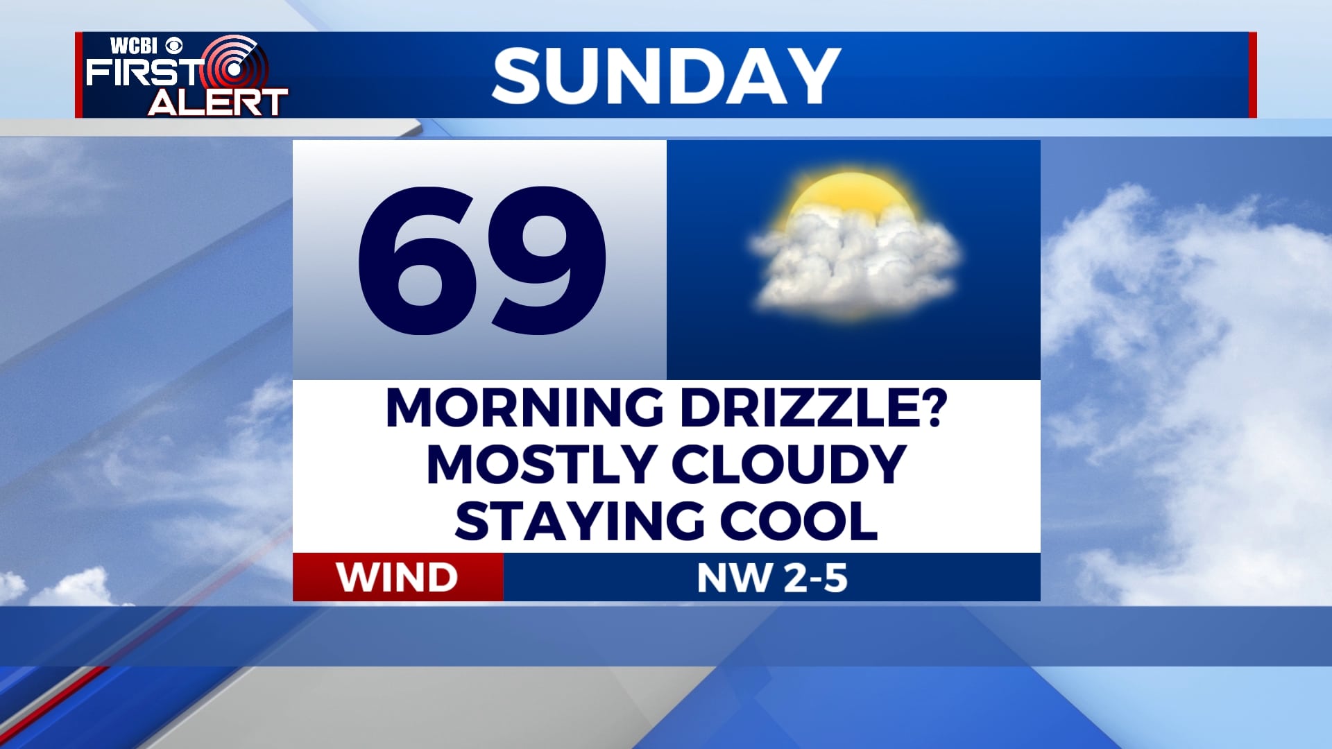
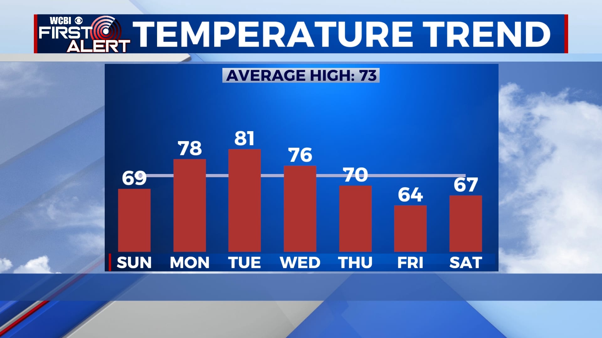
SUNDAY: Aside from some light morning drizzle, Sunday will be dry and mostly cloudy. Temperatures won’t be able to warm up much and highs will only be in the upper 60s.
MONDAY-TUESDAY: Temperatures will warm up a bit as we go into the week as highs return to near 80 for Monday and Tuesday. We’ll remain dry for Monday and much of Tuesday, but some showers are possible late on Tuesday as our next system approaches. Morning lows will be in the upper 50s to near 60.
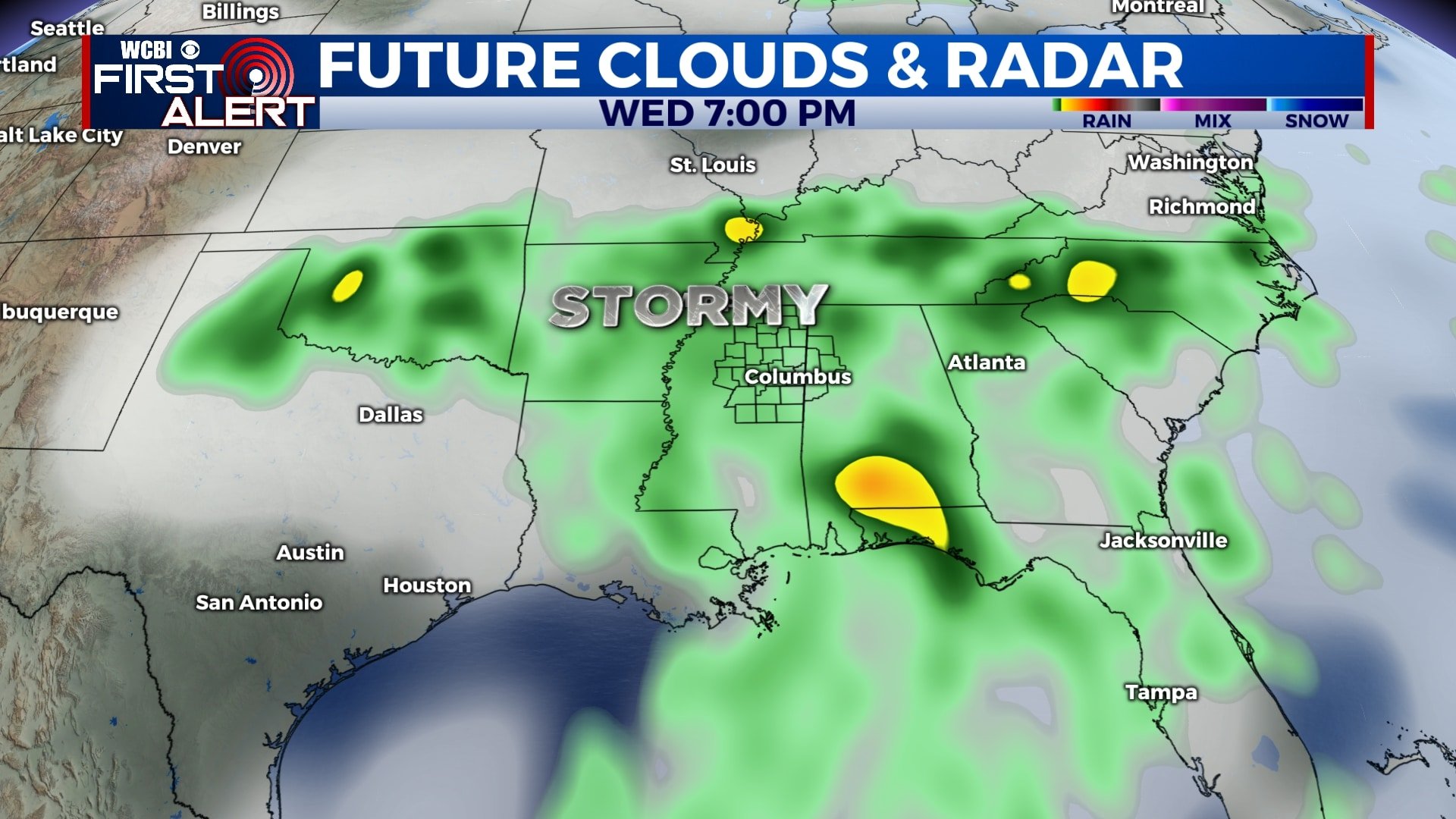
WEDNESDAY-THURSDAY: Our best chance for rain this week will be on Wednesday and Thursday as a cold front approaches from the west. Some thunder is also possible, especially on Wednesday. We’ll also be watching a tropical system in the Gulf that, depending on the exact path, could bring us even more rain and possibly some gusty winds in this time frame. Either way, rain is likely on both Wednesday and Thursday with highs in the 70s.
FRIDAY-SATURDAY: Any rain and storm activity will move out of the area late Thursday, leaving us dry for Friday and likely into the weekend as well. Temperatures will be cooler behind this system, with highs in the mid 60s and overnight lows in the 40s. As of now, Halloween looks to be dry and cool.
Follow WCBI Weather on Facebook, Twitter, and Instagram


Leave a Reply