Cold Front Changing Things Up
COLUMBUS, Miss. (WCBI) — As a dry but strong cold front continues its eastward trek, those summer-like conditions we’ve had most of the week will finally be in the rearview mirror, with more seasonable fall temps straight ahead.
Forecast
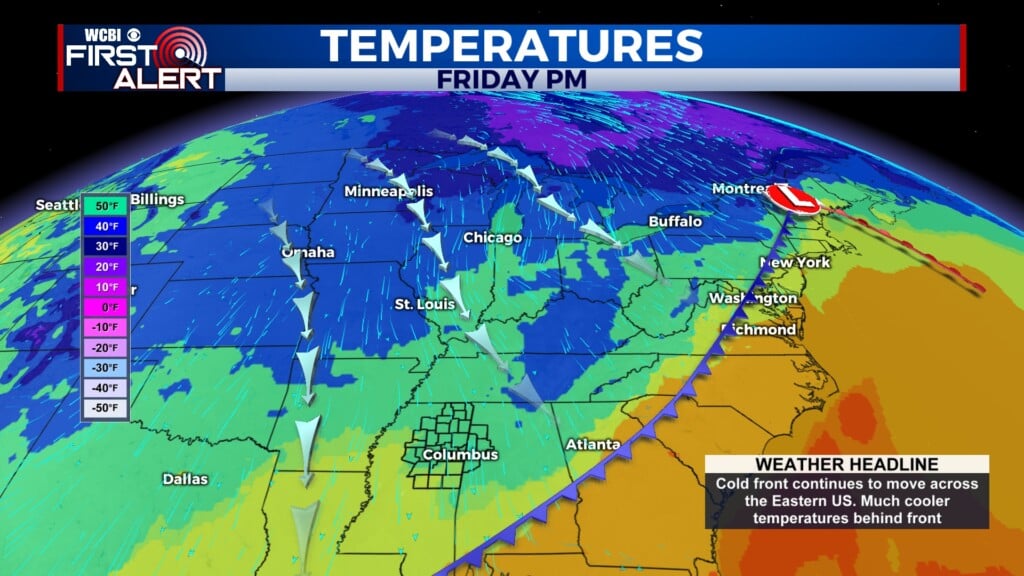
FRIDAY: Today’s high is 82°. However, we will reach it much earlier in the day than normal, likely close to noon. As we get through the afternoon, temperatures will drop rapidly as the effects of the cold air mass behind the front move in. Cloud cover will also increase through the day. We will go from mostly sunny skies in the morning to mostly cloudy by late afternoon. There is a 10% chance of a very isolated shower, but we will most likely not see any rain across our area. Even with that cold front pushing through, the environment is very dry and is not likely to support any precipitation.


Forecast temperatures for 8 p.m. Friday
Moreover, it will be very windy out there today. Winds will start at 5 to 10 mph out of the southwest. After the cold front passes, they will shift to north-northwesterly and increase to 15 to 20 mph. Gusts could reach 30 mph. If you have any loose items or yard furniture outside, make sure you secure them or bring them in!
FRIDAY NIGHT: Skies will gradually clear overnight, but the winds won’t be calming down very much. Northerly winds will persist at 10 to 20 mph, with gusts of 30 mph. Tonight’s low will be around 47° — well below normal for this time of year.
SATURDAY: Tomorrow’s high will reach only about 68°, well below our normal high of 78°. Windy conditions will also continue through the day, with sustained winds from the north at 15 mph and gusts up to 25 mph. Skies will be clear and sunny for much of the day.

Critical Fire Weather Conditions
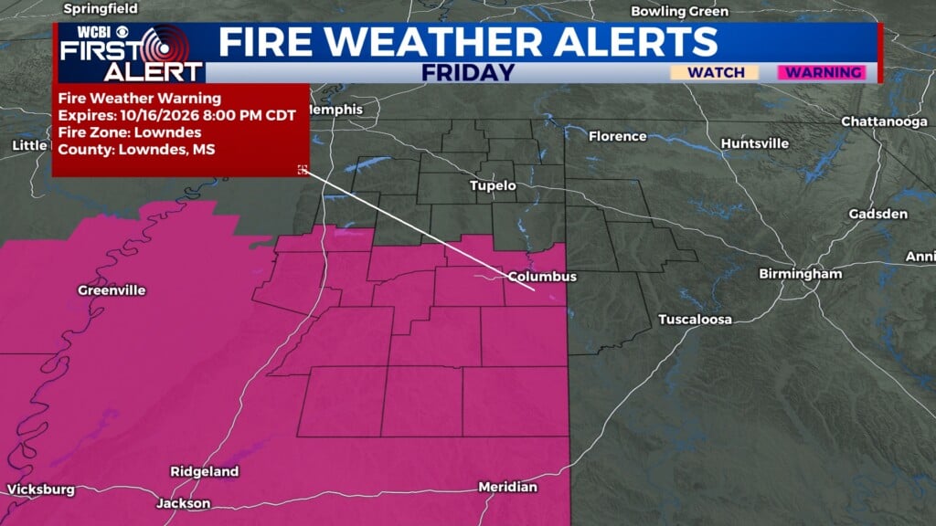
Gusty conditions today and tomorrow, combined with the low moisture in our atmosphere, have increased the risk for fire weather across northeast Mississippi. A Red Flag Warning will be in effect for the southern half of our area today from 9 a.m. until 8 p.m., and a Fire Weather Watch will be in effect for the same area tomorrow from 11 a.m. until 7 p.m. Any fires that develop will likely spread rapidly. Outdoor burning, as well as any activities that promote open flames and sparks, are not recommended.