Frost and freeze risk Friday morning
COLUMBUS, Mississippi (WCBI) – SUMMARY: Rain chances are moving out of the region, but much colder air is on the way to parts of the Twin States.
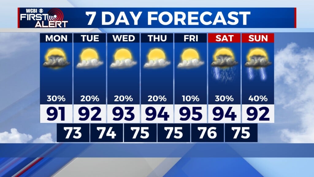
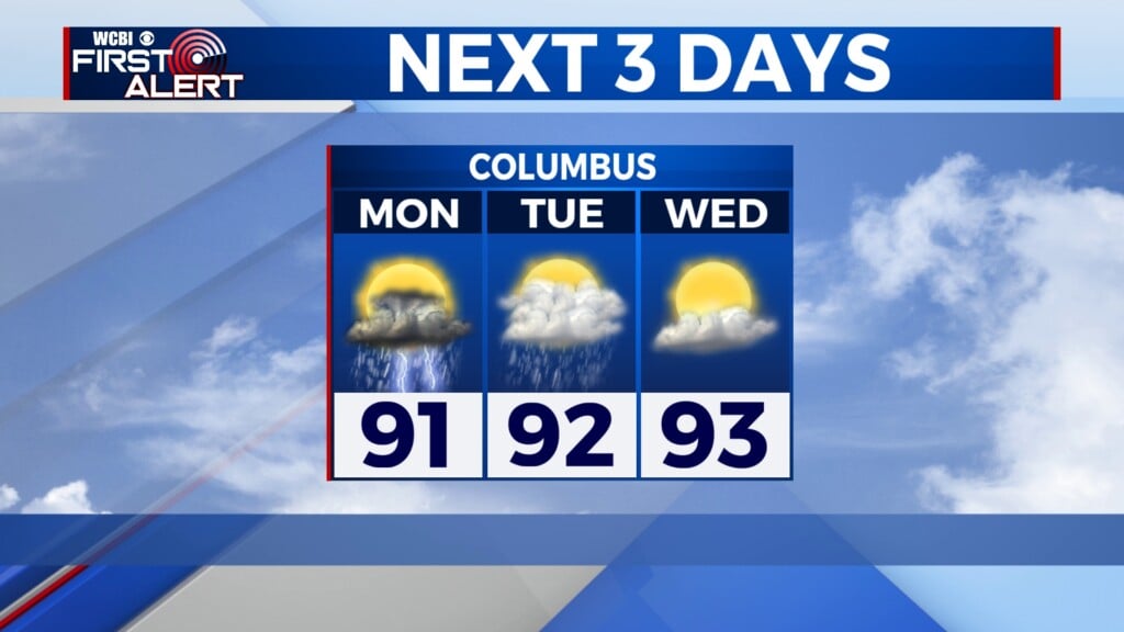
THURSDAY: Expect slow clearing through the day with highs reaching the 50s. Clouds will be slower to clear across far eastern MS into western Alabama.
THURSDAY NIGHT: Areas northwest of the Natchez Trace will be mostly if not fully clear, and frost and freeze threats will result. Temperatures in these areas are expected to drop into the 30s overnight, and frost and freeze alerts are in effect.
FRIDAY: Clouds may hang on for some, but expect a decent mix of sunshine as well. Daytime highs will trend slightly milder to near 60 degrees.
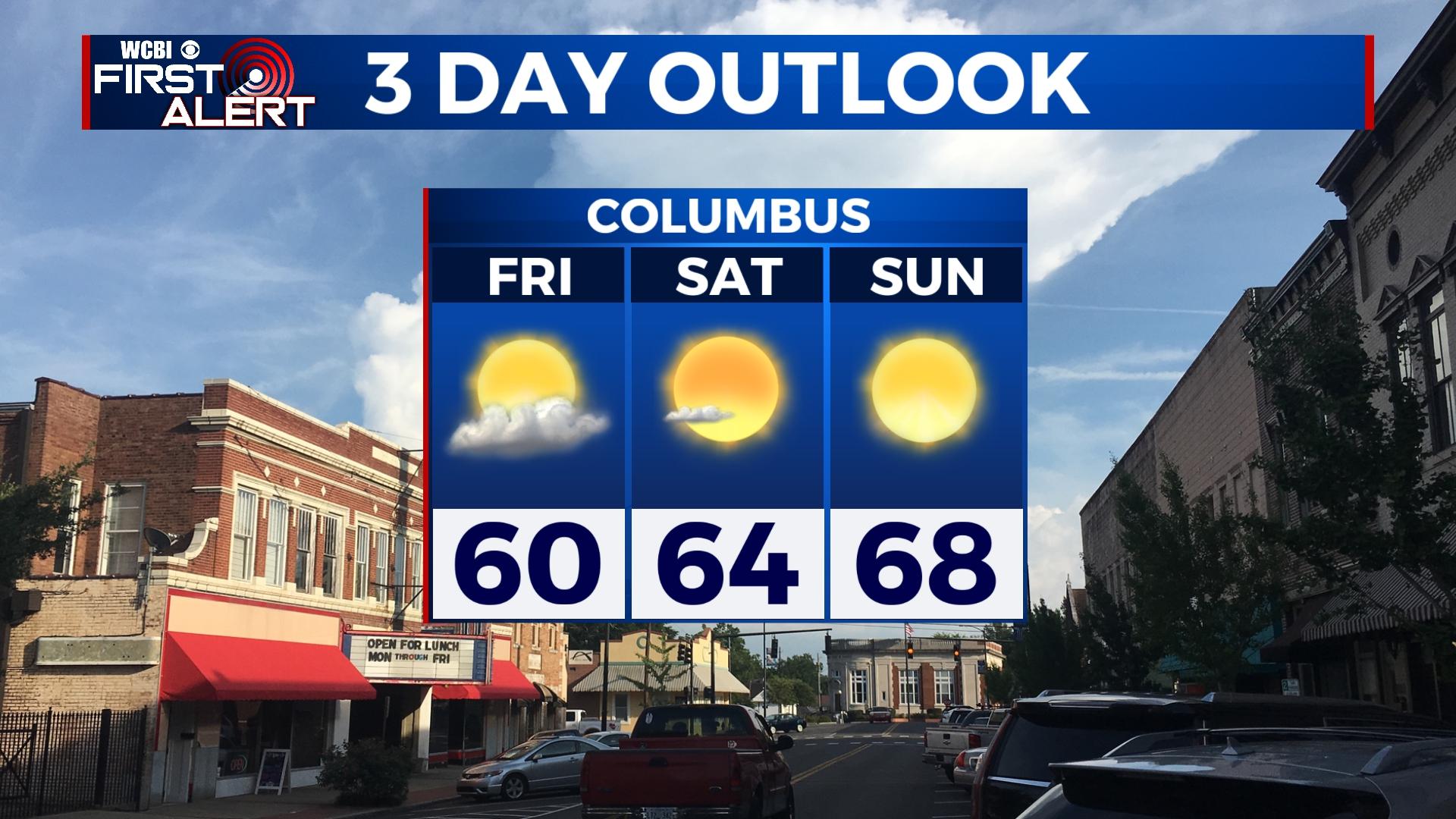
WEEKEND: Expect a good supply of sunshine both days with moderating temperatures. Saturday’s high temperature will be in the middle 60s, and Sunday will bring upper 60s for afternoon highs.
NEXT WEEK: A warming trend is expected to continue with highs reaching the lower to middle 70s through mid-week. Mostly sunny sky conditions will continue as well.