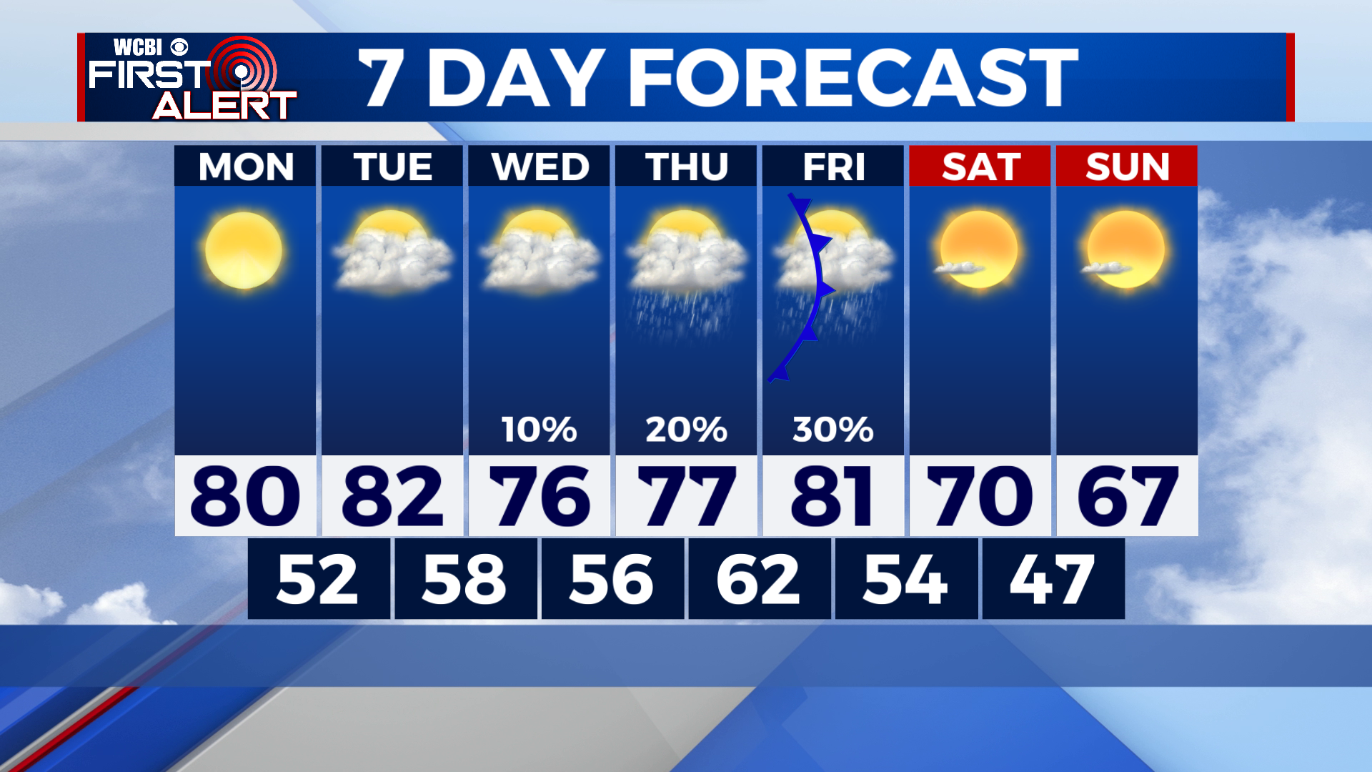
Getting Warmer Ahead of Our Next Front
COLUMBUS, Mississippi (WCBI) – Cool mornings continue, but afternoon get warmer. A passing system on Wednesday and cold front on Friday will bring a couple different chances for rain this week.
TONIGHT: Chilly! Temperatures will drop into the mid-40s overnight.
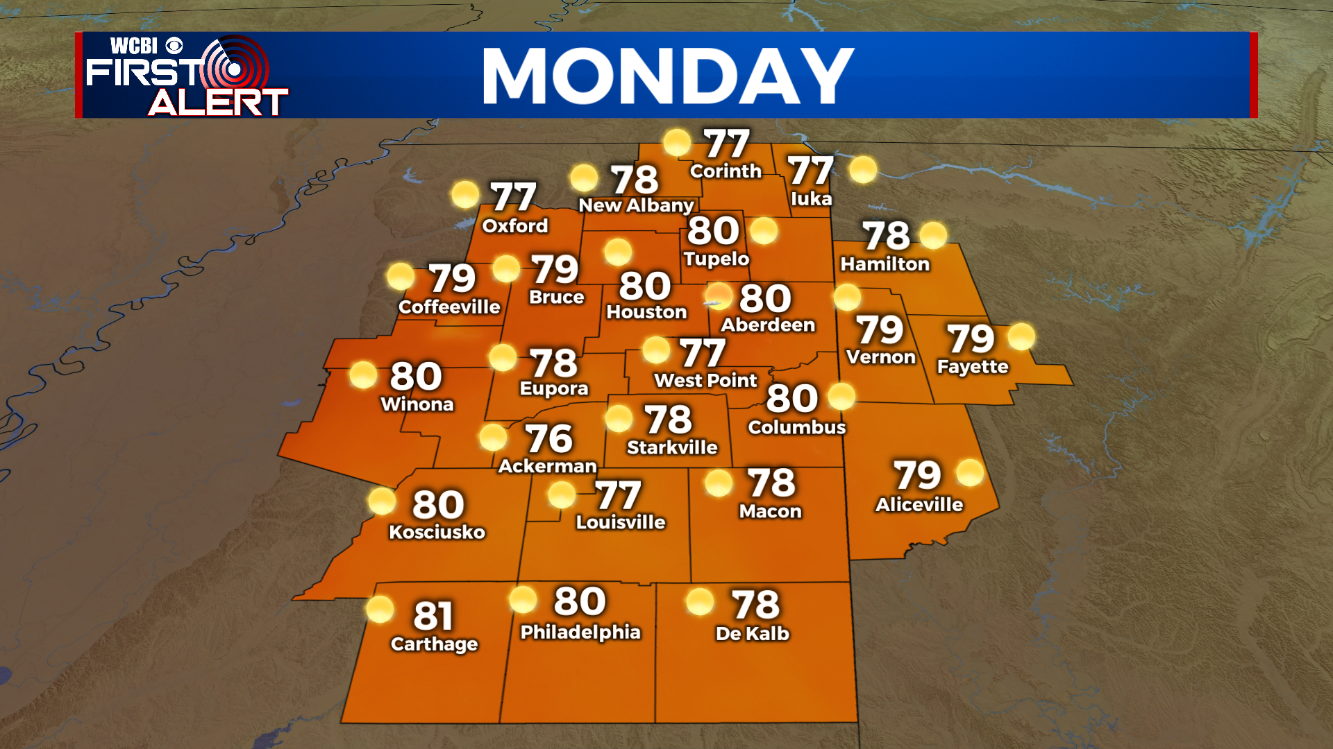
MONDAY: Think about grabbing a jacket before you walk out the door early Monday morning. The day will start off chilly, but sunshine will quickly warm us into the upper 70s by Monday afternoon. Some places will likely reach 80°. Plan on another warm, beautiful day with lots of sunshine.
TUESDAY: Warm again, but with extra clouds. You’ll notice high clouds really start build in by Tuesday afternoon. We’ll be dry with highs in the low 80s.
REST OF THE WEEK: A few showers could clip our southeastern communities on Wednesday, but at this point, it looks like most of the area will miss out on the rain. There’s a low chance for showers on Thursday as well. The “best” chance for rain comes on Friday as our next cold front passes through. Cooler, drier air moves in over the weekend behind the front.