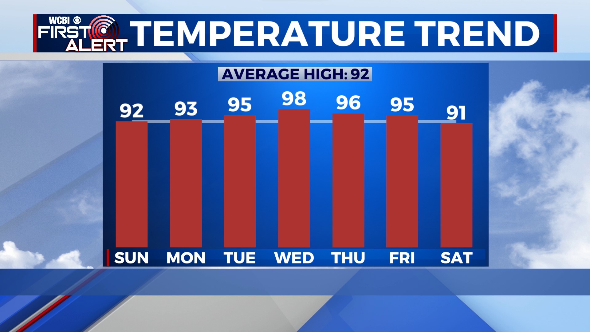
Less Active and Heating Up
COLUMBUS, Mississippi (WCBI) – We’re finally getting a break from the bad storms and flooding. We’ll have less rain over the next few days, but temperatures will respond and soar well into the 90s.
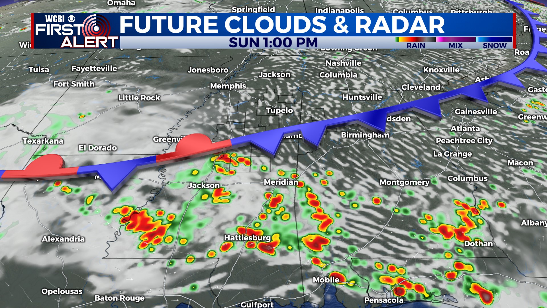
TONIGHT: Mostly quiet aside from an isolated shower north of Highway 82 this evening. For the rest of us, it’ll be dry. Low near 73°.
SUNDAY: An isolated shower or storm is possible south of Highway 82 Sunday morning as a weak front drops southward. Showers and storms will have a hard time popping up in the afternoon as drier air tries to filter in behind the front. Rain chances are low, and most of the area will stay dry. We’ll have some extra clouds later in the day, with highs near 92°. Chance of rain: 20%.
MONDAY: Hot and hazy. Canadian wildfire smoke will be overhead again, but it’ll be suspended high in the atmosphere. Air quality shouldn’t be a big issue; just a hazy tint to the sky. Once again, there’s a small chance for an afternoon shower or storm, but otherwise, I expect a mostly dry day. High near 93°. Chance of rain: 20%.
REST OF NEXT WEEK: Really hot! Wednesday looks like the hottest day of the week, with temperatures possibly reaching the upper 90s. Heat Alerts may be needed for the middle of next week. Storm chances return Friday, lasting into the weekend.