Mid-week rain chances moving in
COLUMBUS, Mississippi (WCBI) – An area of low pressure in the northern Gulf is set to bring another chance for much-needed rain across the Southeast.
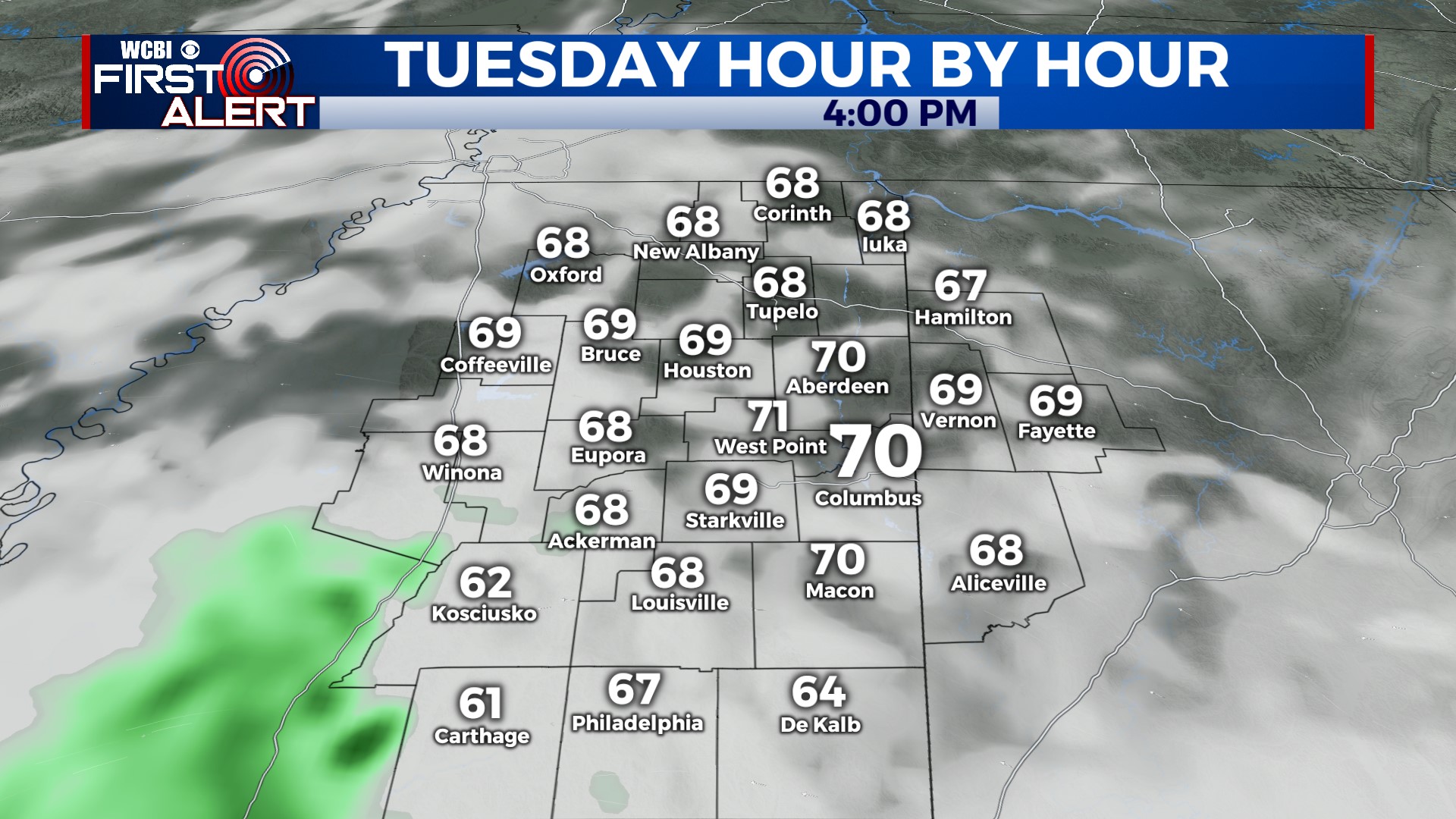
TUESDAY: Most of the day stays mild & dry with highs nearing 70 degrees. Like yesterday, the warmer air will be north of US 82 while cooler air (highs in the 60s) will be more likely south of US 82. While a few showers can’t be ruled out this afternoon, the better chance for rain should hold off until Wednesday.
TUESDAY NIGHT: Scattered showers become a bit more likely in the evening & overnight hours w/temps falling into the lower 50s.
WEDNESDAY: Widespread cloudiness and on/off showers are likely much of the day. As a result, highs will only reach the upper 50s! Unfortunately, steady & heavy rain is not likely…so rain amounts look to remain relatively unimpressive yet again.
THU/FRI: Showers look to generally move out early Thursday, leaving the rest of the day dry w/temps bouncing back into the 60s. Another front is set to move through Friday, but nothing more than a few random showers are expected at this time.
WEEKEND: Behind Friday’s front, we’re set to cool down…especially at night! Expect a good deal of sun Saturday & Sunday, but mornings will be chilly. We expect upper 30s Saturday night with possible frost. Highs rebound into the middle 60s Sunday afternoon.