Potential “relief” Friday as temperatures continue to ramp up
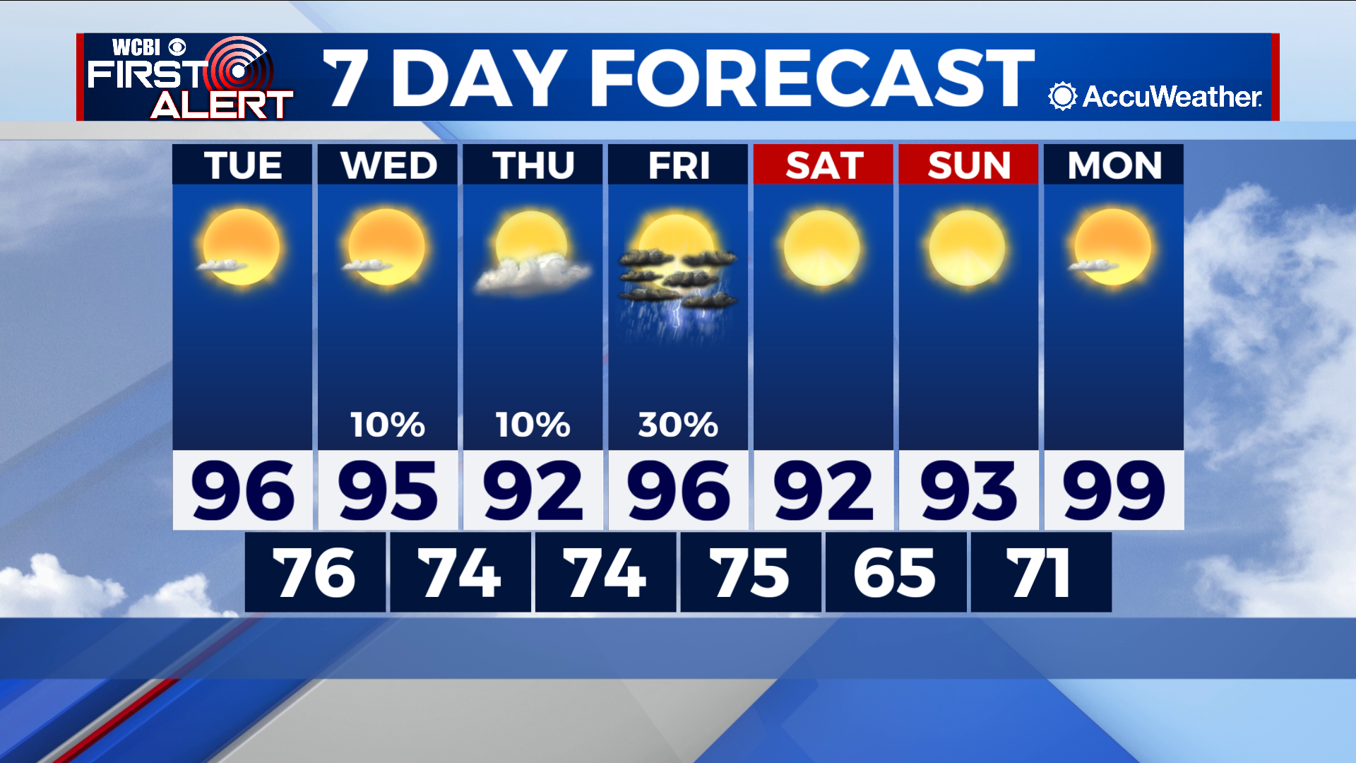
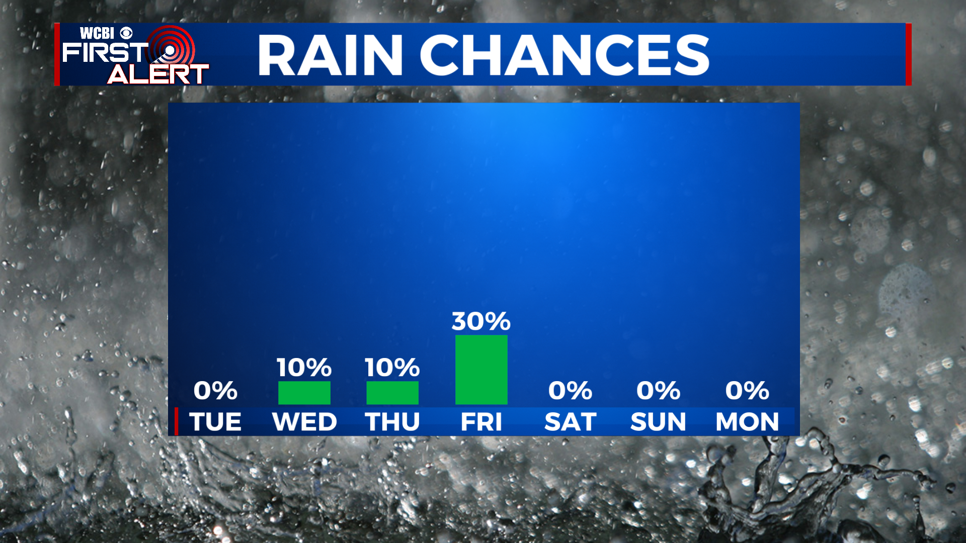
COLUMBUS – SUMMARY: The chance for some rain mid-week will put a twinkle in many of our eyes. Highs remain in the 90s however, fluctuating between the upper and lower 90s for the next week. Lows are fortunately far more comfortable and remain in the mid 70s for the most-part.
TUESDAY: We trek on with the heat advisories and hot temperatures Tuesday, touching the mid to upper 90s once again. The mid 70s overnight low will be comfortable, although the window to enjoy these lows will be small. Once the sun rises temperatures will rapidly warm up in the ensuing hours. Skies remain mostly clear and no rain is expected Tuesday.
WEDNESDAY: The potential for the stray shower or thunderstorm Wednesday will put some hope into our minds. Most of us will not see any rain however as skies will be mostly sunny throughout the day. Afternoon temperatures hit the mid 90s and overnight lows bottom out in the mid 70s.
REST OF THE WEEK: Highs will decrease slightly into the low 90s heading into the weekend, only to shoot back into the upper 90s next Monday. The greatest chance for any rain relief comes Friday in the form of some scattered showers and thunderstorms, while the rest of the week is nearly bone dry. Lows will hover in the mid 70s, making one big drop into the mid 60s overnight Saturday before rebounding into the 70s the next day.