Remaining cool for the week ahead
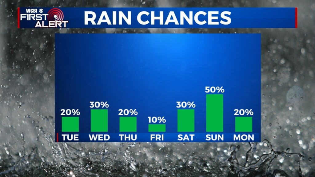
SUMMARY: A cool next 7 days, no 70s in sight. After a brief warmup through Wednesday, chilly weather returns for Thursday and Friday. We’ll see a rain chance Wednesday night, and it could mix with snow in spots on Thursday morning. We warm up again for the weekend with rain Saturday PM and Sunday, and then cold air returns to begin next week.
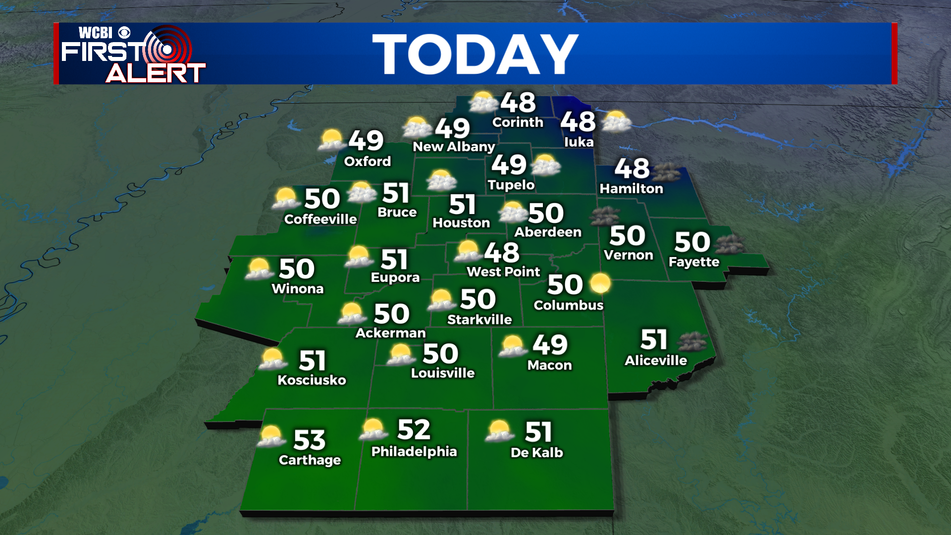
TUESDAY: A nice and sunny day after clouds finally break up. Warmer, in the upper 40s to low 50s.
TUESDAY NIGHT: Cool but not quite as cold, with a low in the low to mid 30s and partly cloudy skies.
WEDNESDAY: Partly cloudy and seasonable in the mid 50s. A stray shower will be possible in the afternoon and evening hours.
WEDNESDAY NIGHT: Rain showers move through Wednesday night with a changeover to snow possible as an area of low pressure slides through. Lows in the low to mid 30s.
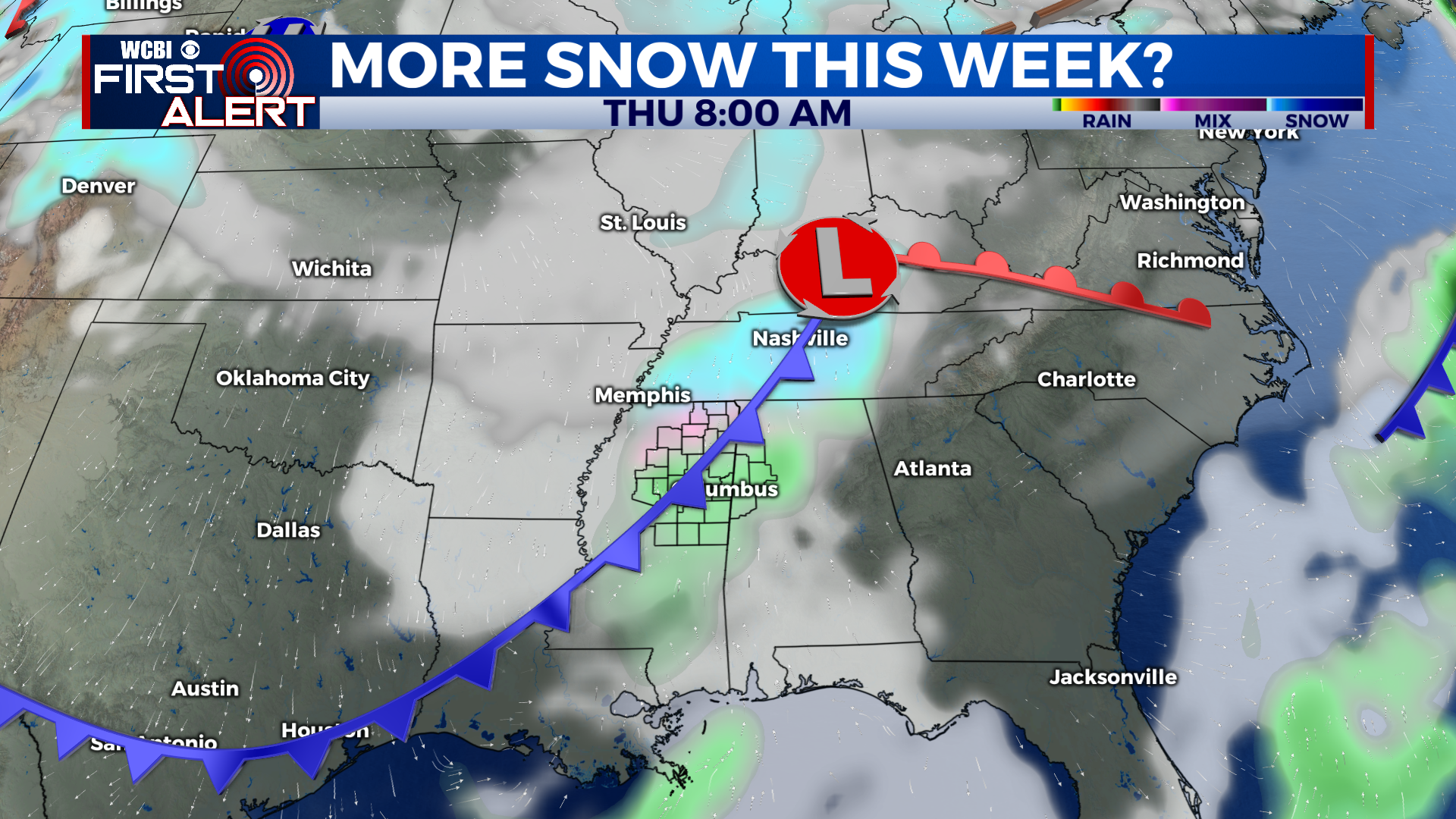
THURSDAY TO MONDAY: We could start off Thursday with some snowflakes, but not expecting an event as powerful as Sunday night’s. Highs will be in the 40s with rain showers. It will be downright frigid Thursday night, in the upper teens to low 20s. Friday will stay very cool in the 30s all day. We’ll see some showers on Saturday afternoon as we rebound to the upper 50s, with heavy rain on Sunday with a high in the 60s. A cold front brings cooler 40s back for Monday with dry conditions.
CONNECT WITH @WCBIWEATHER ON TWITTER, FACEBOOK, AND INSTAGRAM