Round 2 of storms returns tonight, then we’ll shift to a dry pattern
COLUMBUS, Mississippi (WCBI) – SUMMARY: Showers and thunderstorms will continue through tonight as a strong late-May cold front pushes through the region. Rain may be heavy at times. Here is the latest…
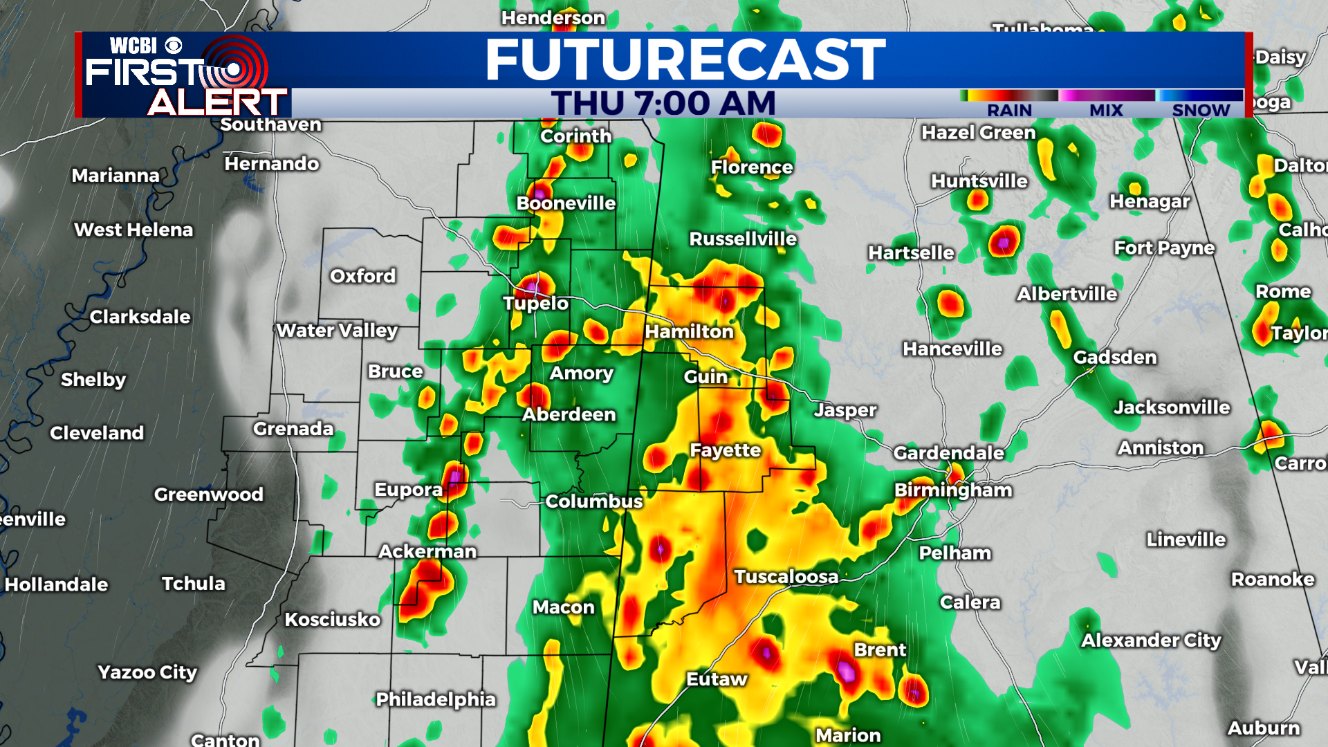
TONIGHT: Showers and thunderstorms developing after 11pm. Some storms may be strong with frequent lightning, heavy rain, and gusty winds. Lows in the mid-60s. South wind 5-10 mph, with gusts up to 25 mph. Chance of rain: 80%.
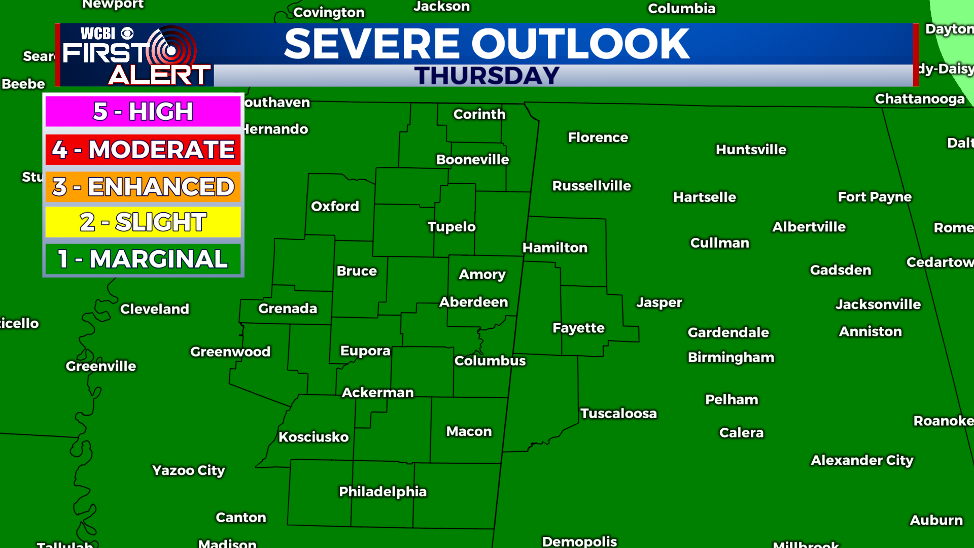
THURSDAY: Scattered showers and thunderstorms ending by 11am. Becoming mostly sunny during the afternoon with highs in the low-80s. West wind 5-10 mph with gusts up to 20 mph. Chance of morning rain: 60%.
THURSDAY NIGHT: Mostly clear. Overnight lows in the mid-50s. West wind 5-10 mph with gusts up to 20 mph.
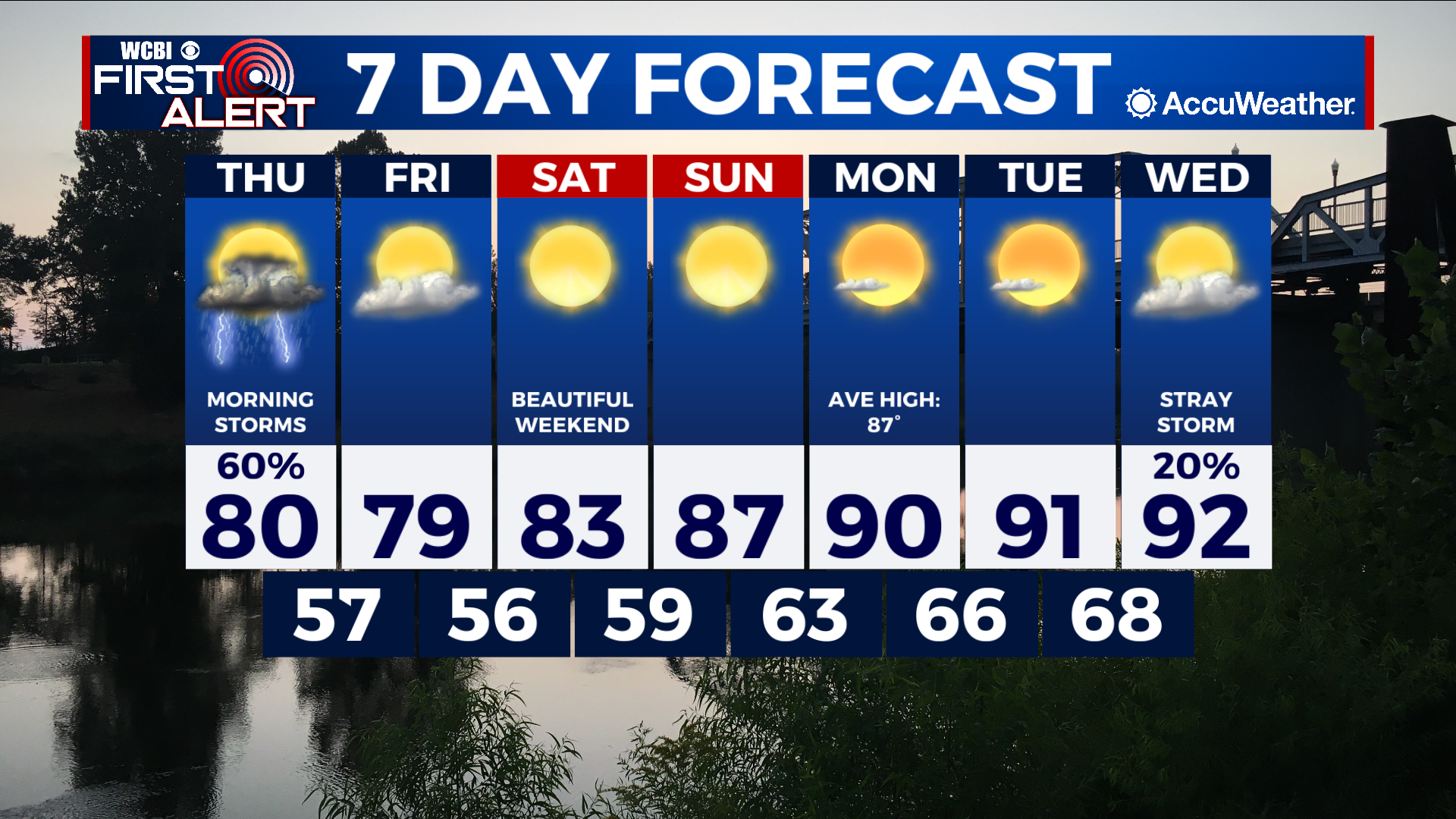
EXTENDED FORECAST: High pressure will settle into the region by Friday and end our rain chances for the weekend. Temperatures will also gradually warm into the mid-80s on Saturday, then upper-80s to low-90s by Sunday. Next week is setting up to be a mainly dry, calm period with seasonable temperatures in the upper-80s to low-90s each day.