Storm threats are no joke
COLUMBUS, Mississippi (WCBI) – A cloudy and humid start to our week. Showers and storms are likely Tuesday afternoon to evening. Once the rain clears out, there will be a mid-week drop in temperatures.
MONDAY NIGHT: Heavy clouds continue across the Deep South tonight, keeping temperatures a bit more mild. Overnight lows will only fall into the upper 60s.
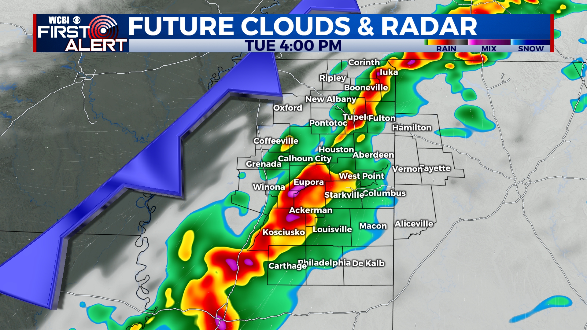
TUESDAY: A cold front from the NW will help drive a line of showers and storms into Northeast Mississippi by Tuesday late afternoon. A few of these storms have the possibility to become strong to severe. An isolated tornado cannot be ruled out. A rough timeline looks to be about 2PM-11PM. High temperatures will be back in the low 80s, while overnight lows will cool down into the upper 40s.
REST OF WEEK: After the rain clears out, we will have a brief cool down into the mid 60s! In addition to the mild afternoon temps, morning lows will be chilly as well ranging between the upper 30s and low 40s. Clouds will clear out it with the rain, leaving us with a mostly clear sky for midweek.


