Strong to severe storms possible Monday night
COLUMBUS, Mississippi (WCBI) – Heavy rain and potential severe storms move in Monday night with a strong cold front. Much cooler weather follows the rest of the week.
MONDAY: Outside some spotty, occasional showers, the day stays dry and mostly cloudy with afternoon highs nearing 70 degrees. It will be a breezy afternoon as well, with wind gusts of 25-30 mph possible after lunch.
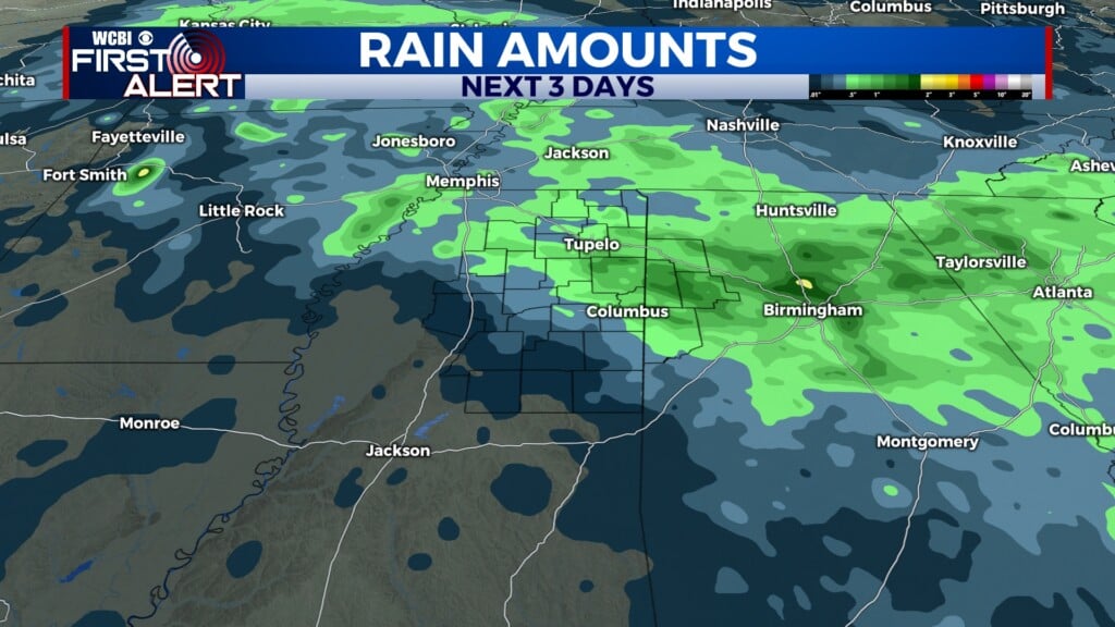
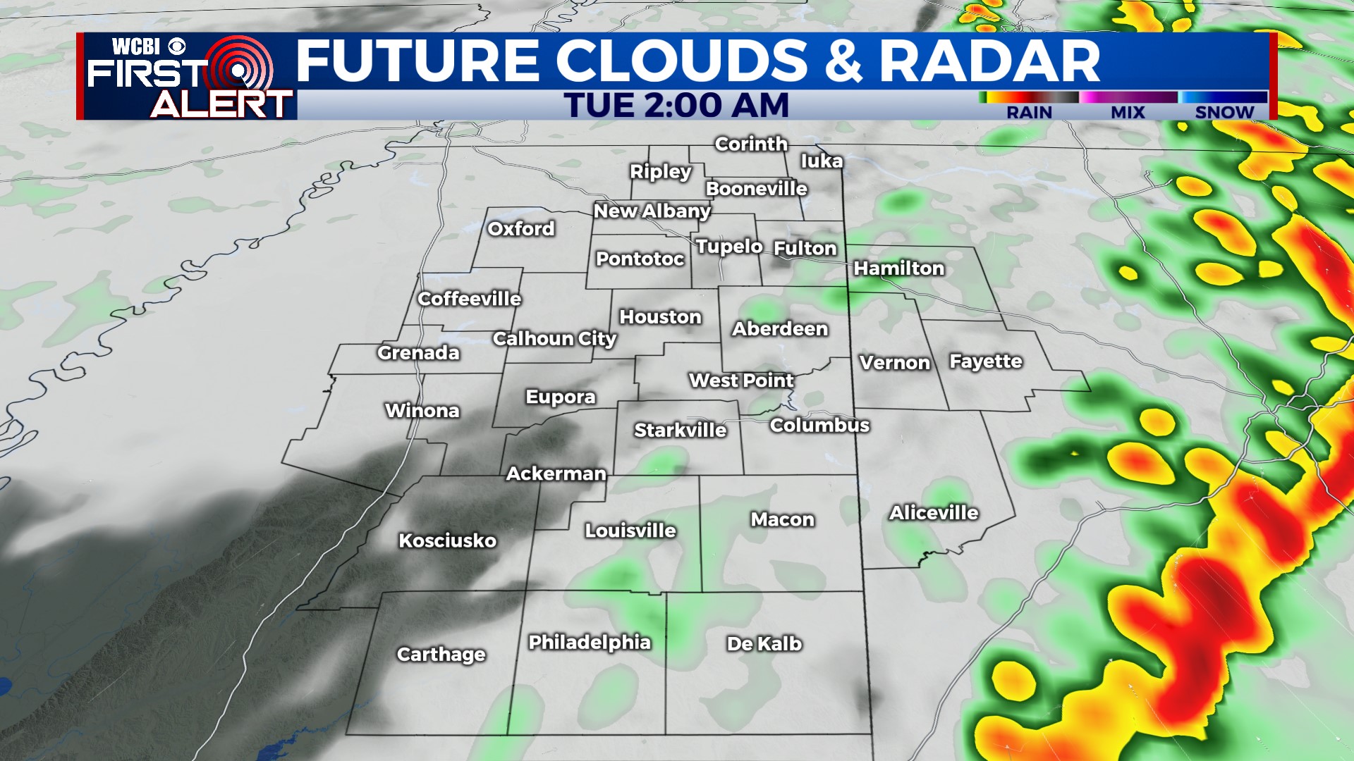
MONDAY NIGHT: Areas of heavy rain and strong/severe storm potential develops into Mississippi near & after sunset. Our broad time line remains unchanged – 5p-2a. We expect a broken line of storms to sweep across the region, with potential for a supercell or two as well. Wind shear is quite favorable for storm rotation, but storm energy will be on the lower end of the spectrum. This type of setup is common in late November, and it is one that historically produces severe weather in our region. Damaging winds and a tornado risk will accompany these storms, as well as heavy rain (which we certainly need). Make sure your severe weather action plan is ready to go in case watches & warnings are issued!
TUESDAY: Overnight storms will clear out before daybreak, but clouds are likely to linger much of the day. Daytime highs will struggle to get out of the 50s with a northwest breeze.
REST OF WEEK: Wednesday looks dry and chilly w/highs back in the middle 50s. Thanksgiving Day looks dry as well with highs only in the middle 50s. The Egg Bowl in Starkville looks to stay dry as well, but it will be chilly! Rain chances return Friday as scattered showers become possible another system moves across the area.