Temperatures stay cool, rain chances eventually increase
While we’ve enjoyed a nice stretch of cooler and drier weather, we could see rain return to the area by the end of the week and the weekend. For now, we’ll keep the clouds around with temperatures topping out near 80 each afternoon.
SUNDAY NIGHT: Quiet and cool weather persists tonight as clouds slowly build back in. We’ll wake up to mostly cloudy skies and temperatures in the mid to upper 50s by sunrise. Winds could be a bit breezy at times out of the east.
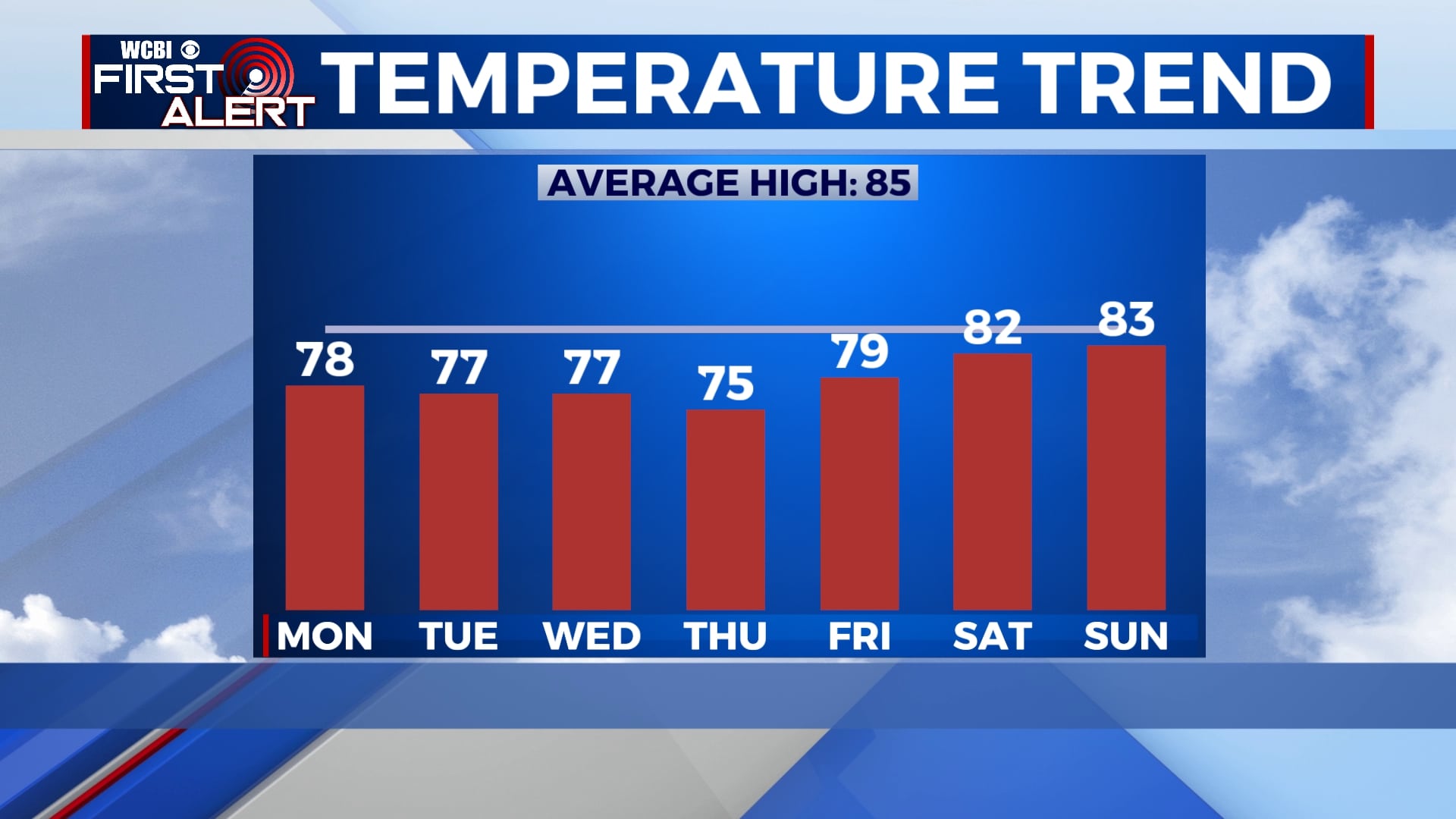
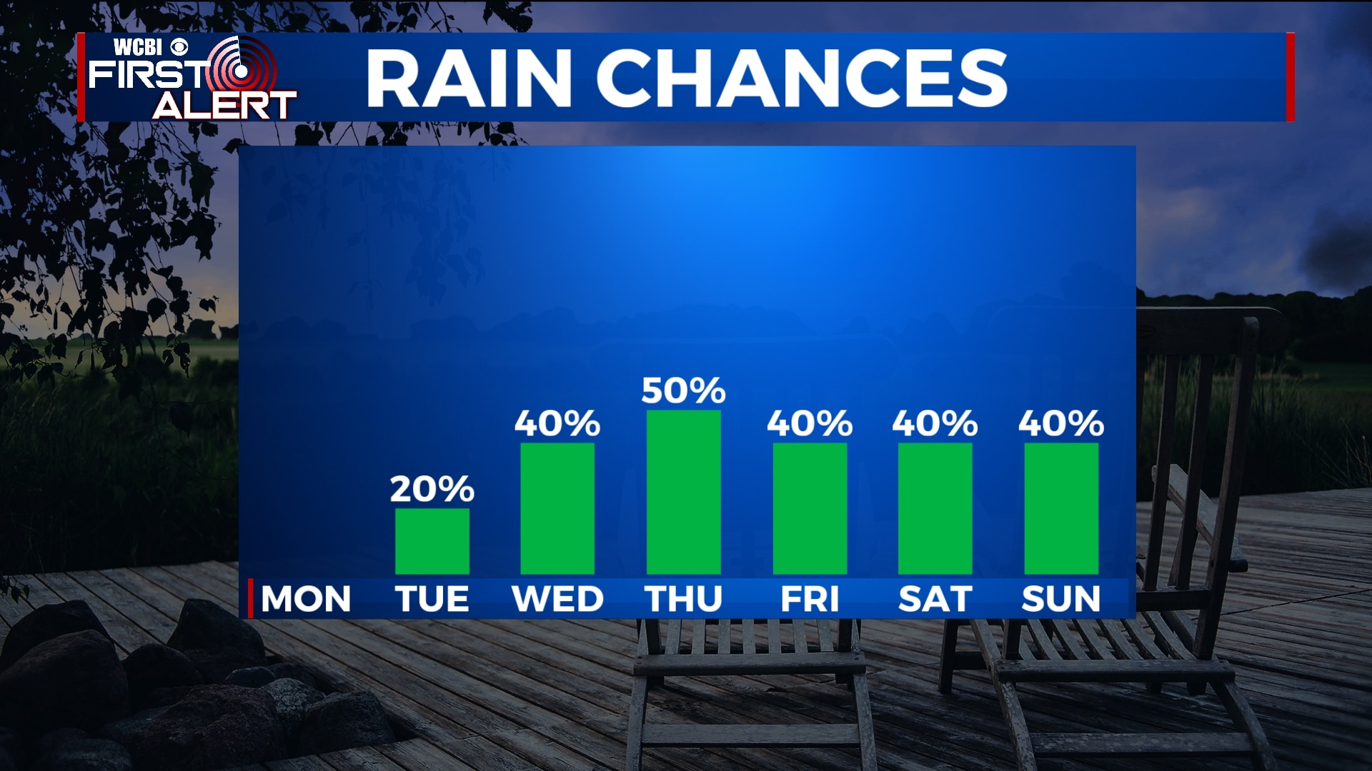
MONDAY-TUESDAY: Clouds will build back into the area for Monday and Tuesday, but chances for rain will remain low. Temperatures will stay on the cooler side with highs only in the mid to upper 70s and overnight lows in the upper 50s to near 60.
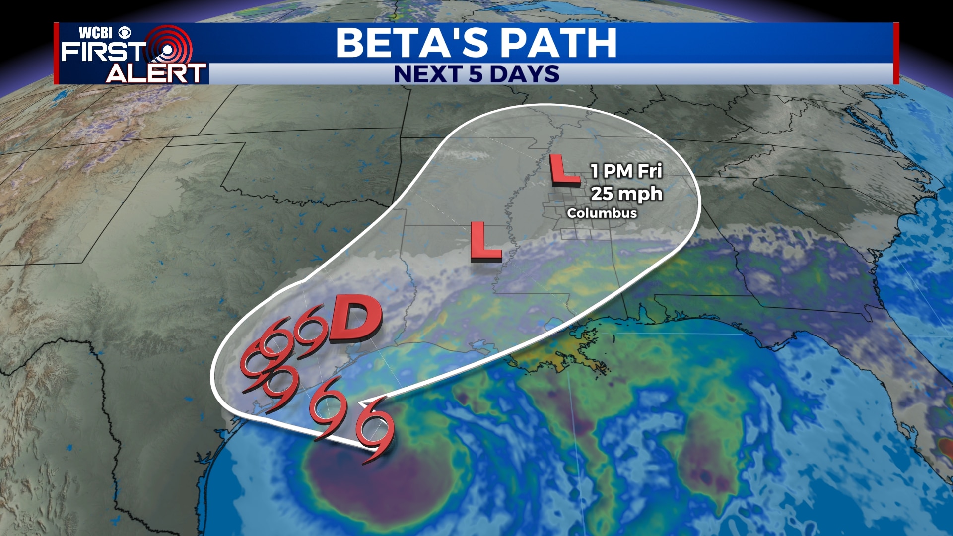
WEDNESDAY-SUNDAY: We’ve increased rain chances to 40%-50% for the second half of the week and the weekend as the remnants of Tropical Storm Beta look to cross over the area. We’ll see off-and-on showers each day with some spots seeing heavier rain at times. Some areas could see 1″-2″ of rain total this week, but many areas won’t see quite that much. Still, any rain will help us to get out of our abnormally dry stretch of weather. Skies will remain mostly cloudy to overcast with highs in the upper 70s to low 80s. Morning lows will be in the mid to upper 60s thanks to the cloud cover.
NEXT WEEK: It’s a little early for an exact forecast, but indications are that one more cold front could come through the area early next week. If it holds true, it would help to move any rain out of our area and return us to some cooler temperatures. We’ll be watching and making adjustments to the forecast as necessary.
Follow WCBI Weather on Facebook, Twitter, and Instagram


Leave a Reply