Two rounds of cold fronts set the tone for a chilly week ahead
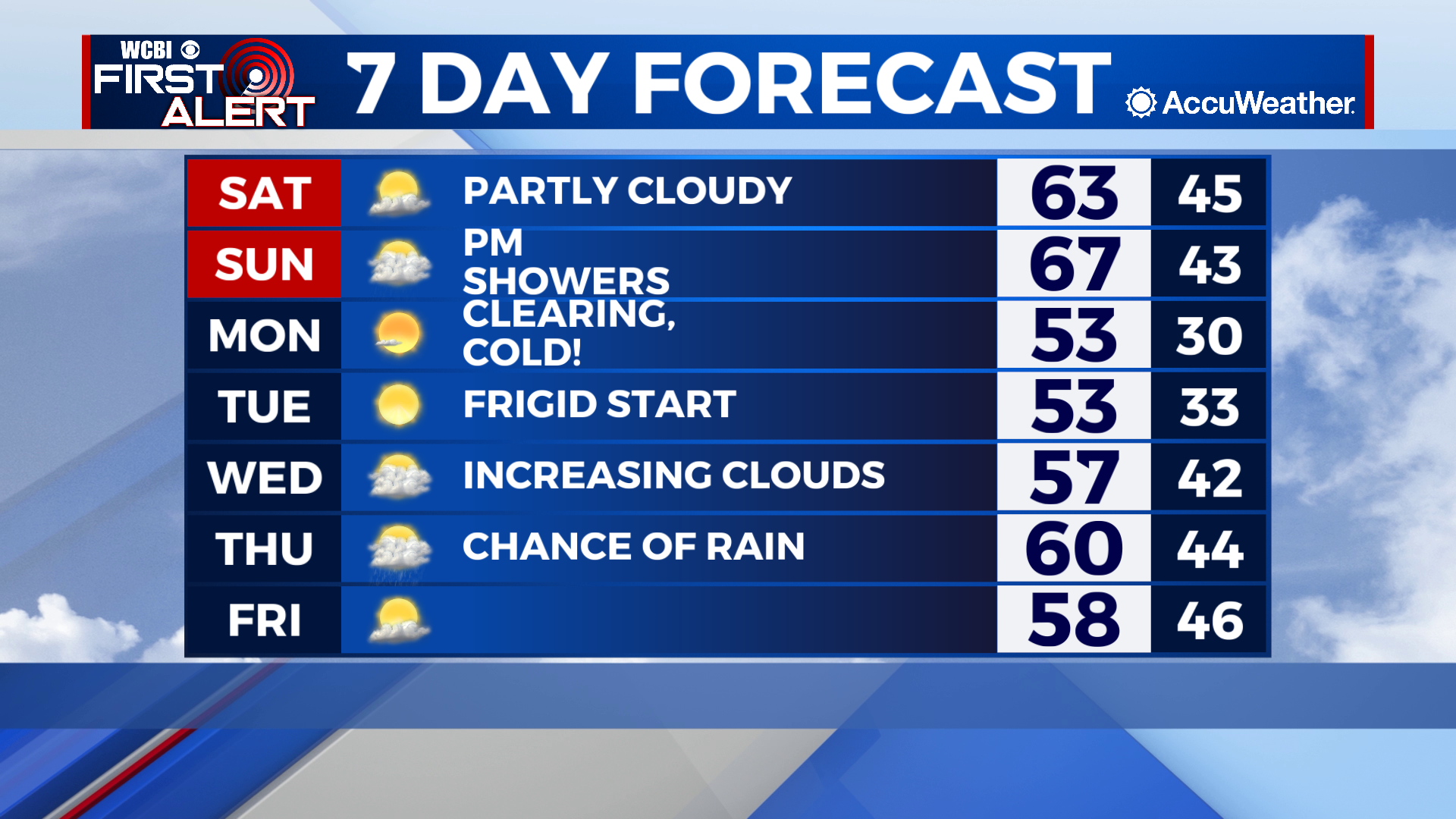
COLUMBUS – SUMMARY:A slow increase in temperatures into the mid 60s over the weekend will be negated by a strong cold front moving into the area Sunday night. Temperatures will drop into the 50s and remain that way throughout next week as a another cold front Thursday keeps the cold air around. Elevated rain chances accompany both fronts but the rest of the week remains otherwise dry.
SATURDAY: Temperatures top out in the low 60s as the high continues its slow climb this weekend. Partly cloudy skies come along as lows drop into the mid 40s overnight.
SUNDAY: Temperatures reach their highest for the next week in the mid 60s. Mostly cloudy to overcast skies are expected as a cold front makes it’s way into the area late in the day. Elevated rain chances with this front mean that at least most of us will get some rain across the area. As of now the latest models show rain moving in around our dinnertime and leaving by midnight.

NEXT WEEK: Sunday’s cold front will drop temperatures back into the 50s and it will stay that way throughout much of next week. Lows drop down to freezing temperatures early in the week before slowly rebounding into the mid 40s. Temperatures slowly climb into the mid to high 50s before another cold front on Thursday stifles the warming trend. Rain chances exist with the Thursday front but the week remains otherwise dry.