Warm and dry weekend then rain and storms return Monday
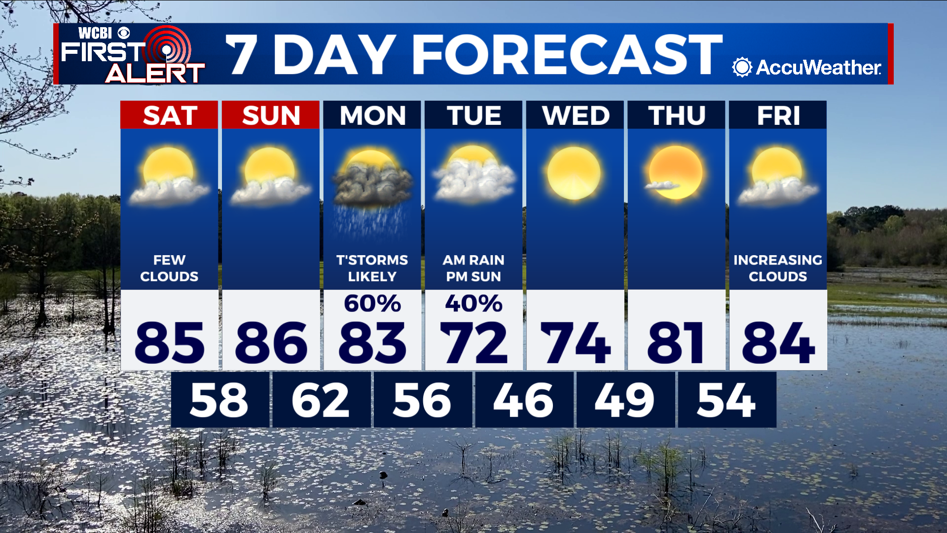
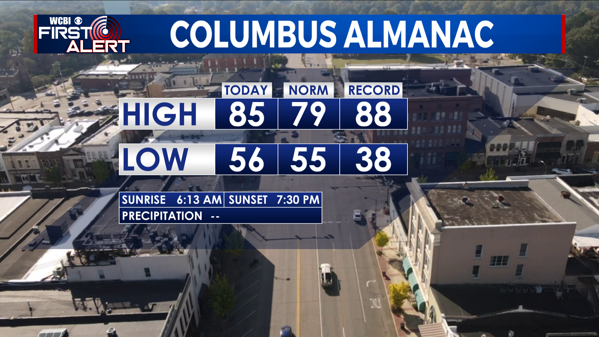
COLUMBUS, Mississippi (WCBI) – SUMMARY: It was a beautiful day with sunny skies, but on the warmer side with highs in the middle 80s. More warm weather is ahead, then a chance of rain to start next week.
TONIGHT: Mostly clear with lows in the mid-to-upper 50s. South winds 5-10 mph.
SATURDAY: Morning sun followed by afternoon clouds. Breezy at times. Continued warm with highs in the middle 80s. South winds 5-10 mph with gusts up to 20 mph.
SATURDAY NIGHT: Partly cloudy with lows around 60°. South winds 5-10 mph.
SUNDAY: Partly cloudy and warm with highs in the mid-to-upper 80s. South winds 5-10 mph with gusts up to 20 mph.
SUNDAY NIGHT: Mostly clear with lows in the low-60s.
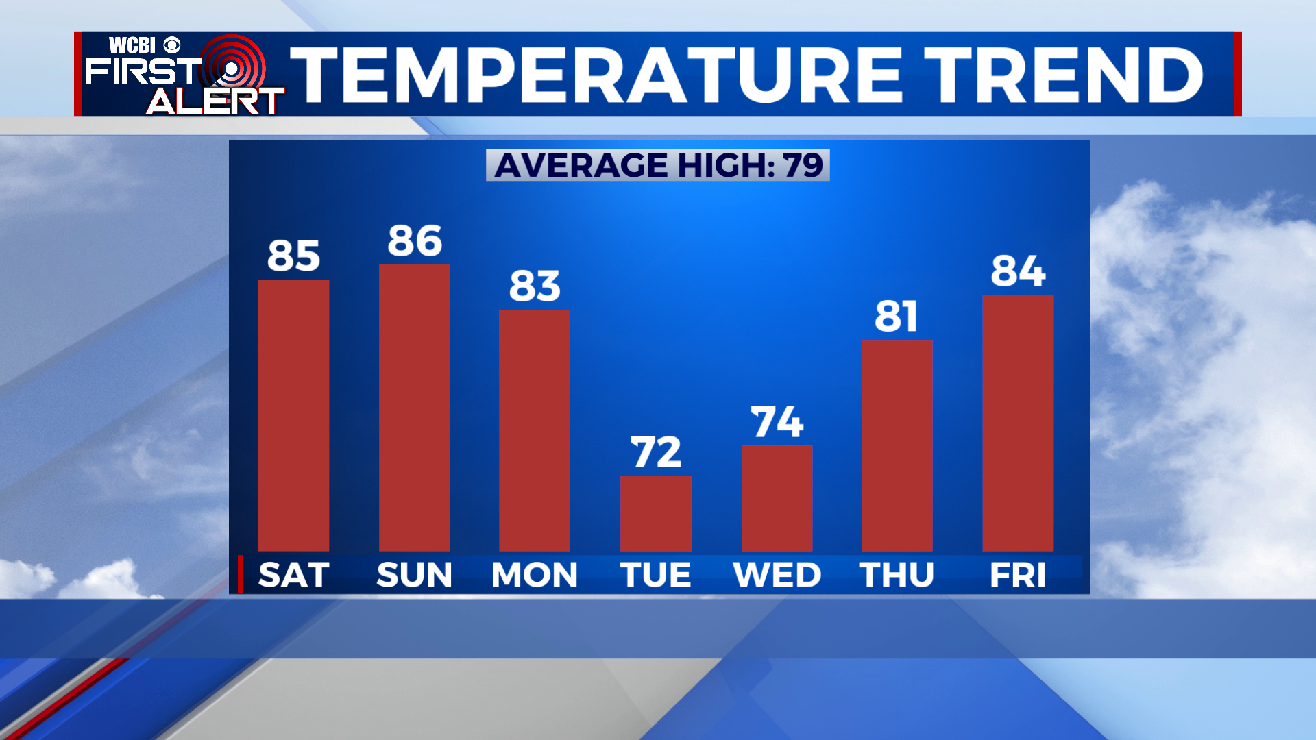
EXTENDED FORECAST: Scattered showers and thunderstorms will arrive Monday afternoon and evening. A couple storms may be strong with heavy rain and occasional lightning, but severe weather is not expected. By Tuesday, the cold front will linger across our eastern counties with scattered showers ending west to east by the late morning. Tuesday’s highs will be in the lower 70s with a sunny sky by the late afternoon. The rest of the week will signal a warming trend as highs reach the low-to-mid 80s by Friday.