Warming up with storms on the way
COLUMBUS, Mississippi (WCBI)- Temperatures are continuing their warming trend, heading towards the 80s. End of the week brings a chance for showers, storms, and severe weather to NE Mississippi.
WEDNESDAY NIGHT: Sky coverage staying partly to mostly cloudy overnight. Temperatures are going to be staying fairly mild tonight, falling into the middle 50s. Overall, it is going to be a calm night.
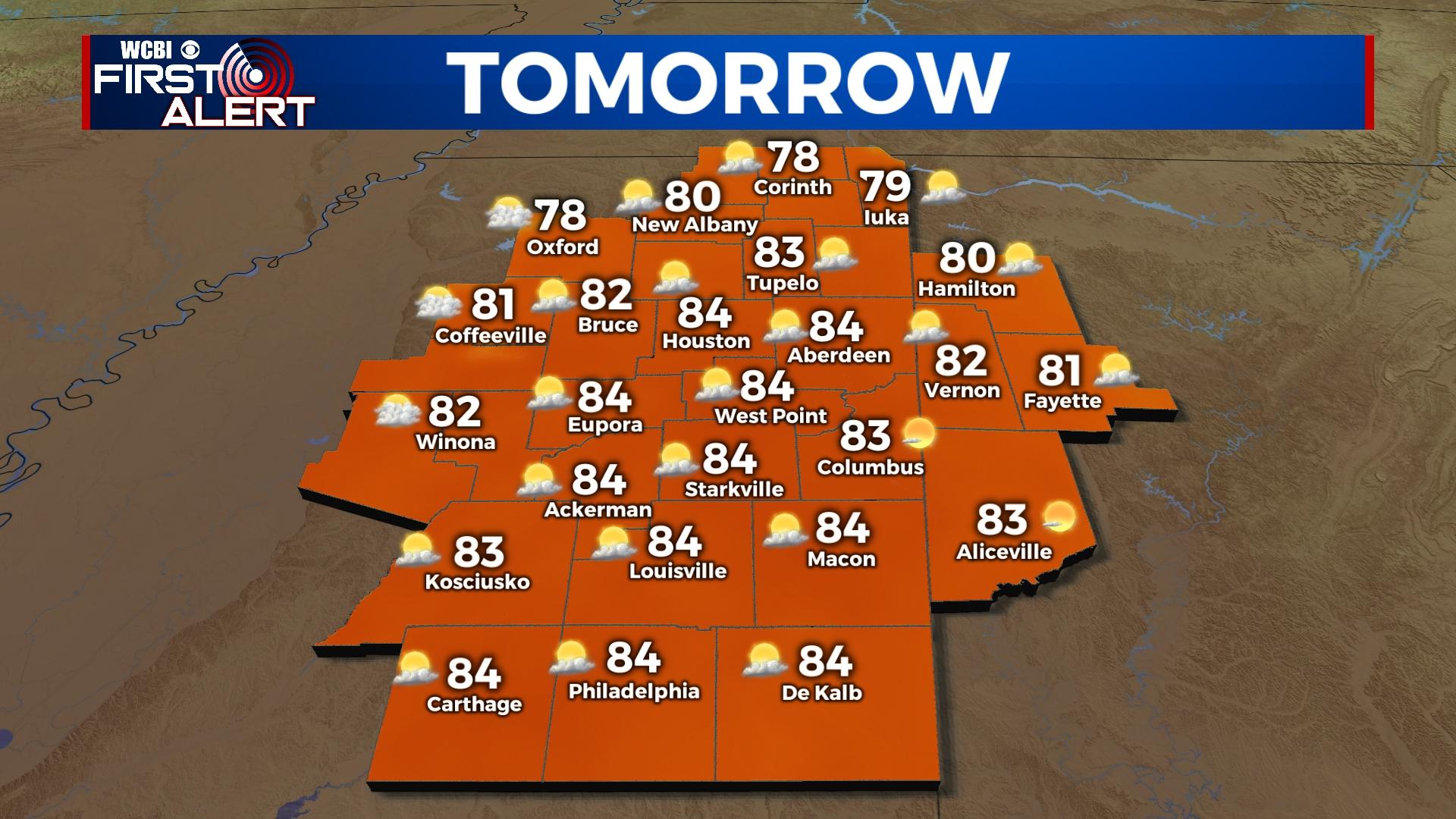
THURSDAY: Our temperatures are going to continue to climb. High temperatures for Thursday will reach into the low to middle 80s. Cloud coverage will stay minimal, mostly clear to partly cloudy depending on location. Overnight temperatures will be mild, into the lower 60s.
FRIDAY: The first half of Friday will stay relatively calm, but hot! Temperatures will return to the low to middle 80s. Cloud coverage will become heavy early. Into the late afternoon and through the rest of the night, make sure to be weather aware with multiple ways of receiving weather alerts. A strong front will be heading towards the Deep South, bringing showers and storms. All ingredients are going to be in place for an active severe weather night. Our timeline has slightly adjusted, focusing between 5pm Friday and 2am Saturday morning. All modes of severe weather are expected with this line of storms. The WCBI Weather Team will continue to watch this system over the next couple of days!


