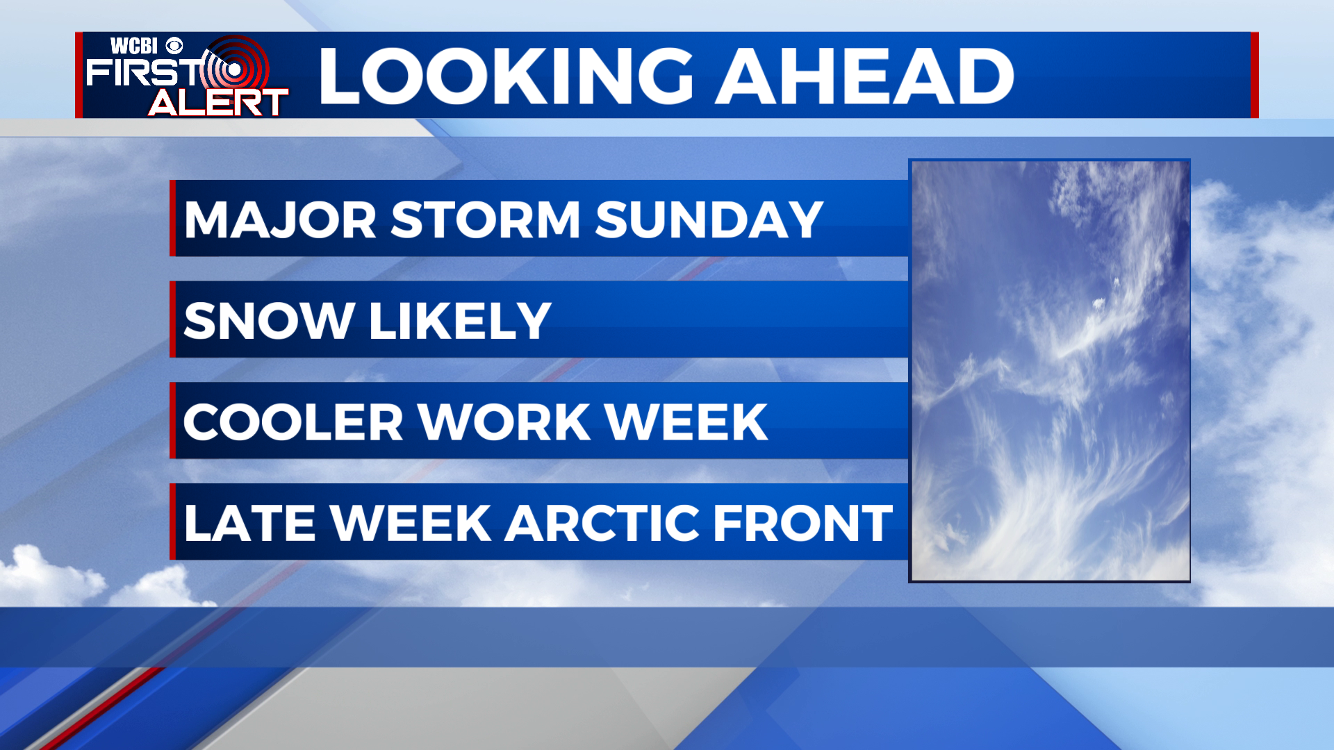
Winter storm on the way
SUMMARY: After a mild and dry Friday, rain will begin to move by Saturday afternoon. A powerful area of low pressure will move through the south Saturday night and Sunday, drawing in cold air and changing the rain to snow for many locations during the day Sunday. Accumulating snow looks likely for much of the area! Any snow will melt quickly by Monday, with temperatures rising back to the upper 40s. We stay fairly calm for the new work week until an arctic front brings a fresh shot of cold air for the latter half of the week.
FRIDAY: A nice day in store, get out and enjoy! Highs will top out in the upper 50s with increasing afternoon cloud cover.

FRIDAY NIGHT: Staying fairly mild Friday night, with lows dropping to near the 40 degree mark. Skies will remain cloudy, with a sprinkle or 2 possible by morning.
SATURDAY: We’ll start the day mainly dry, but showers will develop by the afternoon ahead of the winter storm. Highs will top out in the low 50s.
SATURDAY NIGHT: Rain will become steady Saturday night, with temperatures quickly falling into the 30s. Rain will begin changing to snow from northwest to southeast by early Sunday.
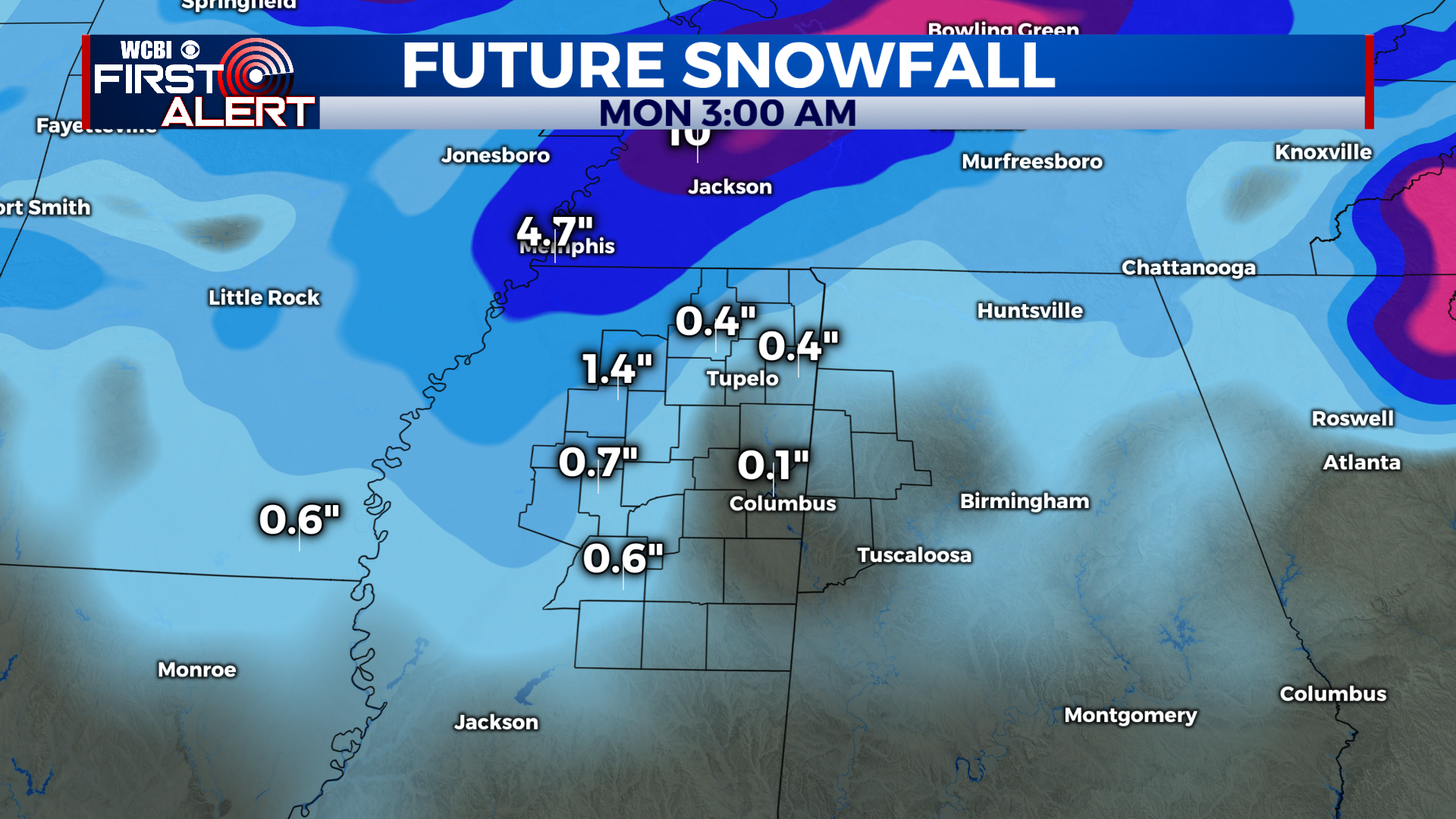
WINTER STORM SUNDAY: As the backside of the storm moves through on Sunday, temps will quickly fall into the low 30s and rain will change over to snow. Pretty much all of us can expect at least some flurries in the air, but northern and western areas could see accumulating snow- anywhere from a dusting to a couple inches are possible. There is still a lot of forecast uncertainty, so amounts could end up being higher and more widespread- stay tuned this weekend! Expect slick travel on Sunday afternoon and evening, and especially Sunday night as temps fall into the 20s.
NEW WORK WEEK: Any snow and ice will quickly melt on Monday with sunshine and highs in the mid to upper 40s. Lows drop to the 20s again Monday night with clear skies. We stay clear and cool for Tuesday, with a high in the low 50s. Wednesday will be mild with a high in the low 60s, with rain showers developing by the afternoon. Wednesday night a powerful arctic front will push through, with temps plummeting into the 20s. Thursday looks frigid, highs will struggle to get above freezing in some spots! By Thursday night, lows will fall all the way into the teens.
CONNECT WITH @WCBIWEATHER ON TWITTER, FACEBOOK AND INSTAGRAM