Yesterday’s cold front brought severe thunderstorms to the region, but it also ushered in northerly winds today. Thanks to that, we have all enjoyed a nice, dry northerly breeze today and it was pleasant across the region. The next few days will be much of the same before changes arrive late this weekend. Here is your forecast…
TONIGHT: Mostly clear and seasonably cool with lows in the low-60s.
FRIDAY: Partly cloudy becoming mostly cloudy and pleasant with highs in the mid-eighties.
FRIDAY NIGHT: Mostly cloudy and seasonably cool with lows in the mid-60s.
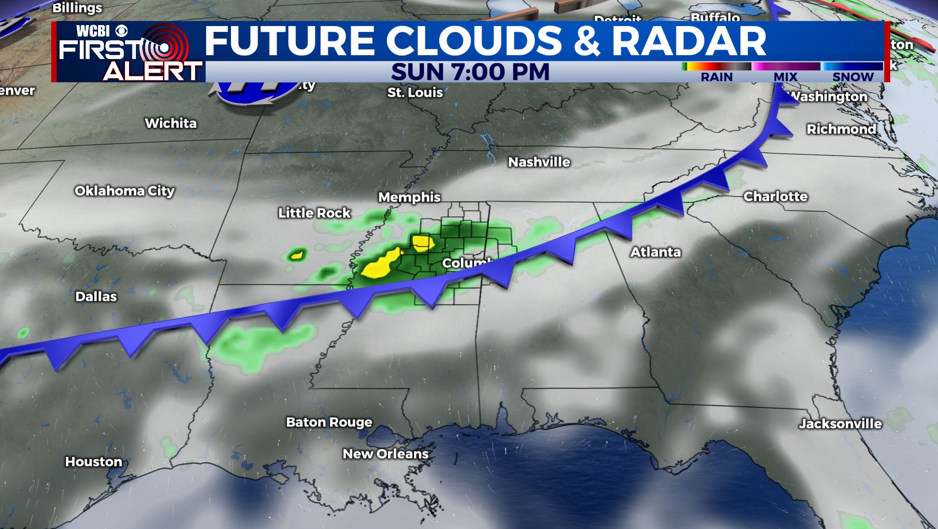
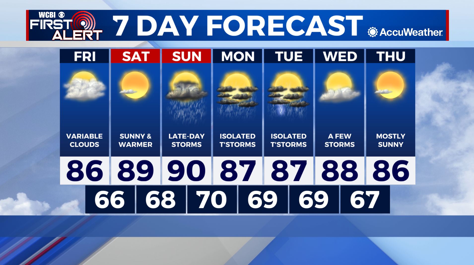
THIS WEEKEND: High pressure will begin to relax across our region and a southerly wind will return to the area Saturday afternoon. Moisture will be slow to return, however, so Saturday is still expected to feel pleasant even though it’ll warm a few more degrees. Saturday’s highs will be in the mid-to-upper 80s. Showers and thunderstorms return to the region Sunday with high temperatures in the upper-80s to low-90s.