Summer weather is back and watching the tropics
SUMMARY: The return of the summer 90 degree weather, afternoon pop up storms and high humidity levels are going to be our top weather stories for the rest of the week. We will need to watch Tropical Storm Cristobal in the southern Gulf of Mexico closely as this could approach the Northern Gulf Coast by the weekend into early next week.
TUESDAY: An isolated shower or two can’t be ruled out as we start getting that warm & humid air from the Gulf of Mexico pumping back into the region. Most of us will just see a mix of sun and clouds with highs in the upper 80s to near 90. SE winds 5-10 mph.
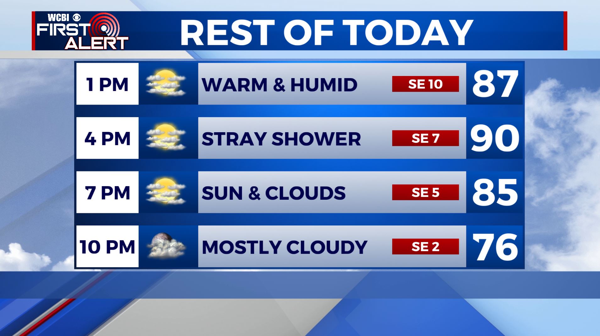
TUESDAY NIGHT: Mild and muggy. Overnight lows in the upper 60s.
WEDNESDAY-FRIDAY: Scattered afternoon pop up showers & storms will be in the forecast each day with partly sunny skies. Highs will above average in the lower 90s with overnight lows near 70. It will be humid and muggy as well.
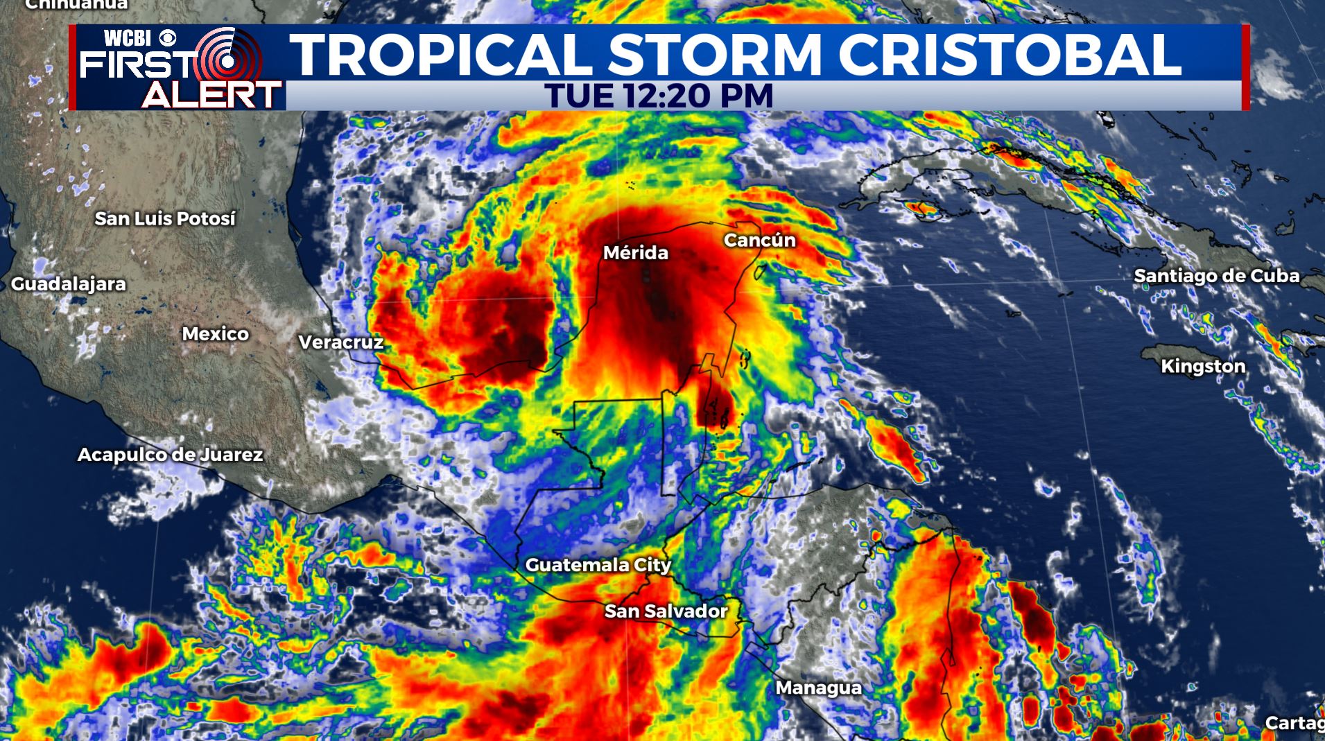
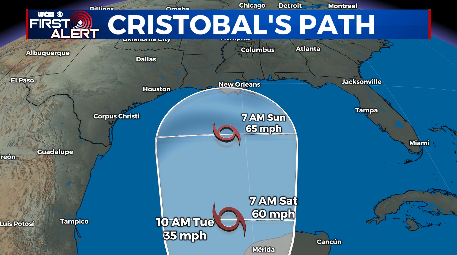
THIS WEEKEND INTO EARLY NEXT WEEK: Highs in the low to mid 90s. As of right now, a mix of sun and clouds with isolated chances of a stray shower or storm in the afternoon, but that could change. June also marks the official start of the Atlantic Hurricane Season. We’ve already had two named storms in May and now we have Tropical Storm Cristobal in the Southern Gulf of Mexico. We’ll keep you updated! This could bring us some rainfall this weekend, depending on when and where it makes landfall.
Stay connected with @WCBIWEATHER on Facebook, Twitter, Instagram, and the WCBI News App


Leave a Reply