Scattered storms to arrive tomorrow morning and early afternoon
COLUMBUS, Mississippi (WCBI) – SUMMARY: Rain chances return tomorrow as a cold front reaches the region. Behind the front, our daily high temperatures will drop into the mid-80s as we reach the weekend.
TONIGHT: Partly cloudy with lows in the low-70s. South wind around 5 mph.
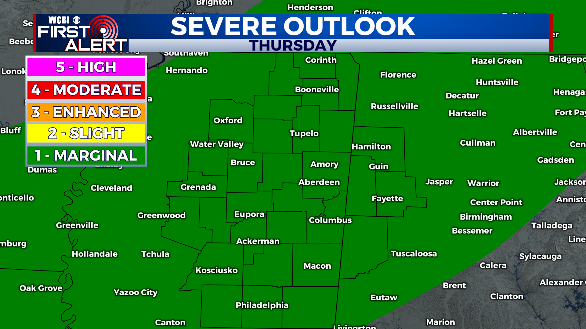
THURSDAY: Scattered showers and thunderstorms, after 10am. Some storms may be strong with frequent lightning, heavy rain, and gusty winds. Highs in the upper-80s. Chance of rain: 60%. South wind 5-10 mph becoming northwest in the afternoon.
THURSDAY NIGHT: Scattered showers and thunderstorms, mainly before 12am. Mostly cloudy with lows in the upper-60s. North wind around 5 mph. Chance of rain: 40%.
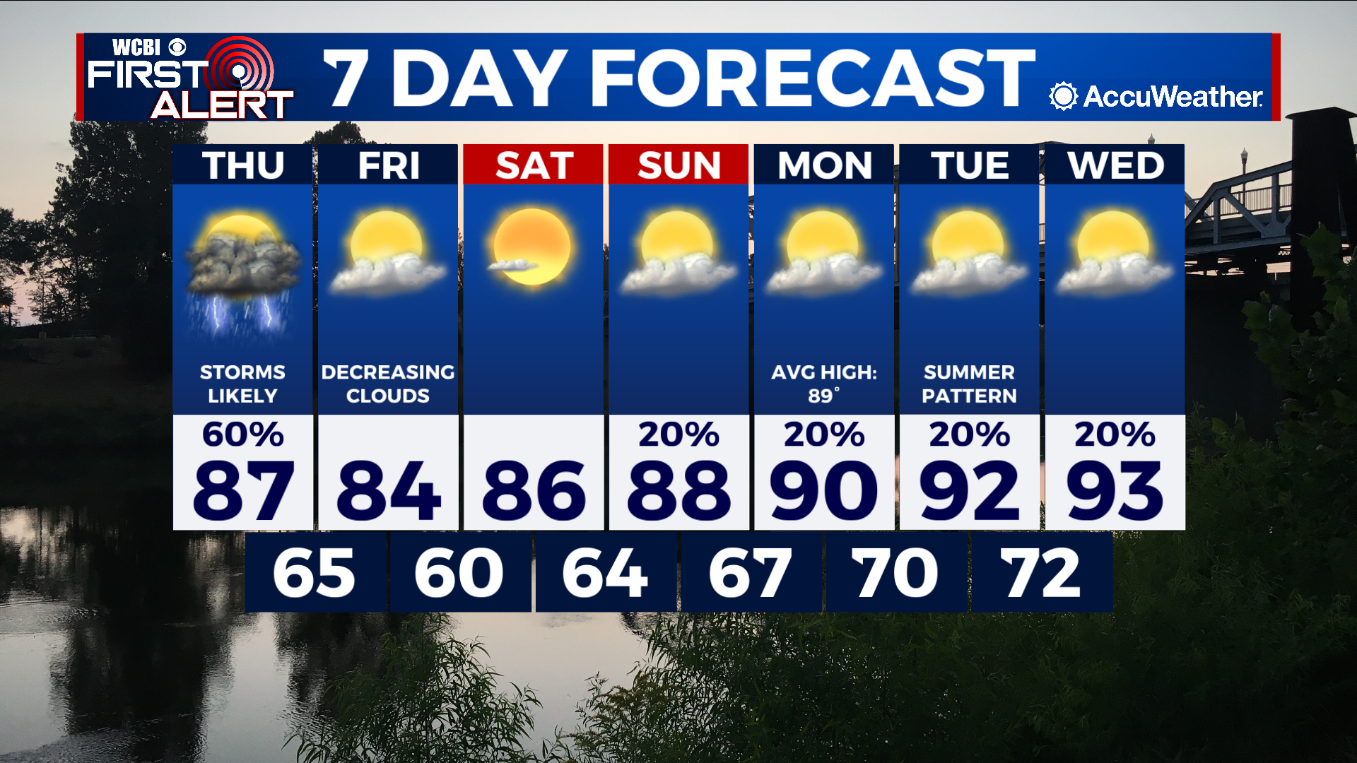
EXTENDED FORECAST: A cold front will reach the region tomorrow, producing scattered showers and thunderstorms during the afternoon and evening. Once the front passes the region, our daily high temperatures will reset to the mid-80s as we approach the weekend and our rain chances will come to an end.
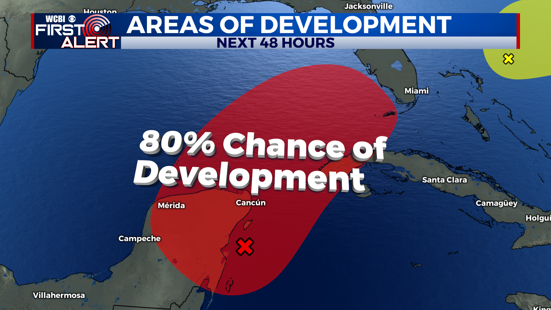
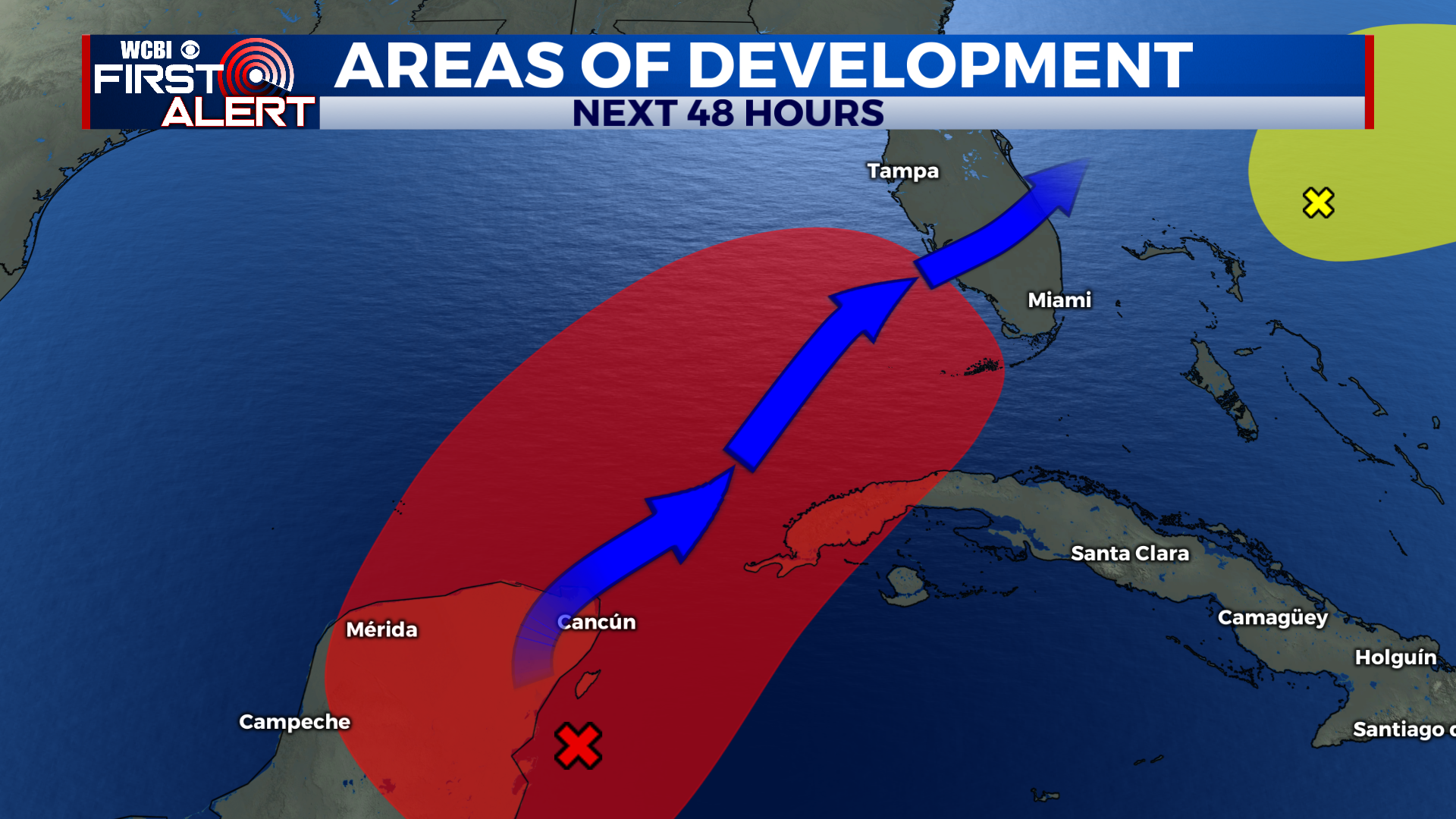
TROPICS: The National Hurricane Center is continuing to monitor the southern Gulf of Mexico for potential development. They have upgraded the chance of development to 70% likely within the next 48 hours. If a tropical storm were to develop, it would be named “Alex”.