A seasonable start to our week
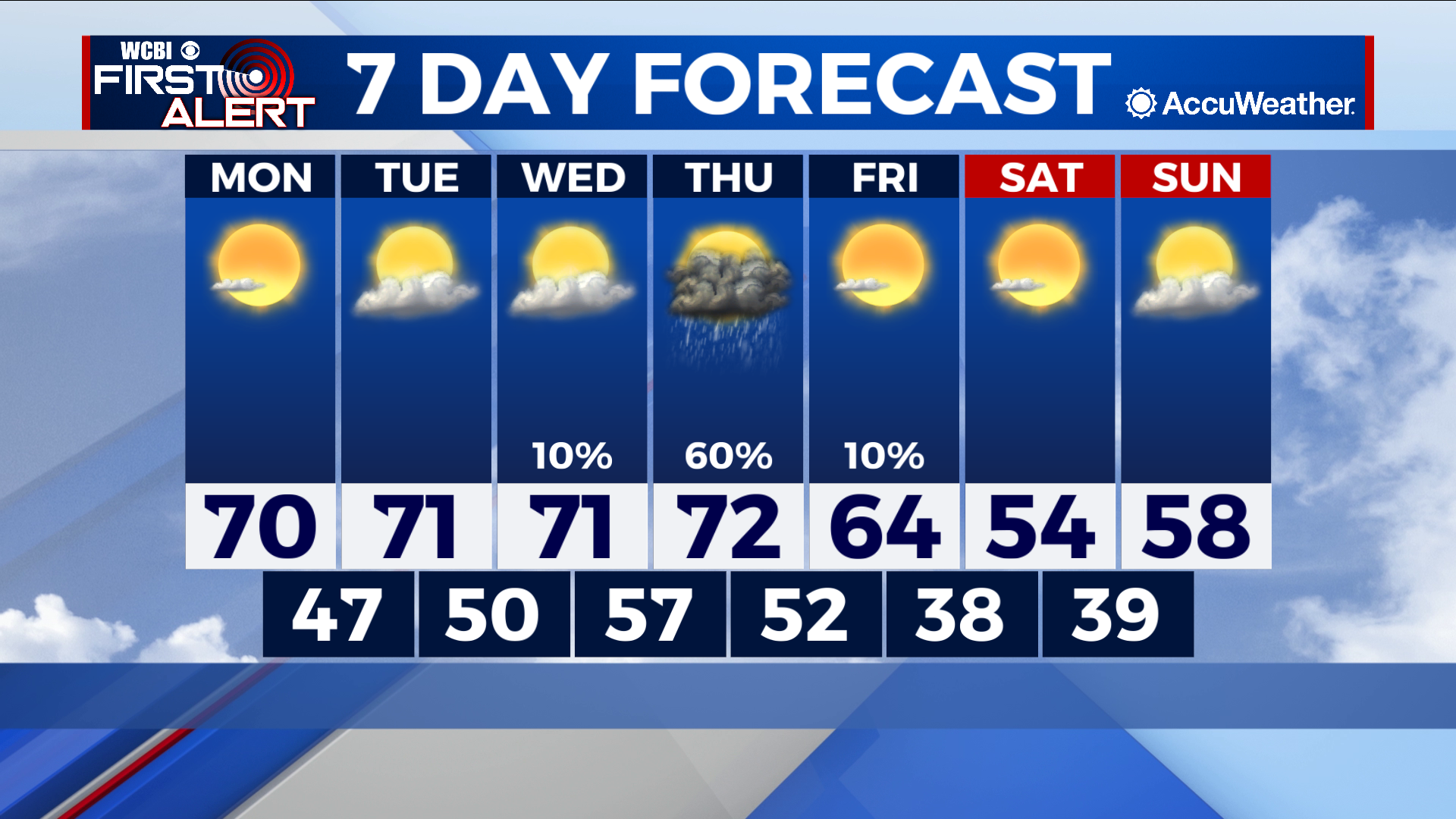
COLUMBUS – SUMMARY: Temperatures remain relatively stable in the low 70s until Thursday, when a strong cold front is expected to pass through the area. Increased rain chances are expected with the front but otherwise the week remains relatively dry.
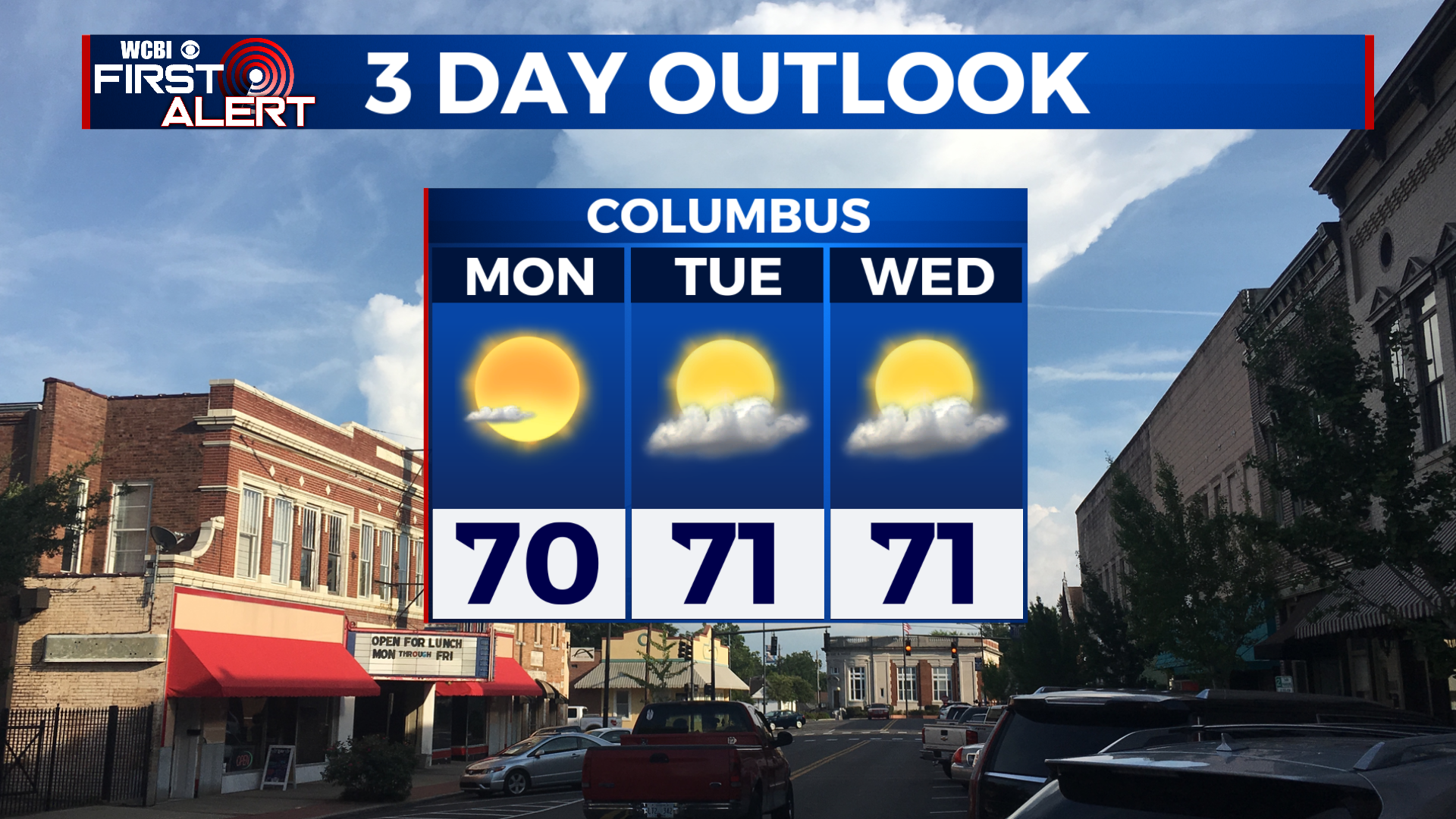
MONDAY:Temperatures cap out in the low 70s for the first time in over a week. Skies will be mostly clear and no rain is expected. Lows continue a warming trend but remain in the 40s overnight.
TUESDAY: Once again temperatures climb into the low 70s and stay there by the afternoon hour. Skies are a little less clear than on Monday with partly cloudy skies, but once again there is no rain expected. Low temperatures break into the 50s overnight.
WEDNESDAY: by Wednesday, the temperature trend has stalled and the high for Wednesday is in the low 70s as was the case for Monday and Tuesday. Partly cloudy skies prevail with an outside chance for a stray sprinkle. Overnight lows will reach their warmest of the week, bottoming out in the high 50s.
REST OF THE WEEK: The big rain-maker comes Thursday with the passing of a robust cold front. Current projections bring the front through the area overnight Thursday although the timing may change as the week goes on. Look for rain to occur in a tight window associated with the passing of the front. Temperatures will dip back down into the the mid 50s by Saturday before beginning to rebound Sunday. Chilled air from the front allows lows to break into the 30s Friday night.