Another round of rain and storms moves in tonight, then severe storms Wednesday
COLUMBUS, Mississippi (WCBI) – Round two of rain and storms will move in tonight ahead of Wednesday’s anticipated severe weather.
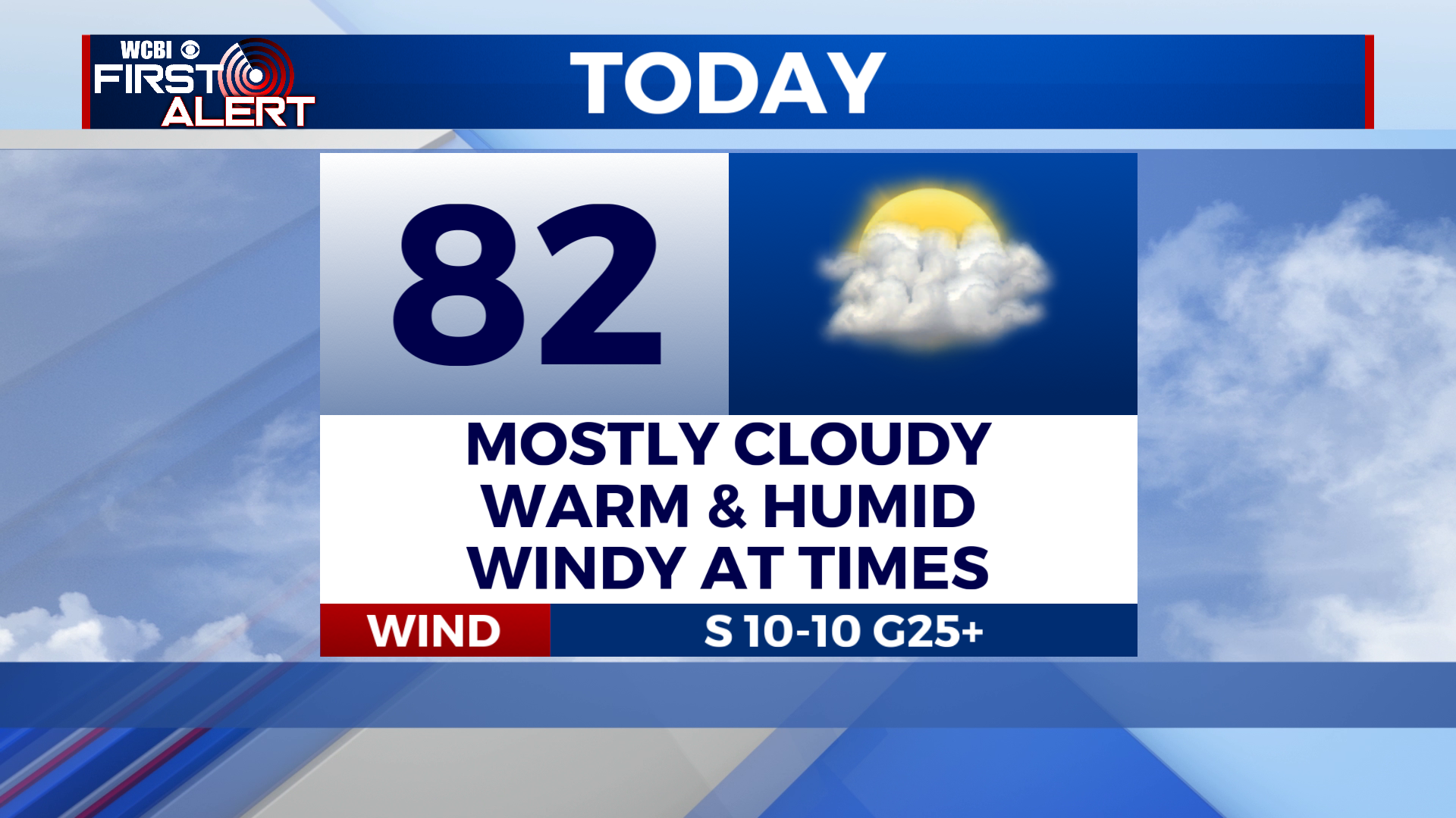
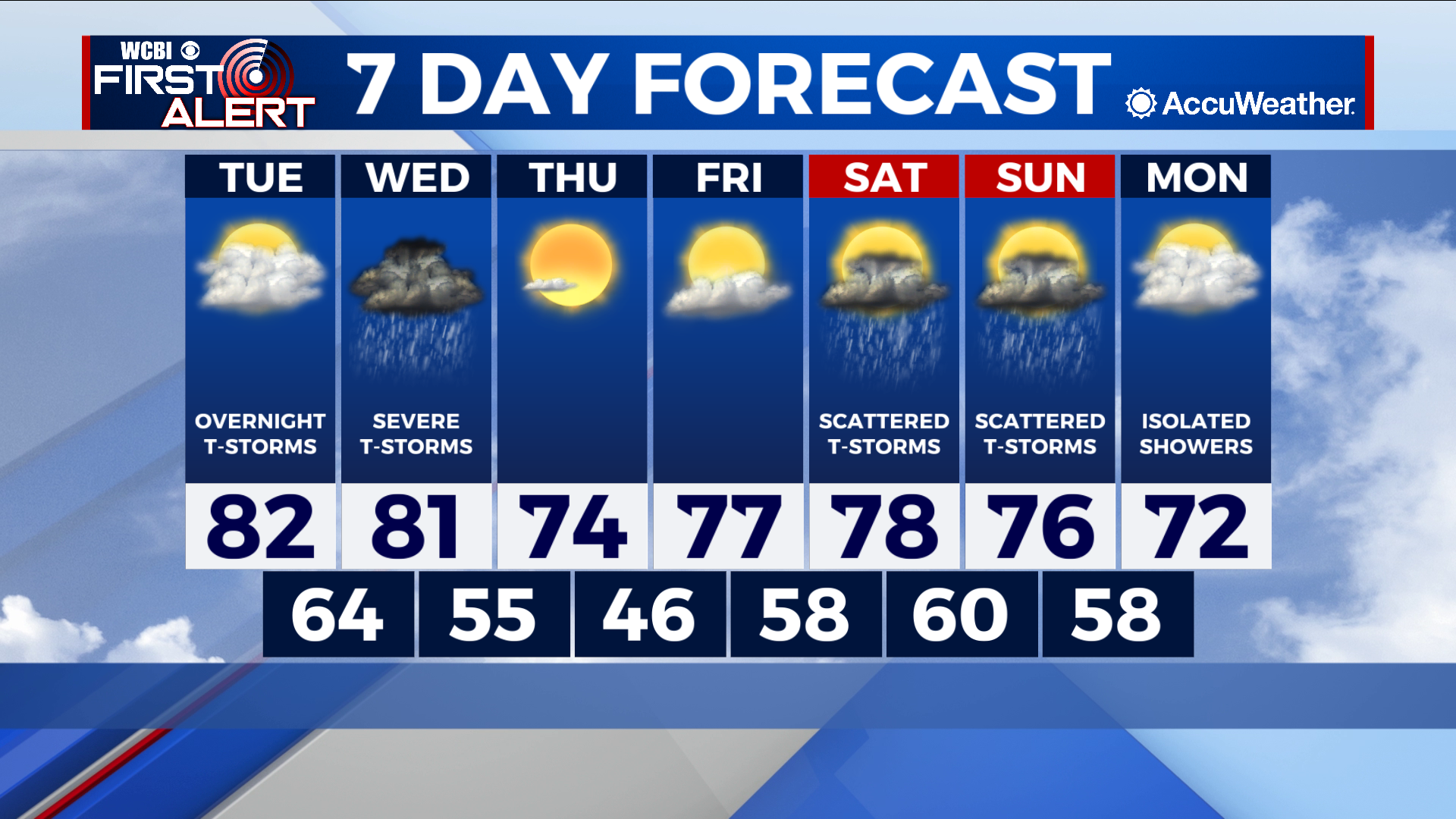
TUESDAY: Mostly cloudy skies. High near 82 degrees. Winds: south at 10-20 mph, gusting higher. Scattered showers and t-storms will move in from the southwest after sunset. The overall severe risk is low, but a damaging wind gust cannot be ruled out.
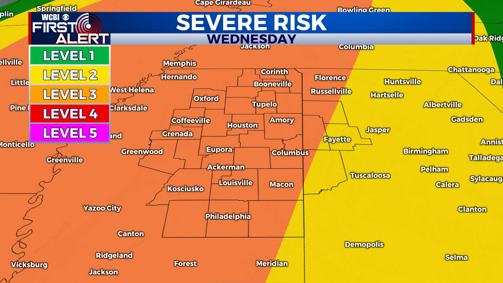
WEDNESDAY: A potent cold front will sweep through the region Wednesday night. Along and ahead of the front, scattered showers and strong to severe thunderstorms will develop. Our best shot at seeing severe storms will be during the afternoon and evening hours. Damaging winds, tornadoes (possibly strong), and large hail are all possible. Most of the region is currently under a level 3 out of 5 “enhanced” risk, but this may be upgraded in future updates. This setup has the *potential* to be a significant severe weather event, but there are also some mitigating factors that we’re trying to sort through. Regardless, we’re starting to get a much better idea of how Wednesday may unfold. Check back for more updates! Chance of rain: 100%. High near 81 degrees.
EXTENDED FORECAST: After the front moves through Wednesday night, things will start to calm down and clear out. We’ll get a break from the rain on Thursday and Friday. Rain chances creep back up Saturday into Sunday, but it’s still uncertain how widespread and intense rainfall will be. Temperatures will generally be in the mid to upper 70s through the rest of the week.