Big weekend system brings chills and snow potential
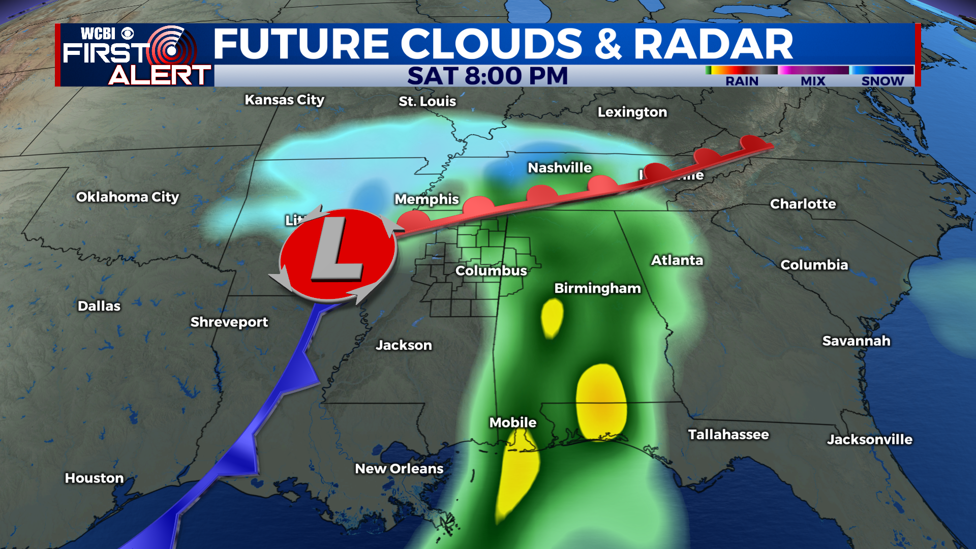
COLUMBUS – SUMMARY: Gradual warming continues into Thursday, before a series of cold fronts knocks temperatures down into the 30s. The biggest story of the week is the snow potential that exists on Sunday. A pronounced mid-latitude cyclone is aiming to move through the region on Saturday and Sunday, bringing significantly colder temperatures to the region.
WEDNESDAY: We continue to sit in a familiar pattern of mostly clear skies and dry conditions. The combination of the two will allow for the ongoing slow heat to persist, bringing high into the mid-50s during the afternoon hour. Lows slow improve as well, reaching the high 30s overnight.
THURSDAY: Thursday marks the warmest part of the week as we approach 60 during the afternoon hour. Skies clear out just a bit more and the continual dry pattern brings our warming trend to a maxima. Lows sit once again in the mid to upper-30s.
REST OF THE WEEK: Two cold fronts on Thursday and Saturday are set to move through the region. The event on Thursday will not bring significant impacts but will bring highs back down into the 40s. The system we will be watching closely is the weekend event, where the potential for snowfall exists along with sub 30 temperatures. At the moment significant snow accumulations seem unlikely for most of our viewing area but we will be monitoring the situation closely as it develops over the next several days. If anything rain will be the primary form of precipitation for this event.


