Brighter end to week ahead of weekend rain chance
COLUMBUS, Mississippi (WCBI) – Some sun is expected to end the week, but rain chances return yet again by Sunday.
THURSDAY: Variable clouds will continue today, but sunshine should make an appearance as well! However, chilly west to northwest breezes will keep highs in the upper 40s.
THURSDAY NIGHT: Clouds will finally clear as higher pressure moves in from the west. As winds die down as well, temperatures should drop into the upper 20s with widespread frost.
FRIDAY: Expect a good supply of sun to close out the week with highs back in the middle 50s.
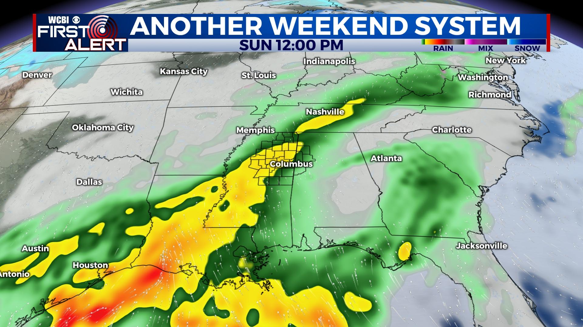
WEEKEND: Saturday begins the weekend on a dry and warmer note with highs nearing 60 degrees. Clouds will gradually increase, and some rain could arrive late in the evening. Widespread and locally heavy rain is expected much of the day Sunday, but any strong to severe potential should remain south once again toward the Gulf Coast. Another 1/2 to 1″ of rain is possible.
NEXT WEEK: Forecast uncertainty remains rather high as “model madness” continues. The overall idea is for a nearly stationary front to remain nearby and for potentially multiple rounds of round and possible storms starting Tuesday through Thursday. Colder air lurking to the north will be need to be monitored, but for now we don’t expect any winter weather issues. Stay tuned for more updates through the weekend.


