Calm Sunday, strong storms possible Monday
SUMMARY: A bit of a temperature see-saw in store for us over the next week. We’ll see multiple disturbances moving through the area as well bringing several rain chances. After a mild weekend, we cool down quite a bit after a cold front moves through on Monday. This front will push a line of storms through the area, with severe weather possible in far northern and western areas. After that, things cool down for Tuesday and Wednesday, before we warm up later in the week. There will be at least a low chance of rain each day.
SATURDAY NIGHT: A few showers will linger into Saturday night, but they should taper off by morning. Otherwise, it’ll be cloudy with a low in the mid to upper 50s.
SUNDAY: Dense fog will be an issue on Sunday morning. Another push of warm air ahead of a cold front will bring our highs back into the low to mid 70s for Sunday afternoon. While most of us will stay dry and mostly cloudy, some drizzle can’t be ruled out.
SUNDAY NIGHT: A line of showers and storms will be approaching the area Sunday night, but we should stay dry until early Monday morning, when a few showers will be possible. It will be a mild night with temps in the 60s.
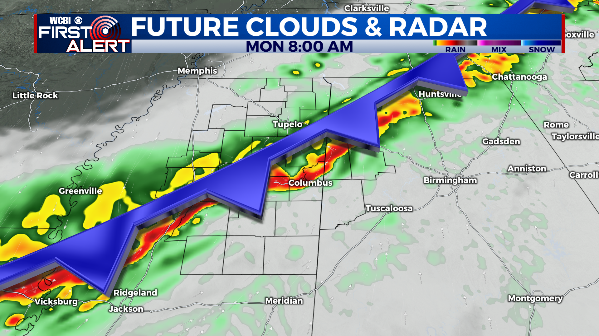
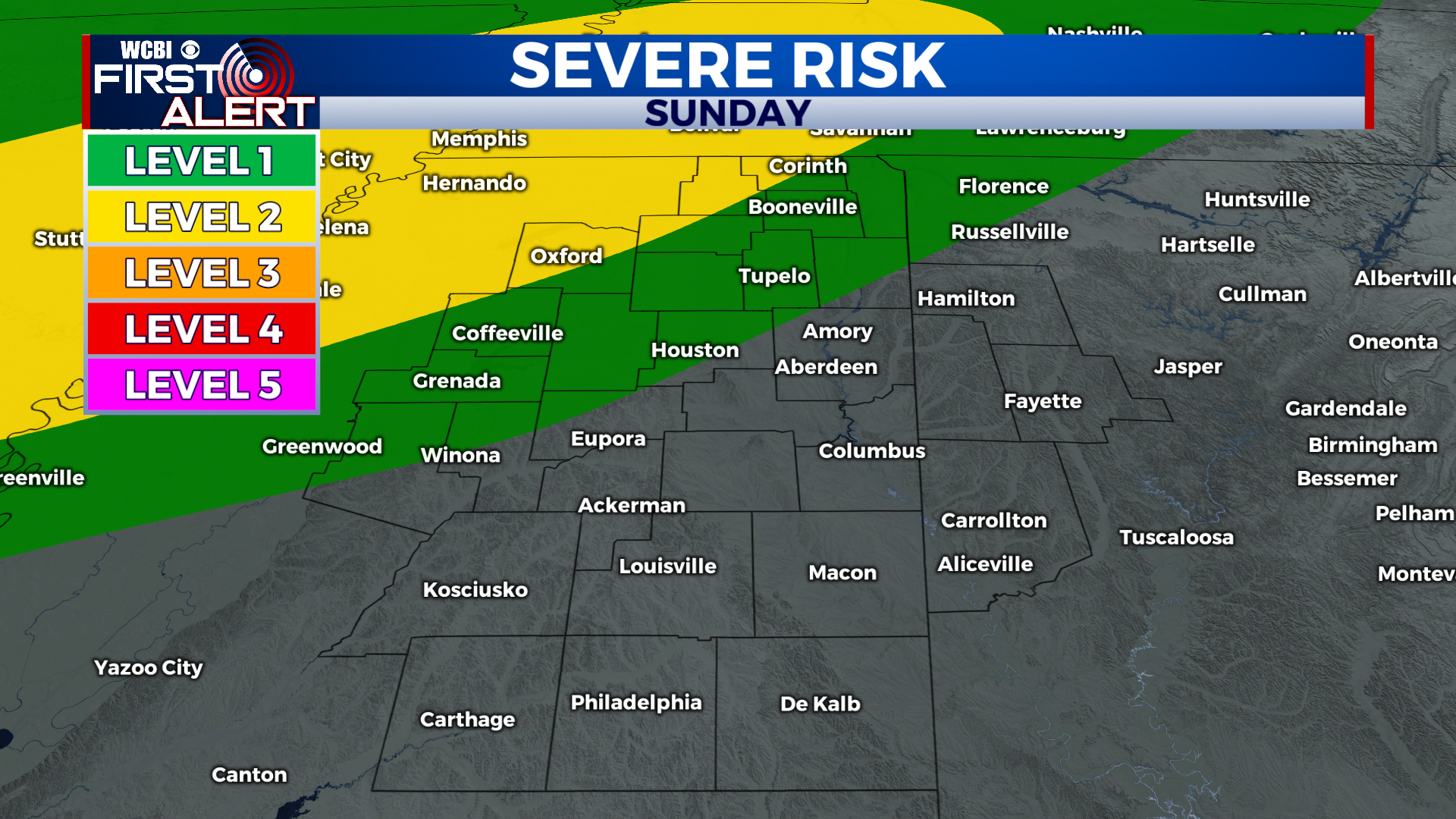
MONDAY: A line of strong storms will be moving through the area to start off the day. North and west of Tupelo, some damaging wind gusts and a brief spin-up tornado are possible. A level 2/5 risk for severe weather is in place for these areas, seen below. This severe risk will come very late Sunday night/early Monday. After the line clears out of the area, much cooler air will be ushered in for the evening and Monday night.
TUESDAY TO SATURDAY: Lows on Monday night will be in the low to mid 30s, a freeze is possible in rural locations. Tuesday, temps will struggle to get out of the 40s. A few showers could enter the picture Tuesday afternoon. Temps Tuesday night drop back into the low 40s. Another round of widespread rain will move through Tuesday night, although areas south and east of Columbus have the best chance to see heavy rain. The rain will taper off on Wednesday morning, with a few afternoon showers possible. Highs will be in the upper 50s with mostly cloudy skies. Thursday and Friday will feature scattered showers and temperatures rising into the upper 60s Thurs to low 70s Friday. Saturday, another powerful cold front will be moving in, pushing rain and storms through the area. It will be very warm in the 70s for Saturday.
CONNECT WITH @WCBIWEATHER ON TWITTER, FACEBOOK, AND INSTAGRAM