Colder air arrives Saturday, but a warming trend begins next week
COLUMBUS, Mississippi (WCBI) – SUMMARY: Much cooler air arrives tomorrow, but a warming trend will begin Sunday.
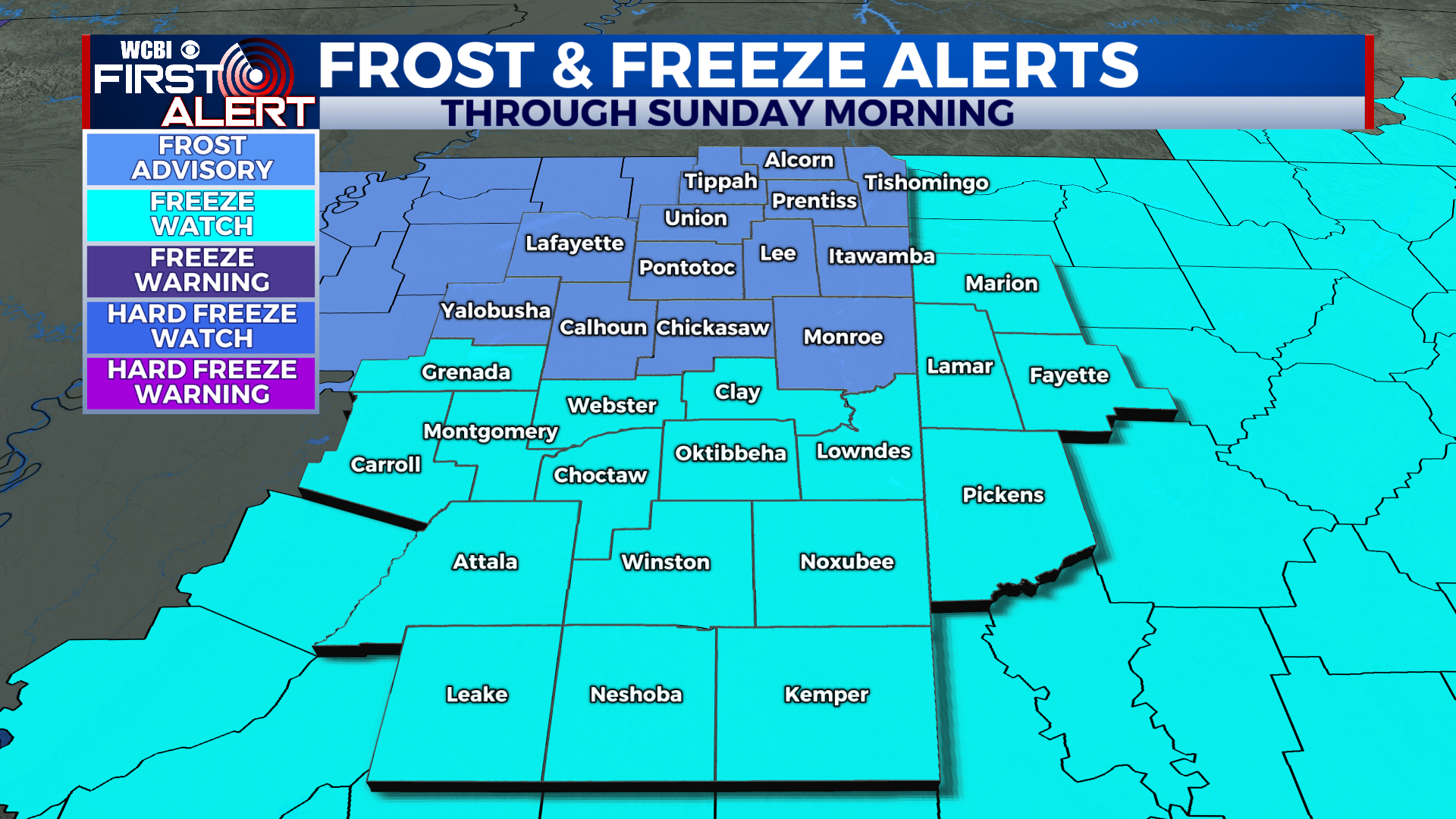
TONIGHT: Mostly cloudy becoming mostly clear overnight. Scattered frost possible, especially north. Cold with lows in the low-30s. North wind 5-15 mph.
SATURDAY: Sunny and cooler with afternoon highs in the low-50s. North wind 5-10 mph.
SATURDAY NIGHT: Mostly clear with lows in the low-30s. Freeze Watch in effect. Northwest wind 5-15 mph.
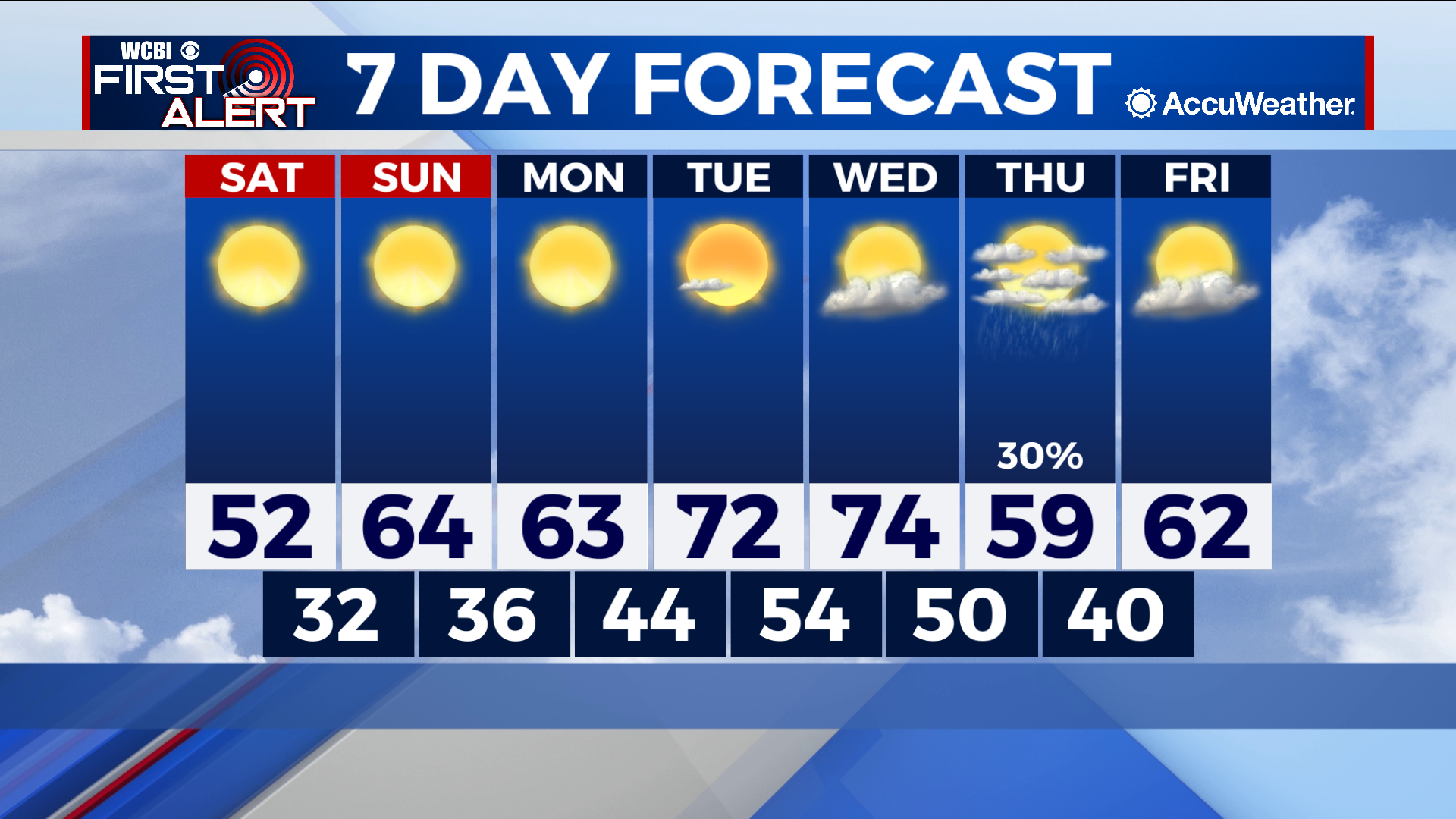
NEXT WEEK: We will begin a warming trend by Monday with highs reaching into the mid-70s by Wednesday. Our next front arrives Wednesday night with showers possible through Thursday afternoon. As with any system this far out, a few inconsistencies remain in the forecast data. This does not look like it will be a widespread rain event like last week’s rain, but we will continue to monitor for trends in the data. Behind the front, cooler air will arrive with highs in the 50s on Thursday.
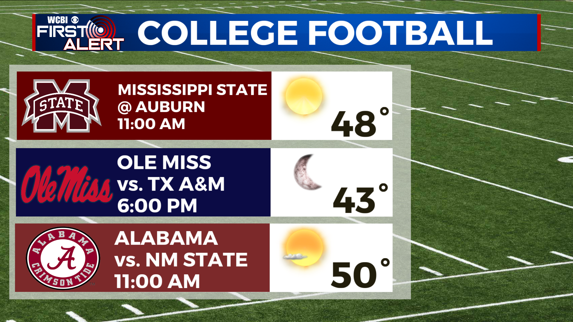
COLLEGE FOOTBALL: Our kickoff forecasts show dry, but cool conditions for this Saturday’s games across the region. Be sure to pack a jacket for the late games, especially for the Ole Miss game in Oxford.