Cooler and wetter weekend, T.S. Fred moves through Mon-Tue
SUMMARY: Showers and storms are likely for Saturday and Sunday. High temperatures will drop from the low 90s into the upper 80s by Sunday, and remain in the 80s through Wednesday. Tropical Storm Fred’s track has been shifting further west towards our viewing area, with impacts likely Monday into Tuesday in the form of widespread rain and cloud cover. Winds could be breezy as well, but the severe threat looks very minimal at this time. After it passes through, scattered showers and storms stick around for the rest of the week. 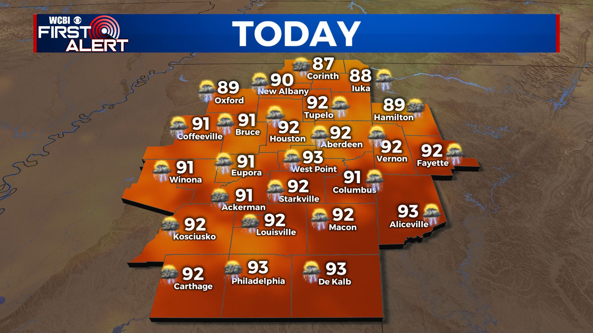 SATURDAY: Showers and storms have already developed across the area this morning, and more showers and storms should pop up as we head into the afternoon hours. Highs top out in the low 90s with partly cloudy skies outside of any storms. SATURDAY NIGHT: Showers and storms should diminish as we lose sunlight, but a few showers and storms may persist into the overnight hours. Otherwise, partly cloudy with lows in the low 70s. SUNDAY: Sunday looks even wetter than Saturday, with widespread showers and storms throughout the day, especially in the afternoon. Cooler, with highs in the mid to upper 80s. SUNDAY NIGHT: Showers and storms persist into Sunday night, with mostly cloudy skies expected outside of any downpours. Lows in the low 70s, fog is possible by Monday morning.
 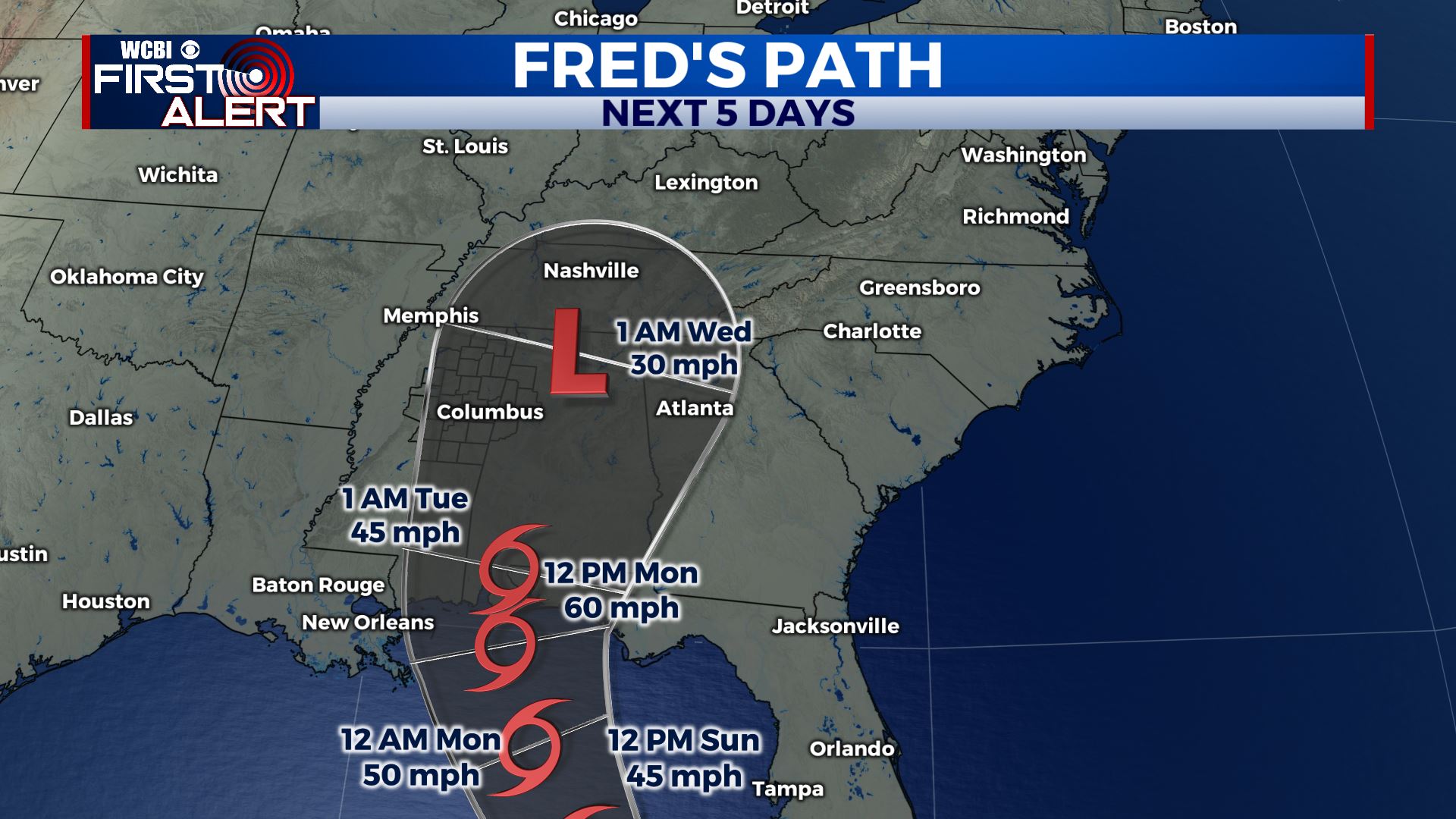 MONDAY TO FRIDAY: Tropical storm Fred looks to make landfall along the northern Gulf coast near the AL/FL border late Monday night. Monday looks cooler with widespread showers and storms and highs in the mid 80s. Fred approaches and moves through the area beginning Tuesday, with heavy rain and some breezy winds. Highs should be even cooler Tuesday thanks to cloud cover and rain from Fred. After it passes, scattered afternoon showers and storms look to stick around for the rest of the week, with highs slowly returning to the low 90s by Friday. Lows look to remain in the low 70s. After Fred, we’ll be watching newly formed tropical storm Grace for any impacts by next weekend, as it looks to be heading towards the US. Stay tuned for updates! Stay connected with @WCBIWEATHER on Facebook, Twitter, Instagram and the WCBI News App


Leave a Reply