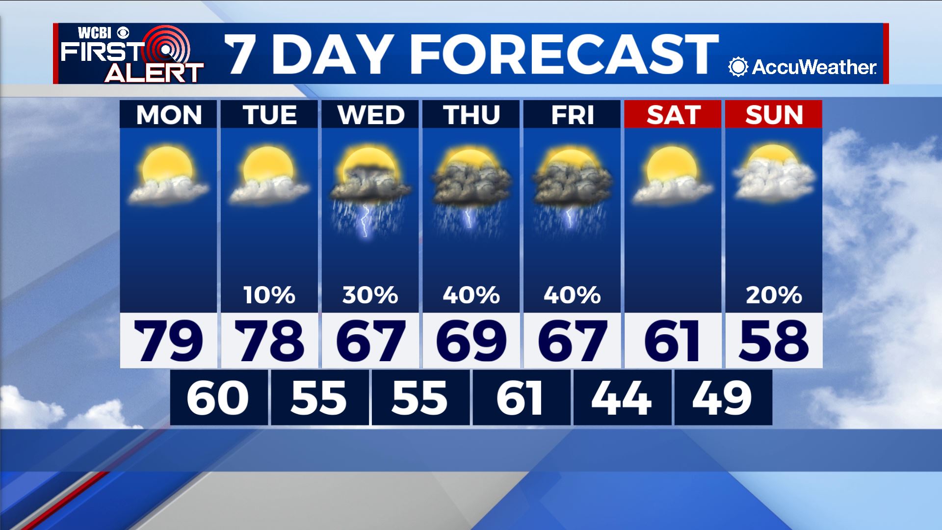
Downshift in temperatures on tap trailing warm start to week
COLUMBUS – SUMMARY: Highs drop from the upper 70s early into the week into the upper 50s by the end of the weekend. A few rain chances in the mix midweek provide our only storm potential for the week.
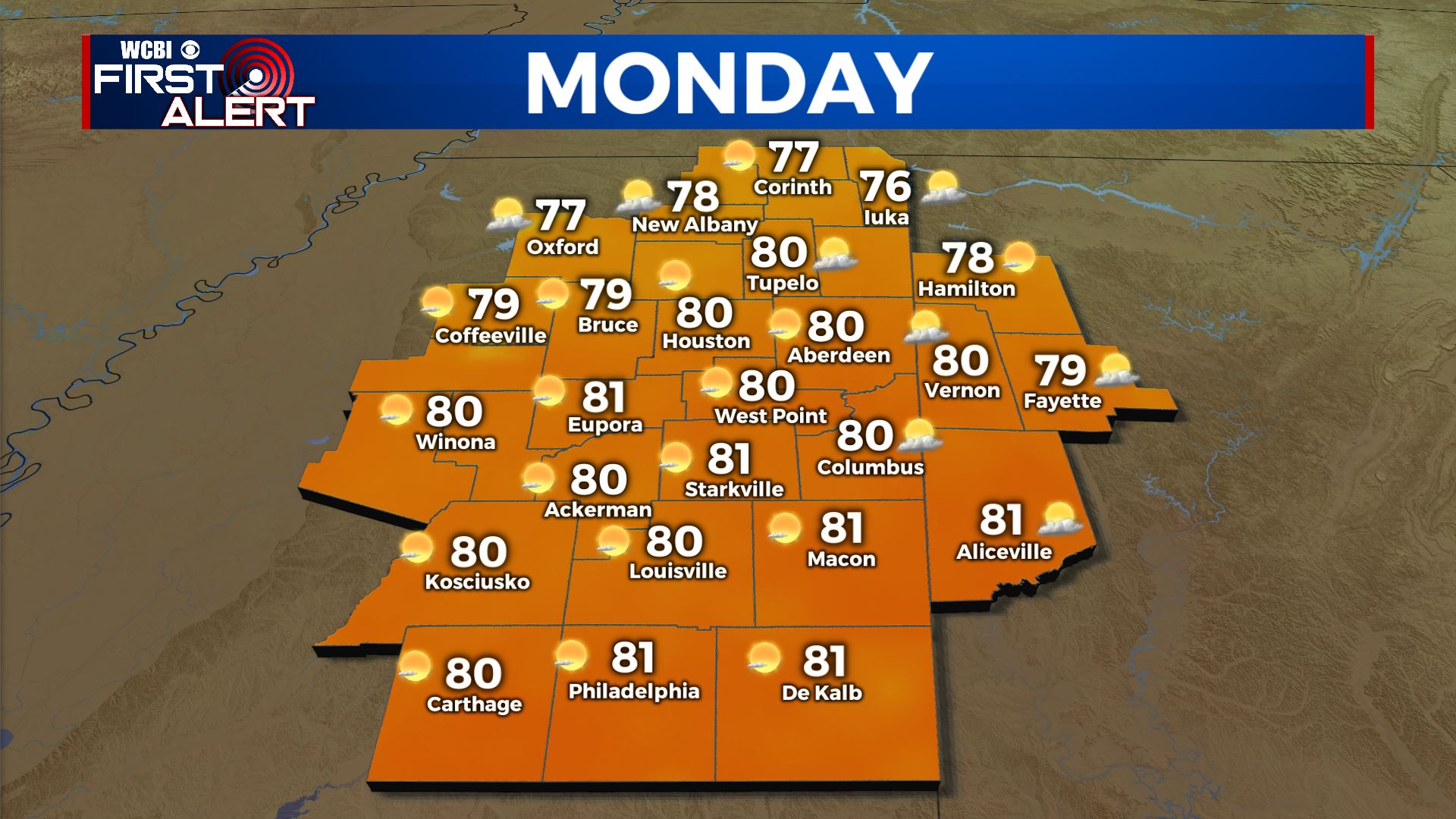
MONDAY: Highs climb into the upper 70s across the board Monday, though some may break 80 in the afternoon hours. Plentiful sunshine will aid in the warming, and no rain is expected Monday. Lows drop to around 60 overnight Monday.
TUESDAY: Highs climb once again into the upper 70s amid increasing cloud cover during the day. The rogue shower is possible although the vast majority of us will remain dry. Lows drop into the mid 50s overnight.
REST OF THE WEEK: Highs will take a noticeable drop into the 60s starting Wednesday, as chances for scattered showers and storms return to the region. Cooler air will arrive into the region over the weekend and bring highs down in to the upper 50s by Sunday. Lows will drop into the mid 40s by overnight Friday.