Drier and more comfortable to start off August
Rain chances will be winding down over the next several days and much of the work week looks to be dry and mostly sunny. Thanks to a couple of cold fronts, humidity will also decrease, making things feel a little bit more comfortable.
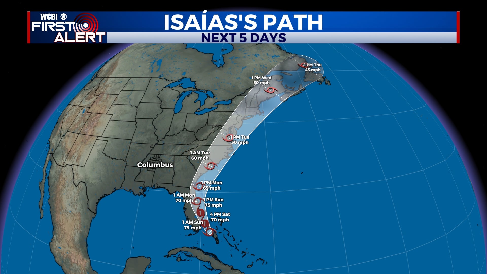
TROPICAL UPDATE: Isaías is not looking very healthy as of Saturday afternoon, and as a matter of fact, the storm has been downgraded from a hurricane to a tropical storm. This is good news for Florida as it means the storm will not strengthen much more than it already has. Still though, gusty winds and heavy rain are possible for eastern Florida as the storm stays just off the coast. More impacts are possible this week in the Carolinas and possibly in the Northeast. There is no threat locally from Isaías.
SATURDAY NIGHT: Aside from a sprinkle or two early, most of us will stay dry tonight. Temperatures will fall to the upper 60s with a light westerly wind, becoming northwesterly late. Skies will remain partly cloudy.
SUNDAY-MONDAY: A few pop-up storms are possible Sunday afternoon, but most of us will just see a mix of sun and clouds. More storms are possible on Monday as a cold front clears the area, but even then, not everyone will see rain. Highs will be close to 90 each day with overnight lows in the upper 60s.
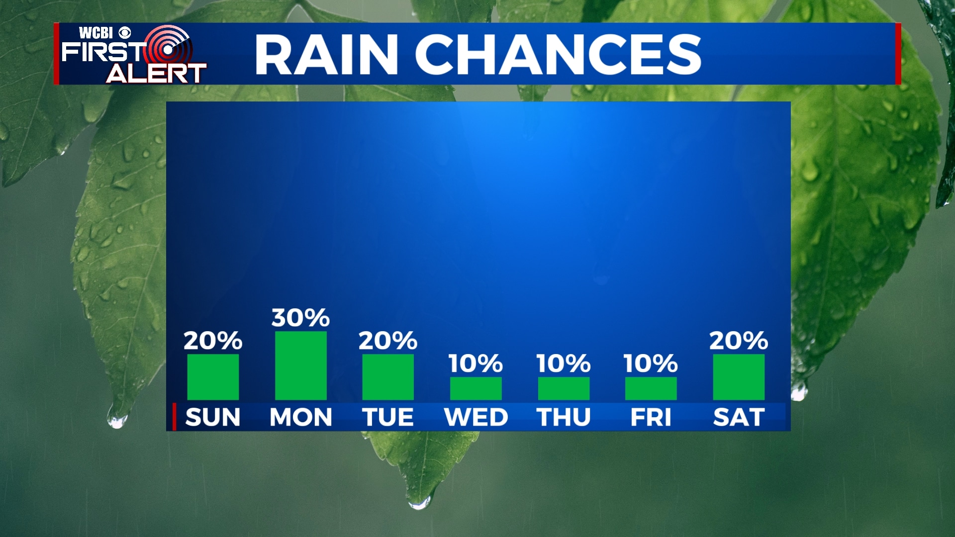
TUESDAY-THURSDAY: The middle portion of this week looks to be dry and mostly sunny and also just a touch more comfortable. Temperatures won’t be much lower, but less humidity will makes things feel a little more tolerable. A very isolated shower is possible, but 90% of us won’t see rain. Highs will be in the upper 80s with overnight lows a little cooler, down into the mid 60s each morning.
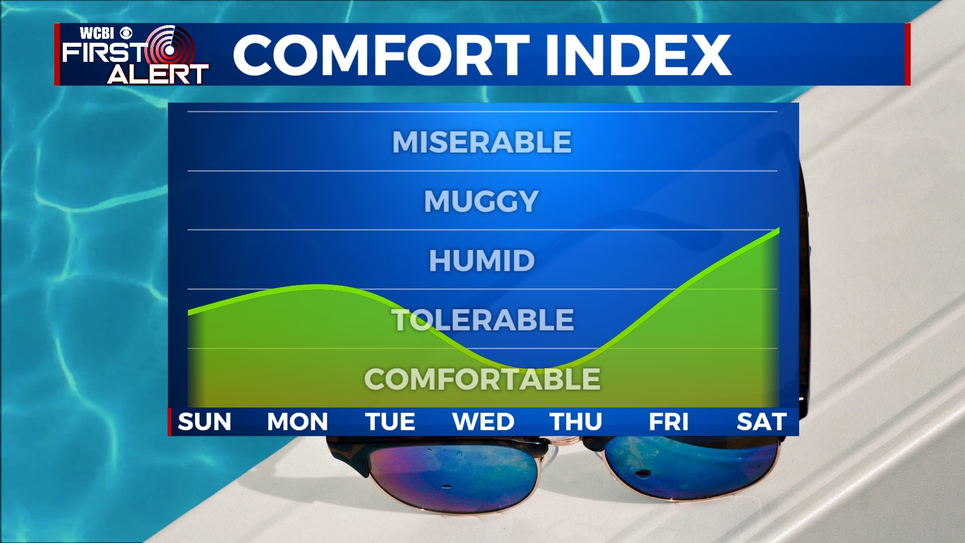
FRIDAY-SATURDAY: A warm front will move closer to the area by the end of the week and weekend, bringing back warmer air, higher humidity, and increased rain chances. Due to some uncertainty in the forecast, we’ll keep rain chances at a 20% chance for Saturday, but early indications are we could see some more pop-up storms through next weekend. We’ll keep an eye on things. Highs will be back into the mid 90s by Friday and Saturday.


Leave a Reply