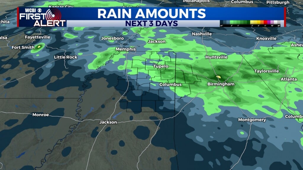
Ending a month and starting a month with rain
COLUMBUS, Mississippi (WCBI)- With January coming to a close and February on the in, rain showers are going to make this a smooth transition into a new month. Temperatures will be staying consistent, warming by the weekend.
TUESDAY NIGHT: Rain showers will be continuing on and off throughout the night. Winter precipitation will be following an easy to follow line, with Winter Weather Advisory and a Ice Storm Warning in place for northern Mississippi until Thursday morning. GTR is staying out of those luckily. Significant ice accumulation is expected tonight. Unnecessary travel should be put on pause. Temperatures are going to be in the 30s tonight.
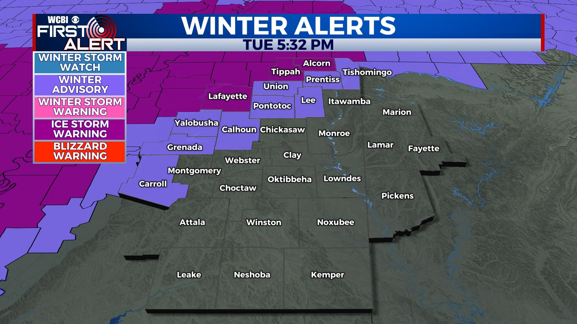
WEDNESDAY: There is going to be a little bit of a lighter chance of seeing rain throughout the morning and afternoon. High temperatures will be in the middle 40s for the Golden Triangle Region. Rain will return Wednesday evening, continuing through the night into Thursday. The risk for further ice accumulation is a hazard overnight once again. The warning and advisory go until Thursday morning. Temperatures will only fall into the lower 40s Wednesday night.
THURSDAY: Heavier rain showers are expected to move across the state Thursday. Southern Mississippi may have a chance of seeing some severe activity, the NE corner of the state will only see thunderstorms at most. High temperatures will warm slightly into the upper 40s, with lows in the middle 30s.
FRIDAY/WEEKEND: Temperatures will continue warming through the upper 40s into the lower 60s. Low temperatures will drop Friday into the middle 20s and climb into the upper 30s by Sunday night. Rain and cloud coverage clears out Friday morning, allowing the sun to make a grand appearance back into the sky for a few days.