Fall Air on the Way Later This Week
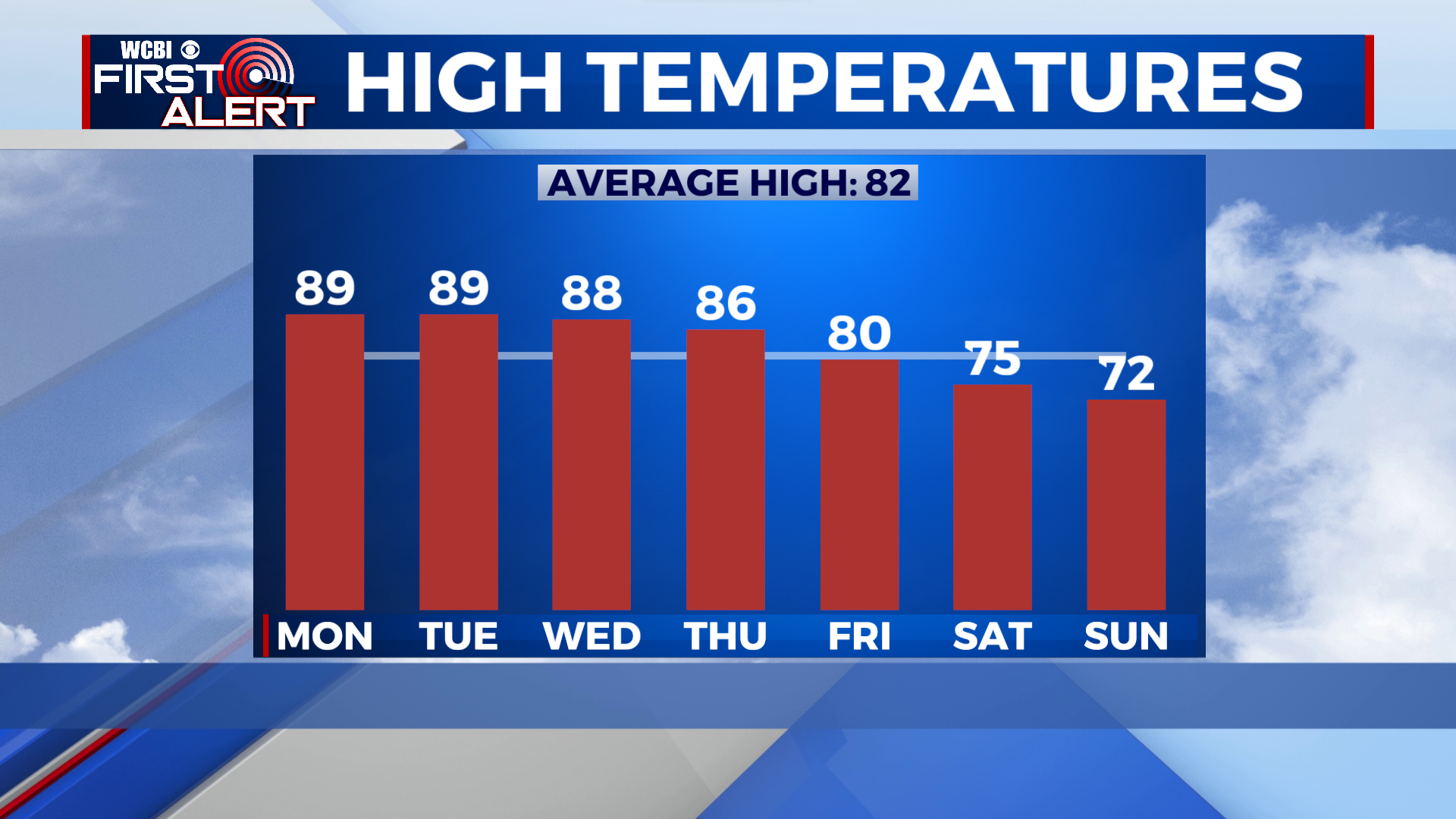
COLUMBUS, Mississippi (WCBI) – Very warm and dry for the next few days, but a cold front on Friday will bring in cooler air over the weekend!
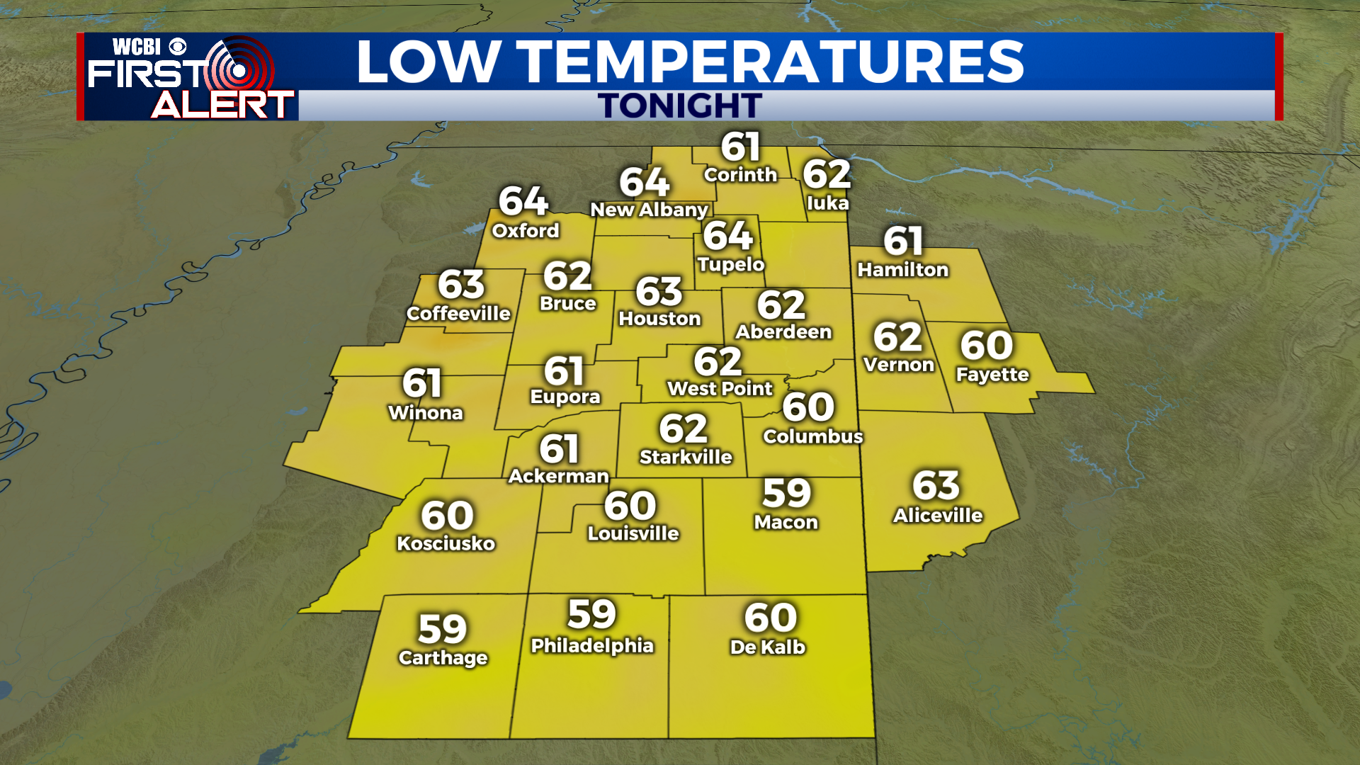
TONIGHT: Clear and comfortable with temperatures falling into the low 60s.
MONDAY – WEDNESDAY: A very easy forecast. The weather will be nearly identical Monday through Wednesday. Upper 50s and low 60s each morning, then warm in the afternoons with highs in the upper 80s.
THURSDAY – FRIDAY: Clouds start to build in on Thursday, and skies become mostly cloudy in the afternoon. Most of Thursday looks dry with the cold front still off to our west, but a few showers could move in Thursday night. There’s a somewhat “better” chance for rain on Friday as the actual cold front passes through, but overall, moisture is pretty pitiful with this setup. Sadly, it doesn’t look like we’re going to get a lot of rain from this front. Something else to note: Friday won’t be as warm with highs only near 80.
THE WEEKEND: Cooler air rushes in behind the front Friday night, and temperatures will drop into the upper 50s by Saturday morning. Fall air and a northwesterly breeze will keep highs in the 70s on Saturday afternoon! It’ll feel amazing. Sunday morning looks even more chilly! Lows in the upper 40s are possible!