Heavy rain, storms arrive late Thursday and early Friday
COLUMBUS, Mississippi (WCBI) – After a decent afternoon Wednesday, more rain and storms move in late Thursday after midnight.
THURSDAY: Patchy, dense fog this morning will clear up into intervals of sun later today with highs in the 70s.

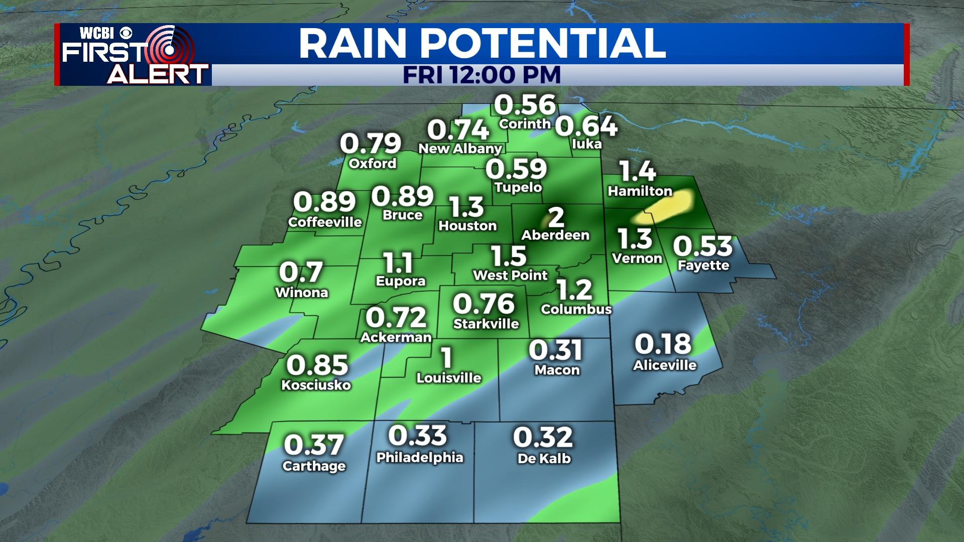
THURSDAY NIGHT: Clouds thicken up this evening, and rain and storms will overspread the region after midnight toward daybreak Friday. Rain amounts up to 1 inch are likely for most spots. While some small hail could also occur, severe weather chances remain quite low.
FRIDAY: Rain and storms will clear out by mid-morning, leaving a gradually clearing sky through midday. Increasingly warm and humid air along with the approach of a front could be just enough to trigger isolated storms by 3-5p. Should this occur, severe weather will be possible; however, this remains a highly conditional threat, suggesting little concern at this time.
WEEKEND: Plenty of sunshine is still on tap for both Saturday and Sunday. Chilly mornings and mild to warm afternoons are also expected – 60s for Saturday and low 70s Sunday.
NEXT WEEK: Monday still looks dry and pleasant, but Tuesday continues to offer up severe weather potential with the approach of a strong system from the west. At this point, all modes of severe weather are on the table Tuesday afternoon and Tuesday evening. Stay updated through the weekend as more specifics come into view.