Heavy rainfall and flooding possible in the next few days
Several rounds of showers and storms are likely over the next few days, and this rain could be heavy at times. Many spots could see 2-4″ of rain with locally higher amounts. River and creek flooding will continue in some areas for the next week.
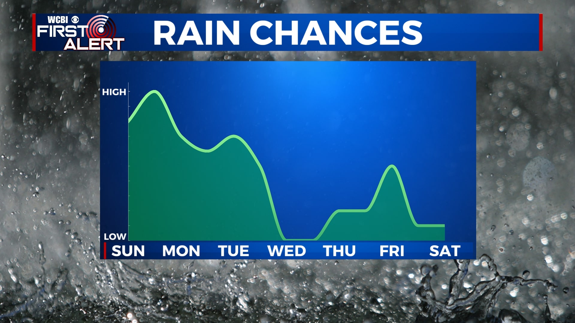
SATURDAY NIGHT: A few isolated showers are possible overnight, but many of us will just be dry and cloudy. Temperatures will remain in the mid 60s with a light southerly wind.
SUNDAY: While a few spotty showers are possible through the day Sunday, most of the rain will hold off until after sunset. Skies will remain mostly cloudy as temperatures remain very warm. Highs will be close to 80 degrees.
SUNDAY NIGHT: Showers and storms are likely Sunday night and early Monday morning. Some storms could produce heavy rain, gusty winds, and lightning. Lows will be in the mid 50s.
MONDAY: Showers will continue off-and-on through the day on Monday. Temperatures will be a bit cooler but closer to normal for us this time of year. Highs in the mid 50s.
TUESDAY: More heavy rain and some storms are likely on Tuesday. Highs in the mid 50s.
WEDNESDAY-THURSDAY: The middle of the week is when it looks like we’ll see a bit of a break from the rain. Sunshine will return on Wednesday with clouds slowly building back in Thursday. Aside from a shower or two Thursday, most of the day will be dry. Temperatures will be a bit warmer with highs in the 60s and lows in the 40s.
FRIDAY-SATURDAY: Yet another round of rain will come in through the day on Friday and could last into early Saturday. However, it appears most of Saturday could turn out dry. Highs will be in the mid 60s with lows in the 40s.
Follow WCBI Weather on Facebook, Twitter, and Instagram
Follow Meteorologist Trevor Birchett on Facebook and Twitter


Leave a Reply