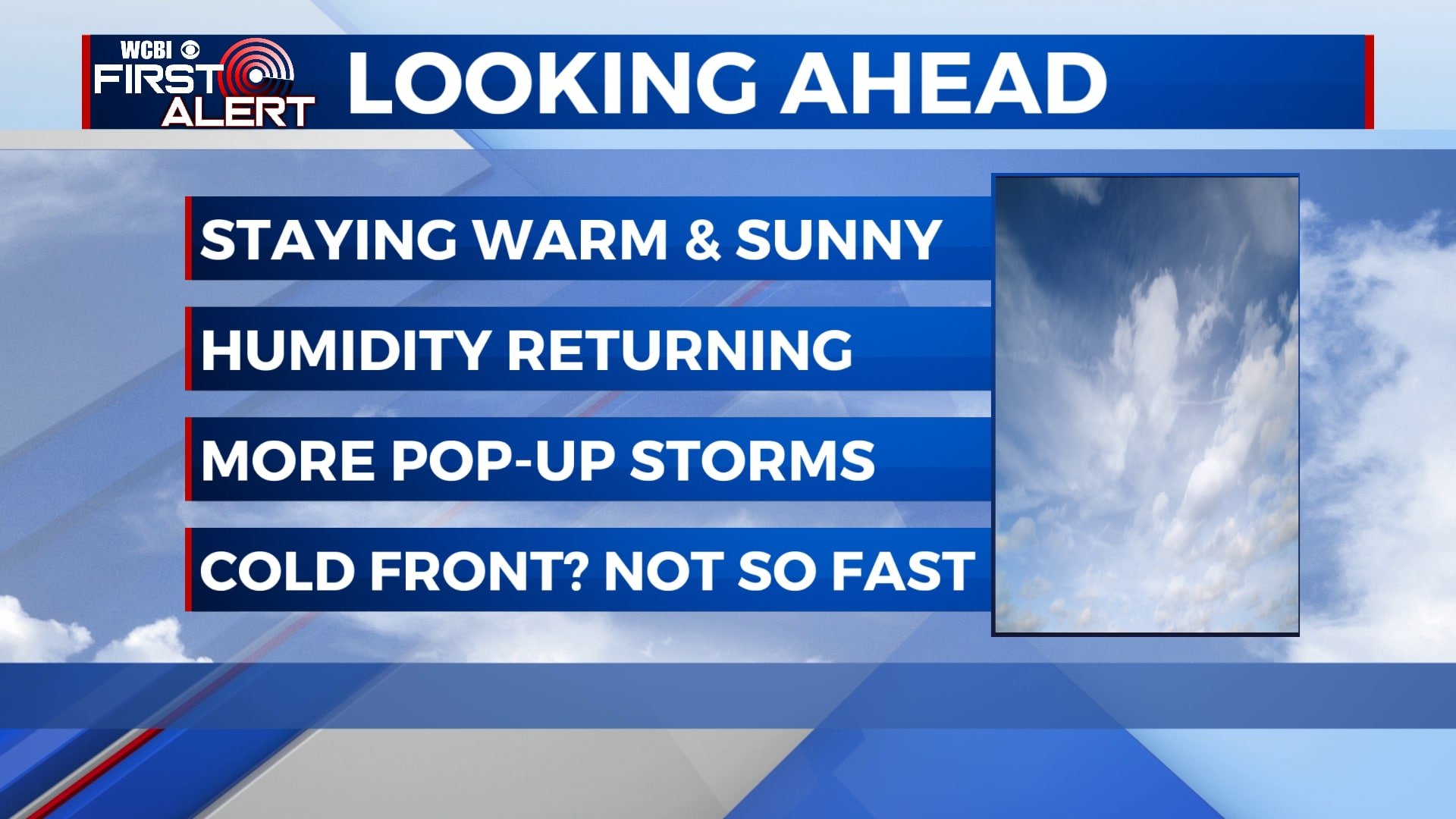
Hot and humid weather continues, a few storms late this week
While our fingers were crossed for a late-week cold front, it looks like we won’t see many effects from that here, meaning we’ll stay warm and humid. Highs will remain in the upper 80s to low 90s with chances for storms returning by the weekend.
MONDAY NIGHT: Mostly clear skies will continue tonight with quiet and calm weather. Lows will be in the low 60s with a light southeasterly wind.
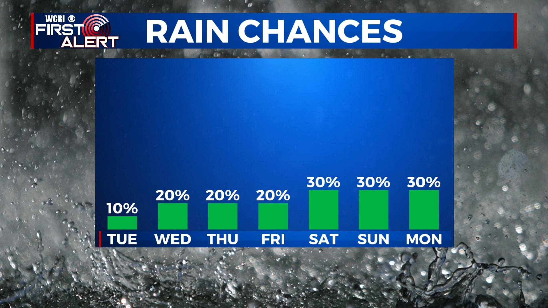
TUESDAY: Aside from a few clouds, Tuesday is shaping up to be mostly sunny and warm. Temperatures will top out in the low 90s, but with the added humidity, the heat index could be as high as 95 at times. We’ll add in a 10% chance of an afternoon shower, but rain is very unlikely.
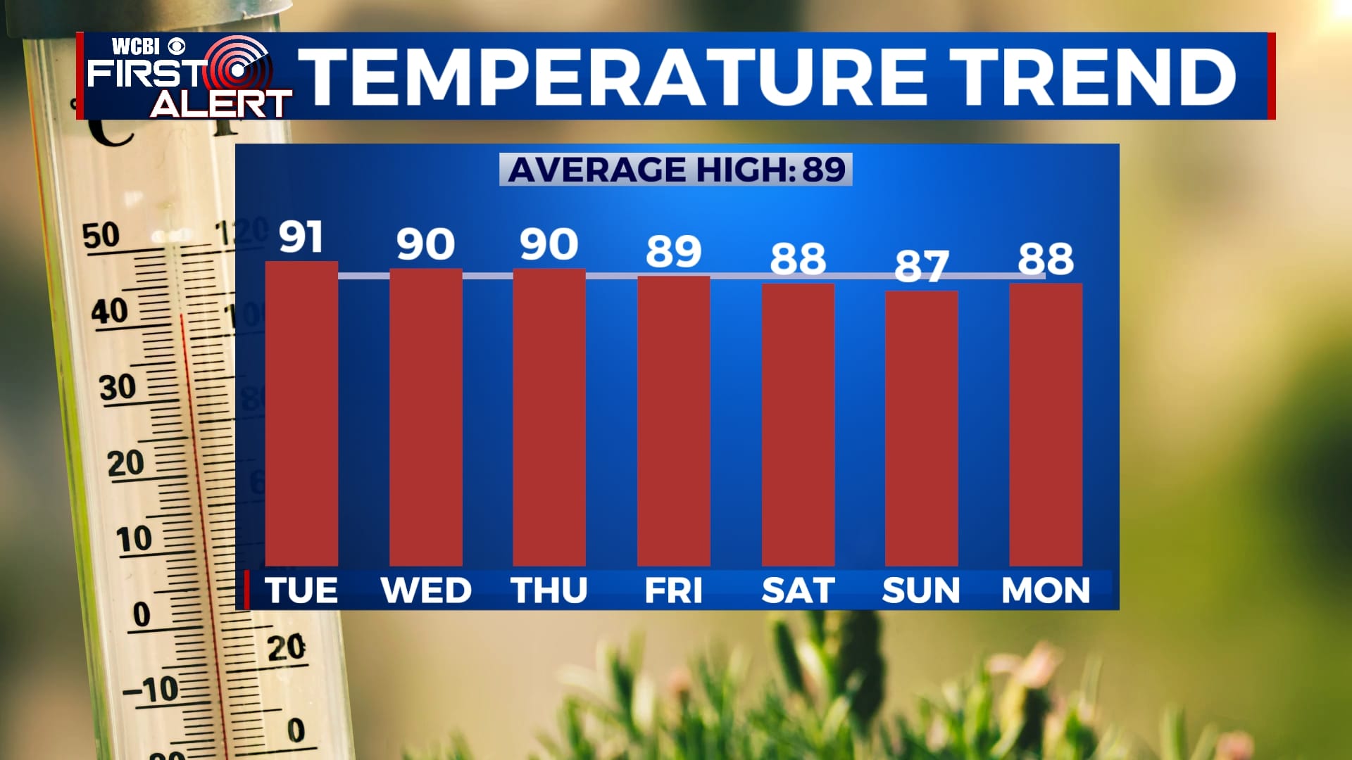
WEDNESDAY-FRIDAY: We’ll see a few more clouds for the second half of the week with a few isolated showers or storms possible each afternoon. In general, rain will be very hit-or-miss and total amounts will be low. There will be some peeks of sunshine helping us to warm to near 90 each afternoon. Overnight lows will be near 70.
SATURDAY-MONDAY: As our much awaited cold front approaches the area, we’ll have a few more chances for showers and storms through the weekend and into early next week. We’ll only call it a 30% chance, so most of us won’t see rain every single day. Still, don’t be shocked if you see some quick downpours. Highs will be in the upper 80s with lows in the upper 60s.


Leave a Reply