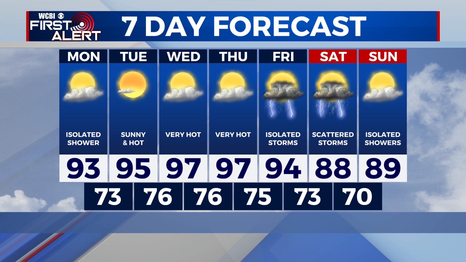
Hot Week Ahead
COLUMBUS, Mississippi (WCBI) – Heat is the big story this week. As a ridge of high pressure builds in from the west, temperatures will soar into the upper 90s by midweek.
TONIGHT: Mostly cloudy skies as a complex of rain and storms passes south of us through southern Mississippi. Rain chances for us tonight are slim to none, but I can’t totally rule out a brief shower before midnight. Low near 73°.
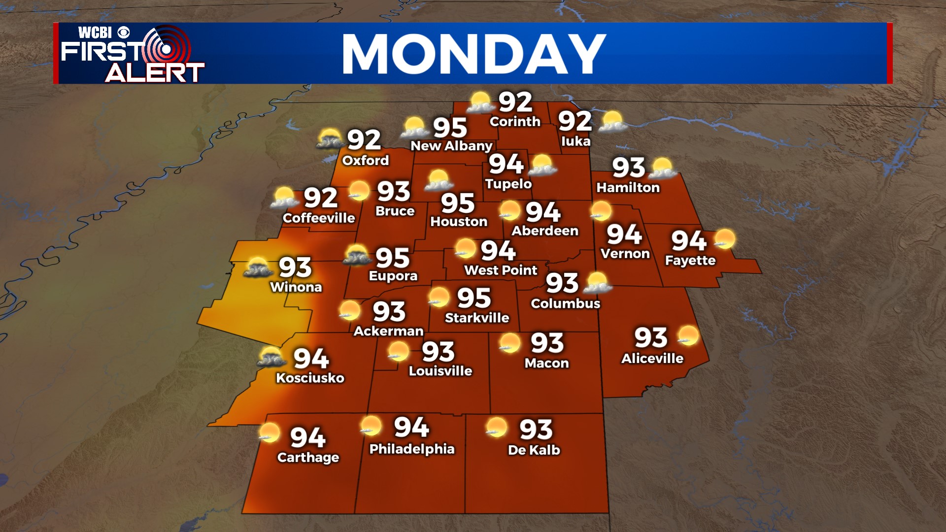
MONDAY: Canadian wildfire smoke will still be passing through, so you may notice a hazy tint to the sky. The smoke won’t be enough to cause air quality issues, though. Aside from the haze, we’ll see a mix of sun and clouds, with the chance for a pop-up shower in the afternoon. Most of us will just be hot and dry. High near 93°.
TUESDAY: Lots of sunshine and really starting to heat up. Highs will reach the mid-90s in most places Tuesday afternoon. Heat advisories may be issued, so take care of yourself and find ways to stay cool!
REST OF THE WEEK: Really hot. Temperatures will likely reach the upper 90s on Wednesday and Thursday. The heat dome will begin to weaken and break down on Friday, so it looks like the weekend will be cooler with temperatures in the 80s. We’ll also have a chance for rain and storms on Friday and Saturday as a front drops southward through the area.