Humid Friday, worst tropical impacts south and east
SUMMARY: A warm and humid day Friday, most of us should stay dry, although a few tropical showers are possible in the evening. The tropical system, currently ‘Potential Tropical Cyclone 3,’ will slide by the region on Saturday and could bring heavy rain to southern and Eastern areas. Models are now very consistent on the track being to our south, so we avoid the worst of the rainfall and severe weather impacts. Still could be some areas of heavy rainfall, however. This lingers into Saturday night, but Sunday is looking pretty calm save for a few scattered showers and storms. A frontal boundary will approach the area Monday and Tuesday, raising rain chances again, with scattered to numerous afternoon showers and storms. Wednesday and Thursday look drier, with just a stray afternoon storm chance.
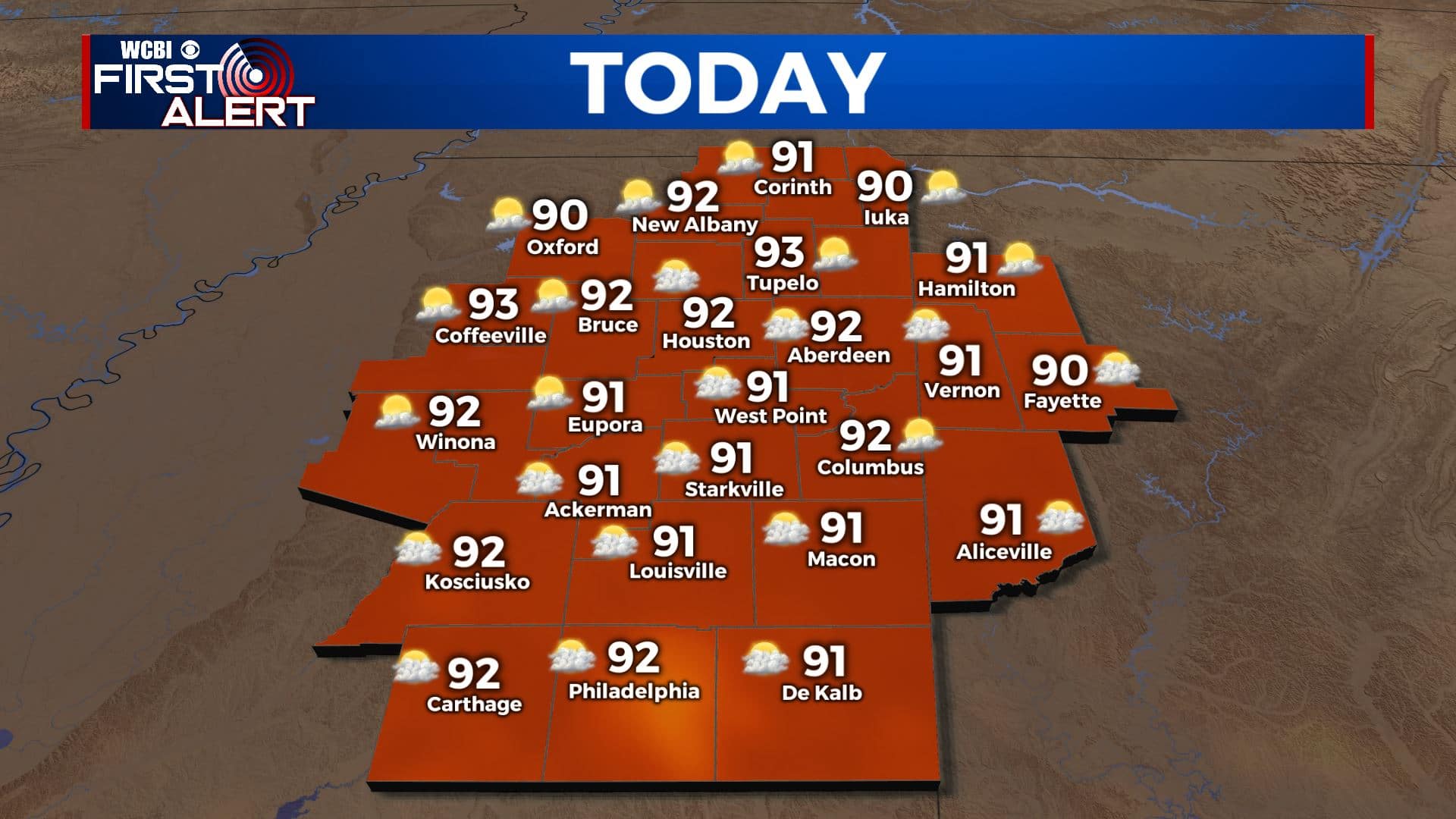
FRIDAY: A warm and humid day, highs in the low 90s. Cloud cover will increase throughout the day, ahead of our upcoming tropical system. A few late day showers are possible.
FRIDAY NIGHT: A mild and mostly cloudy night in store, with rain chances increasing as the night goes on. By daybreak Saturday, the rain shield from the tropical system will be sliding by. Lows near 70.
SATURDAY: A wet day looks to be the case for at least part of the viewing area. The heaviest rain and any severe threat will stay to our south and east, but we could still see a period of steady rain during the day. Highs in the low 80s with cloudy skies for most of us.
SATURDAY NIGHT: Rain from the tropical system will continue, and it will begin to move to the east so rain should begin to abate on Saturday night. Lingering showers still possible, lows in the low 70s and staying cloudy and humid.
SUNDAY: Father’s day and the first day of summer is not looking too bad, other than a few showers or storms it should be mostly dry, highs in the mid to upper 80s.
MONDAY TO THURSDAY: Rain chances ramp back up to begin the work week, as a frontal boundary will make an approach to the region. Expect widespread afternoon showers and storms Monday and Tuesday, with highs in the low to mid 80s and mostly cloudy skies. Things look to dry out a bit towards the middle of the week, with partly cloudy skies, cooler lows, and only a slight chance of a stray shower or storm on Wednesday and Thursday. Highs staying in the mid 80s with lows in the mid 60s.


Leave a Reply