Ida makes landfall, will impact the region Mon-Tues
Hurricane Ida made landfall Sunday at 12pm CDT at Port Fourchon, LA with 150 mph sustained winds. This makes Ida one of the most powerful hurricanes to ever make landfall in Louisiana. As Ida has progressed inland, widespread power outages, flash flooding, and structural damage reports have begun to come in. Social media reports have included a bridge collapse, runaway barge, and at least one levee failure. Thankfully, Ida will continue to weaken as it moves to the northwest.
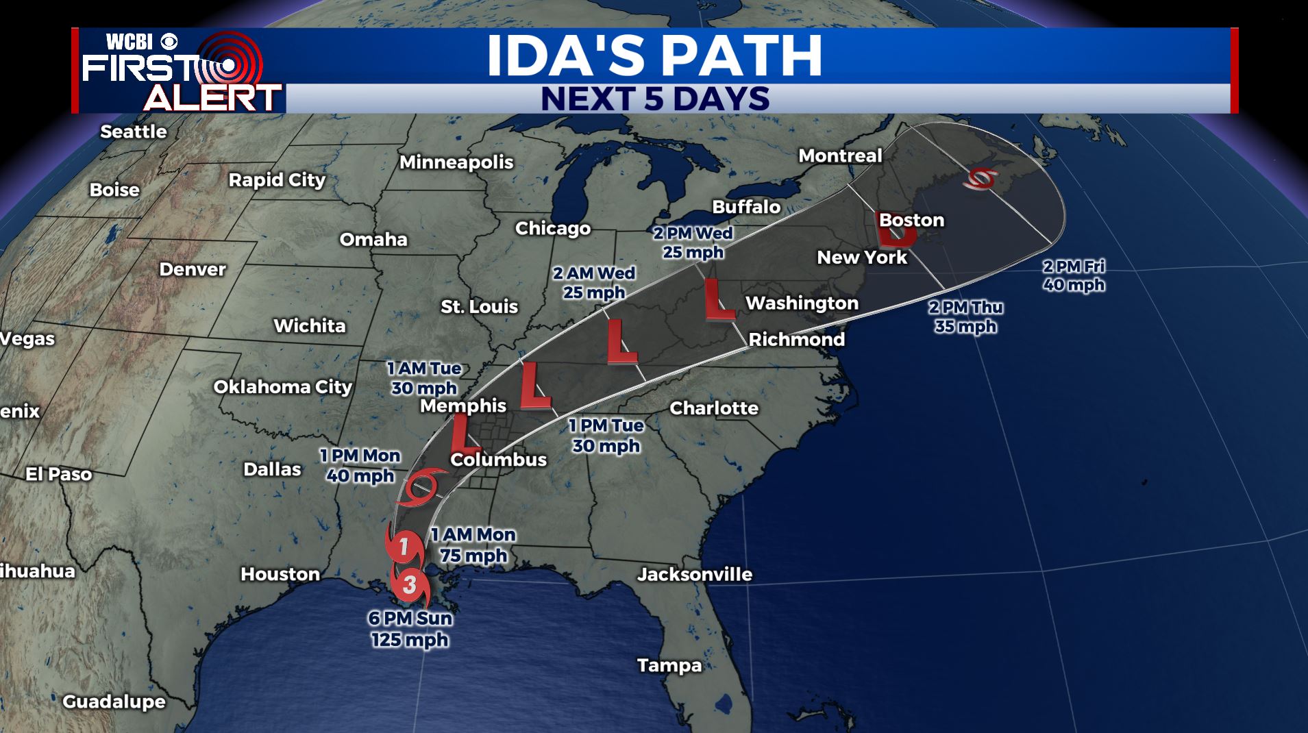
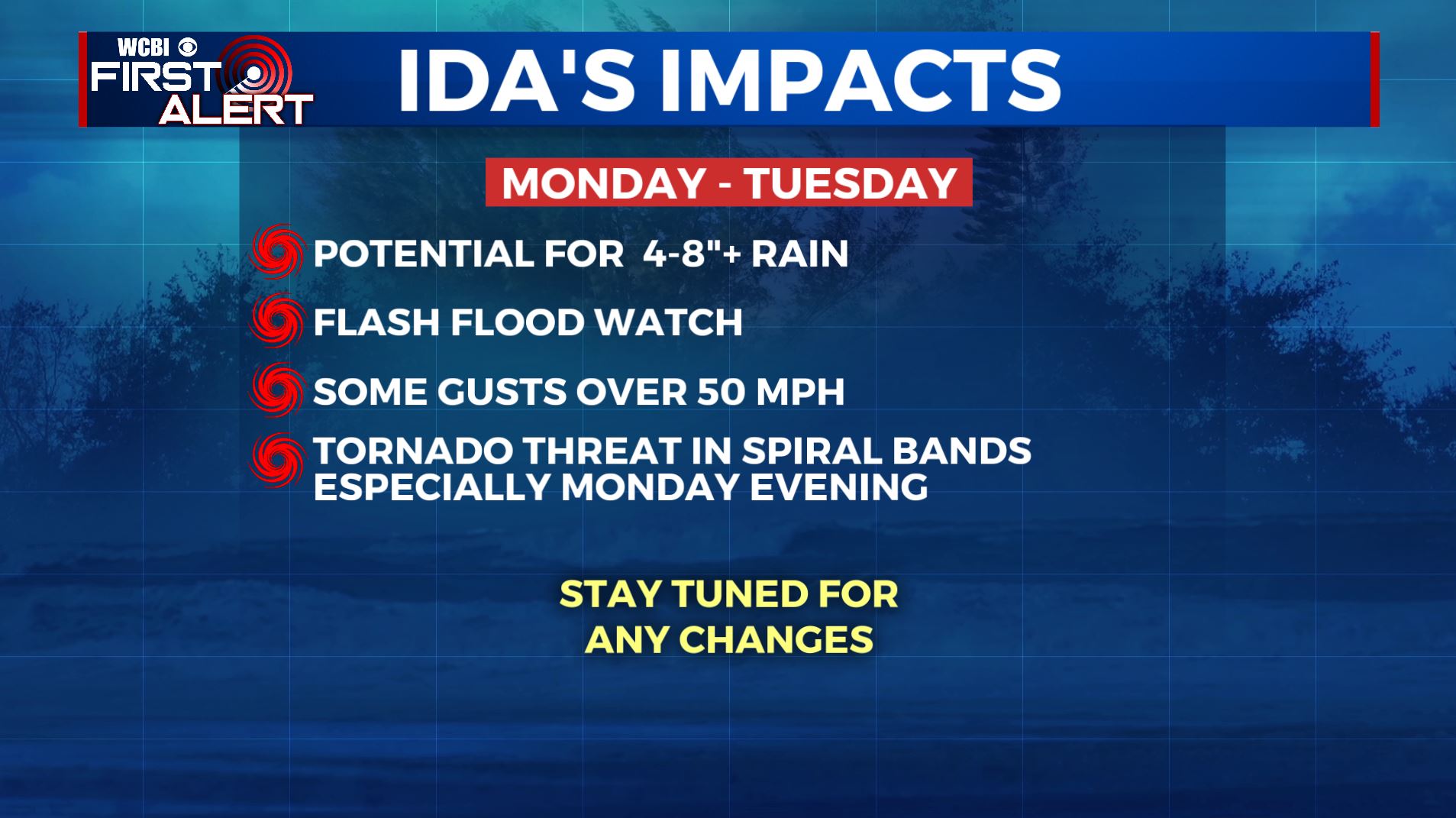
This evening, Ida will turn to the north, then northeast overnight into Monday. This track will bring Ida just to the west of our region as a tropical storm or tropical depression. This forecast places our region within the northeast quadrant of Ida which contains the strongest winds and highest potential for tornadoes. Make sure you have a way to receive a tornado warning that will wake you up if one is issued for your area.
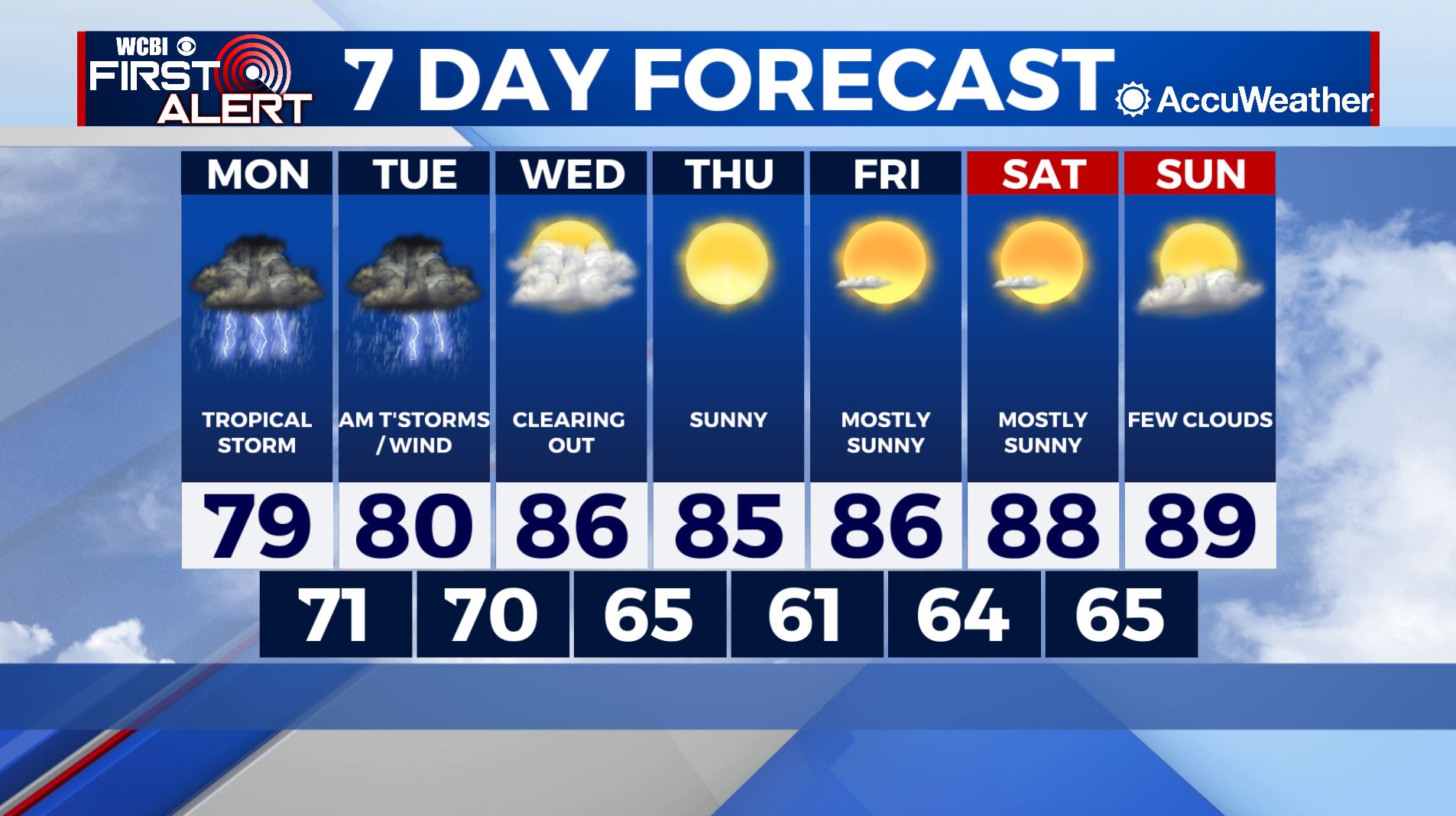
Check in for additional updates to the forecast.
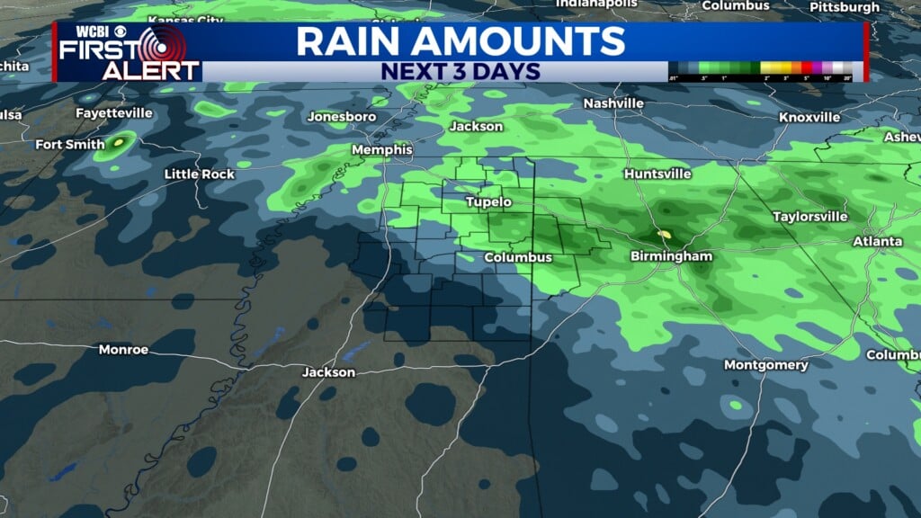
MONDAY: Tropical storm conditions possible with highs in the upper-70s. An isolated tornado is possible with the strongest storms. 1-3″ of rain likely. Chance of rain: 100%.
MONDAY NIGHT: Tropical storm conditions likely with lows in the low-70s. An isolated tornado is possible with the strongest storms. 2-4″ of rain likely. Chance of rain: 100%.