Isolated Storm Chance on Sunday
COLUMBUS, Mississippi (WCBI) – There’s a slightly better chance for a few showers and storms on Sunday.
TONIGHT: Mostly clear and feeling muggy outside, with temperatures only getting down into the mid-70s. Most of the area will be dry tonight, but a shower or storm is possible in northeast Mississippi before sunrise Sunday morning.
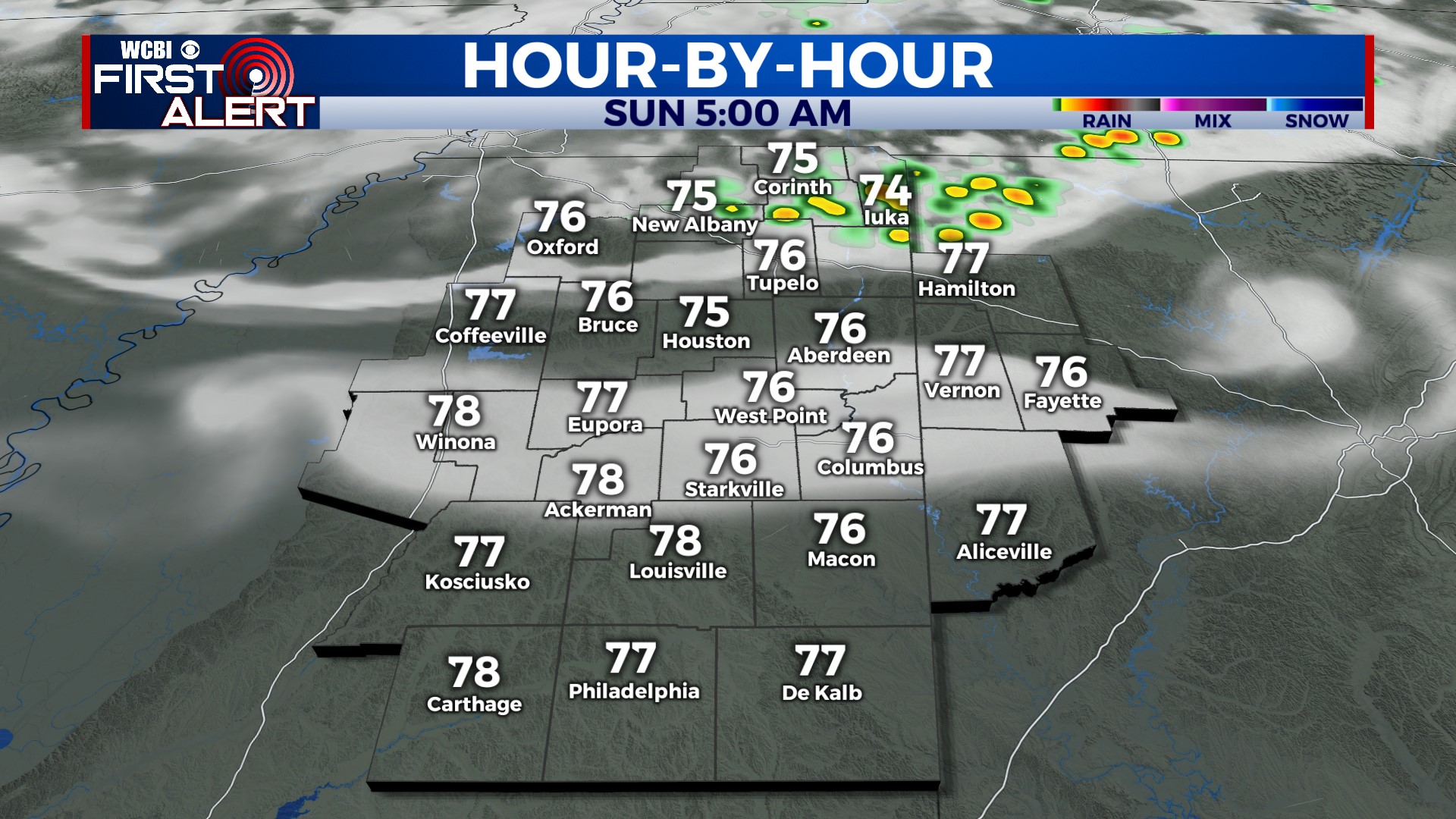
SUNDAY: Another hot day, depending on where you live. Temperatures will reach the upper 90s in places that don’t get rain, but places that do get rain or a storm will stay slightly cooler. That being said, there is a slightly better chance for storms on Sunday, mainly in the morning and afternoon. Some storms could have heavy rain, gusty winds, thunder, and lightning. Not everyone will get a storm, though—about a 30% chance.
NEXT WEEK: A front will drop through the region on Monday and bring temperatures back to average in the mid-90s. There’s a small chance for a brief shower or storm each day, but for now, I still don’t see any meaningful rainfall in the near future. The heat cranks up again on Thursday as another ridge of high pressure builds closer to home. It looks like temperatures will be back in the upper 90s late in the week.
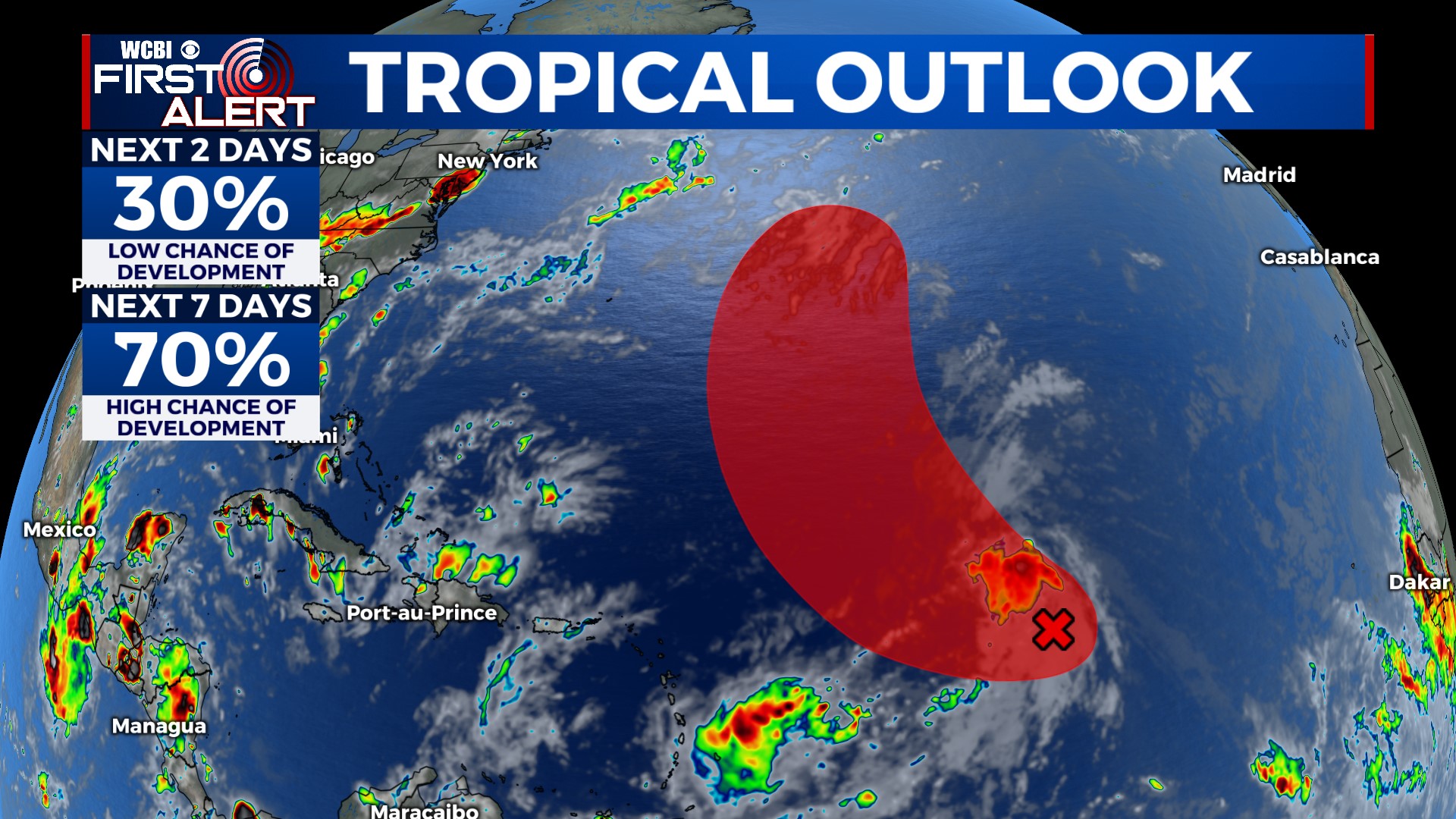
TROPICS: A disturbance in the central Atlantic has a high chance of becoming a tropical depression sometime early next week. This system will likely become Emily. It will curve away from land and move out to sea. Nothing to worry about for the U.S.